Sunny spells and showers with a few thunderstorms for today. Met Eireann has named Storm Hannah, a low moving in later on Friday and across Britain on Saturday which will bring gales and rain.
This week continues with its change to more unsettled and cooler weather. By the start of the weekend, daytime temperatures will be struggling and there will be a deep area of low pressure heading in from the Atlantic. This has now been named #StormHannah by Met Eireann. Before that, there are more showers, a scattering of thunderstorms but still some warm sunshine with blustery winds.
Thunderstorms broke out yesterday for the Midlands and northern England later in the afternoon. Eastern England saw the highest temperatures with 23C in Norfolk and 22C in Suffolk and Lincs. Overnight temperatures dipped near to +2C for a few inland parts of England and today the top temperatures will be into the high teens.

Already today there have been showers, there are two main rain areas on the Radar image. A cold front which has move up through Scotland overnight and is still over the far north of the mainland and islands to start Thursday. This will clear away to the NW this morning.
Over southern Britain there is an occlusion which is bringing clusters of showers and some heavier bursts of rain to Wales and parts of England. These are spreading northwards. For a time, there will be fine and dry weather over Northern Ireland and much of Scotland, but the shower risk increases by lunchtime and for this afternoon. The showers over SE Britain become more scattered but lines continue for parts of Wales and western England. In the sunny spells sheltered from the wind it will feel fine but do prepare for the downpours and a sudden gusty chill.

The brisk easterly wind continues for eastern Scotland and NE England but elsewhere there will be a south to SW wind which will be fresh for west Wales and Devon and Cornwall.
There is the risk of thunderstorms, with hail and lightning today. The convective forecast has been issued for today - click here to read it.
This evening more persistent rain will move off the North Sea over eastern Scotland, although little will make its way over the Grampians to the Moray Wildfire area, as it clears off to the NW.
Showers continue to whirl around the low pressure out west with more persistent rain moves into Wales from the west and then to NW England. Under the clearer skies over much of Britain it turns cooler tonight.
The moderate southerly wind will add to the cool feeling for the start of Friday before an occlusion moves in from Ireland and the winds veer to a westerly. The frontal band pushes more cloud and showery outbreaks of rain in from the west during the morning but with some fair weather ahead of that for eastern Britain. The showers move west to east with temperatures in the brighter spells ranging from 12 to 16C.
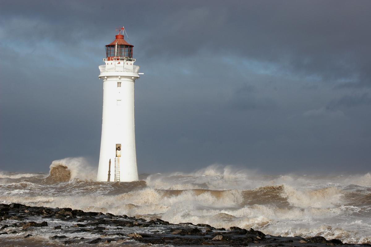
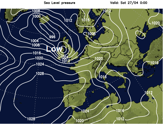
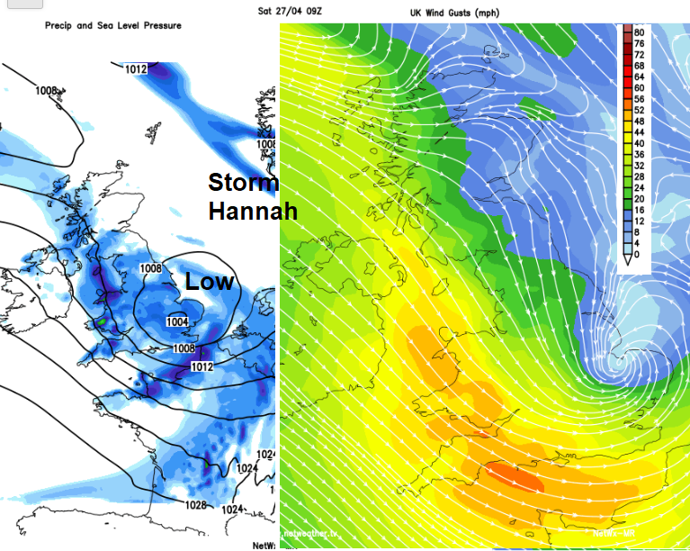
Storm Hannah
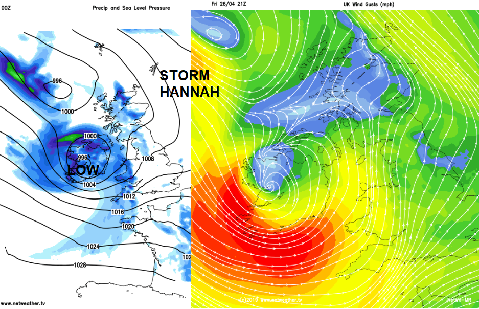
A deep area of low pressure is forecast to move across southern Ireland later on Friday bringing severe gales around the south coast before heading across Britain. This will bring rain lasting into Saturday. Strong to gale force SW winds will affect Wales and SW Britain, along the English Channel coasts and along the Bristol Channel. Gusts around 60mph are expected for SW Britain but southern Ireland could see storm force winds
Status Yellow - Weather Advisory for Cork and Kerry Potential for stormy conditions for the southwest later on Friday and early Saturday. Valid: Friday 26 April 2019 18:00 to Saturday 27 April 2019 06:00 Met Eireann
The winds veer to the NW during Saturday but remain fresh to strong
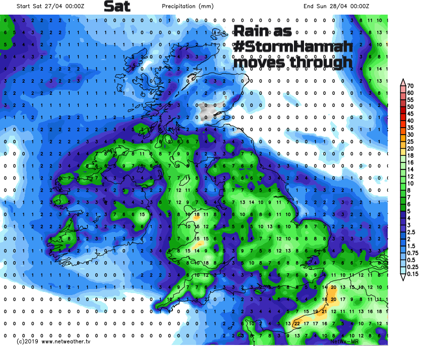
Everywhere will feel colder in the NW winds on Saturday as the rain spreads over England during Saturday morning and Ireland improves with some fine, bright and calmer weather.
Pressure then rises for the second half of the weekend and Sunday looks, fine and sunny. It should be dry but with a brisk north wind along the east coast of Britain. Temperatures throughout the weekend will be subdued only around 13C.
Conditions look fine for the London Marathon, it should be dry, bright with light winds. Temperatures should only reach 12C after a chilly even damp feeling start. Moderate air pollution levels and UV levels are forecast, but not the heat of last year.
More chat about #StormHannah and the #NameourStorms project