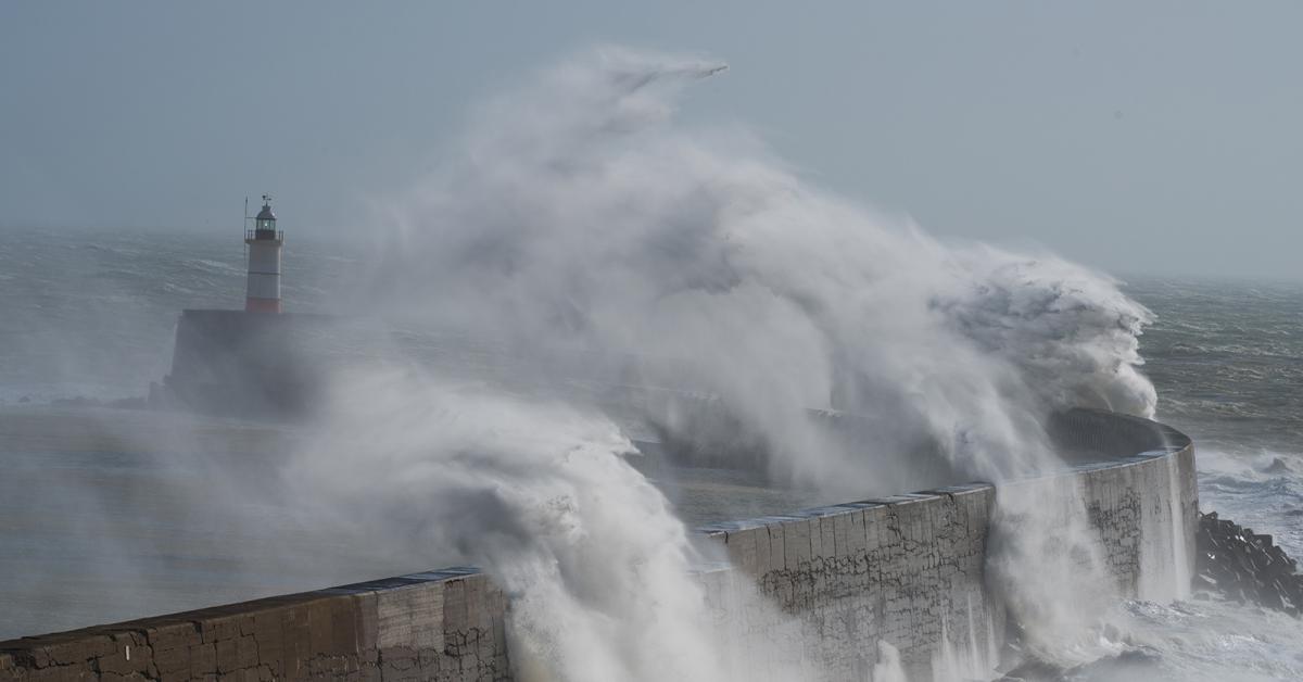
Storm Freya is already the southern half of Britain this morning. Winds will strengthen during the day too, with gales or severe gales in places.
After a quiet start, March suddenly behaves like a lion, with warnings of weather rough issued for today into tomorrow as storm Freya moves in from the South West. It seems likely that all but northern Scotland will bear the brunt of this storm, with the strongest winds giving damaging gusts across the South West later this afternoon, the Midlands into the evening and then northern England overnight. There'll also be some heavy rain, particularly over England and Wales.
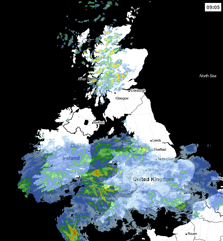
We have three distinct areas of weather across the country at the moment, with blustery showers giving hill snow over Scotland that'll become confined to Highland and the Northern Isles through the day, as a strong to gale South West wind at first decreases. Over Northern Ireland and northern England, it's a mainly dry start with some sunshine across the North East, but this won't last as cloud increases from the South bringing outbreaks of rain to most parts before dusk. A blustery South West wind at first will decrease for a time, before turning into the South East.
 View the live weather radar here
Across Wales and central southern England, it's dull with patchy rain and drizzle, that'll move into the Midlands and East Anglia through the morning. After a brief drier slot, a spell of heavier rain clears from the South through the afternoon. There'll then be a scattering of blustery showers as storm 'Freya' brings strong South then South West winds, that be gusting to 60 to 70mph towards Devon and Cornwall before dusk.
Despite the conditions, temperatures reach a very mild 12 to 14C in central and southern areas, with a somewhat colder 7 to 11C more likely further North.
All but Highland and the far North of Scotland where there'll just be a few showers giving hill snow, feel the effects of storm Freya after dark. There'll be some heavy rain into the evening over northern England and the East and South of Scotland, with blustery showers elsewhere some prolonged in the West. Strong winds will gust to 60 to 70mph across parts of the Midlands and northern England later, with 80mph possible along some western coasts before winds moderate a little towards dawn.
It'll remain very blustery though, and as the wind turns into the North West or North briefly, it'll introduce colder air, with some snow likely over the Southern Uplands, the northern Pennines and perhaps the Cumbrian Fells before dawn. Despite this, the boisterous conditions will keep a frost away from all but a few sheltered Highland glens, with minimum temperatures mostly in the range 2 to 7C.
Monday begins blustery with severe gales at first across North East England to greet the new working week, in a day that'll bring a mixture of sunny intervals and showers. These will be most frequent in the West and across Northern Ireland, some heavy giving local hail and thunder. The showers will fall as snow on northern hills, with South Wales, southern England and the Home counties probably seeing some lengthier rain or a time.
A West or South West wind will remain fresh or strong but should be somewhat lighter across the North of Scotland. This'll make it feel rather cold but despite this, temperatures should still manage to reach 5 to 7C over Scotland and 8 or 9 locally 10C further South in the sunny intervals there'll be on offer.
After dark things should quieten down a little, but a South West wind will remain somewhat blustery in most parts. This'll continue to bring showers mostly to Northern Ireland and western areas, with eastern and some central parts seeing skies break sufficiently to perhaps give a few clear intervals. This could allow it to turn quite cold with a ground frost possible briefly towards in a few sheltered rural valleys and glens as temperatures fall to between 2 and 7C again.