An unsettled second half of the week with rain and strong winds from the SW. Risk of snow over the hills, a bit to low levels with high gusts tonight and more wind and rain on Friday.
At times in the wind and rain it will still feel pretty chilly this week, but the cold Arctic air won’t return until late on Sunday and that will only be briefly. We’re looking at more unsettled weather as low pressures rattle in from the Atlantic with a few wintry bits in the mix.
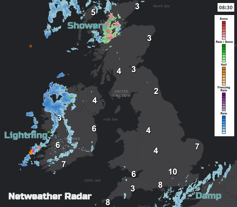
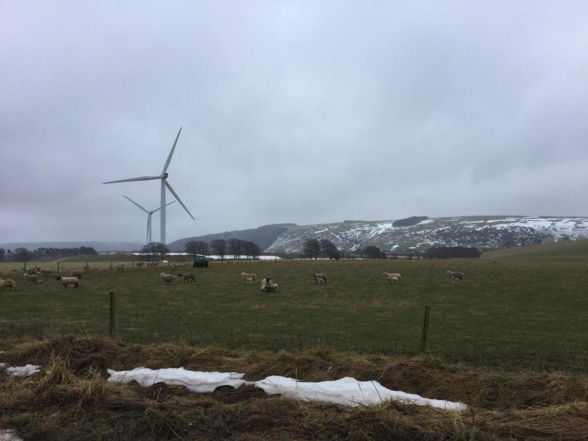
This morning it’s 10C in London and zero in Aberdeen. There is a lingering front draped over SE England and the Channel Islands bringing a damp and grey start this morning. Way to the far NW there are showers bringing a mixture of rain, hail, sleet and hill snow to the Highlands and Northern Ireland with the risk of lightning.
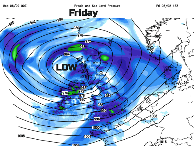
One low pressure develops over Ireland this evening and as that moves across Britain tonight it will bring heavier rain, snow mainly over the hills and blustery winds. Another larger area of low pressure heads in during Friday resulting in wet and very windy weather with gales lasting into Saturday morning. Then on Saturday evening, a low pressure looks to approach from the SW and there could be a spell of rain, sleet and snow as this nips across Wales and England with a secondary low over Ireland following eastwards on Sunday.
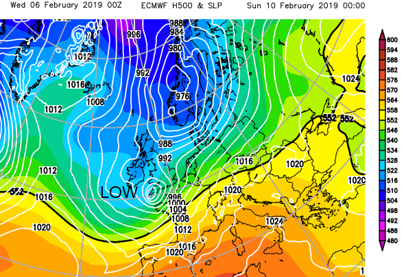
Lots of uncertainty about positions of the lows and their frontal bands and so where the rain will end up and will it turn to snow. Then how much, where and when. The main time frame for this wintry mix is over the weekend and for the hills although we’ll have to watch this low pressure tonight for Northern Ireland and Scotland.
Today
This morning there is a little bit of frost and mist and fog, quite dense in the SW. The SW winds are light but begin to pick through the day particularly across Ireland. Many places will have a fair day with bright skies, the odd shower and the best of the sunshine for NE Britain. More showers move in from the west, so turning quite wet for western Scotland and Cumbria by this afternoon.
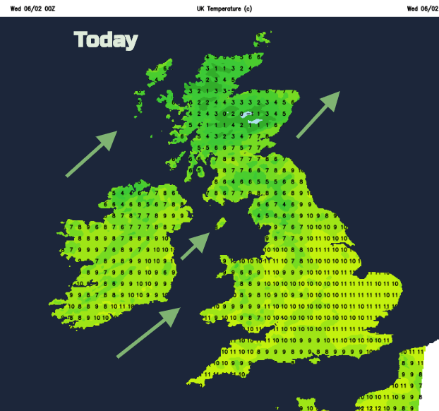
The grey damp weather over the SE fades towards lunchtime but another pulse of rain heads up through the English Channel. SE England turns damp once more and heavier rain with sleet moves through Ireland into SW Scotland then across the Pennines. It will turn windy through the Bristol Channel and Irish Sea tonight with westerly gales potentially into Morecambe Bay and Blackpool.
There will be strong winds overnight for Pennine routes and first thing on Thursday for eastern England. There is the risk of snow overnight for hills and even to lower levels, which along with the strong winds will create tricky conditions at times. Once this bout clears there will be a blustery cooler day with sunshine and showers once more from the west.
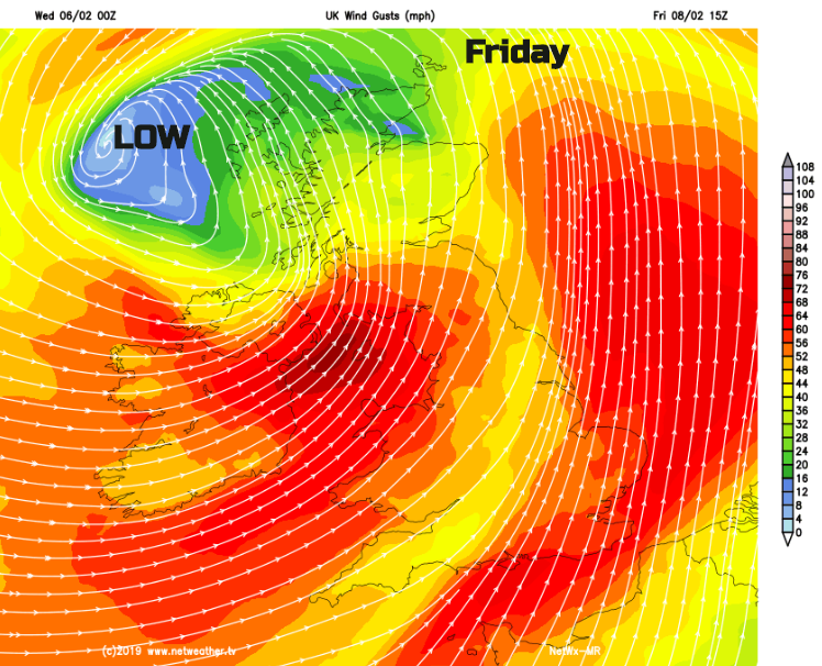
Watching out for wild and wet weather on Friday by day as the large low pressure heads in. Plenty going on this week. Further ahead.
VIDEO with Jo