Cold air has arrived across the UK following the rain overnight, and it's going to bring a good number of wintry showers today. Watch out too for ice, early and late.
Following the clearance of yesterday's cold front, it's an icy, chilly start this morning. There are already wintry showers in the west, and some of these will be migrating east during the day. Away from the showers though, there'll be lots of winter sunshine.
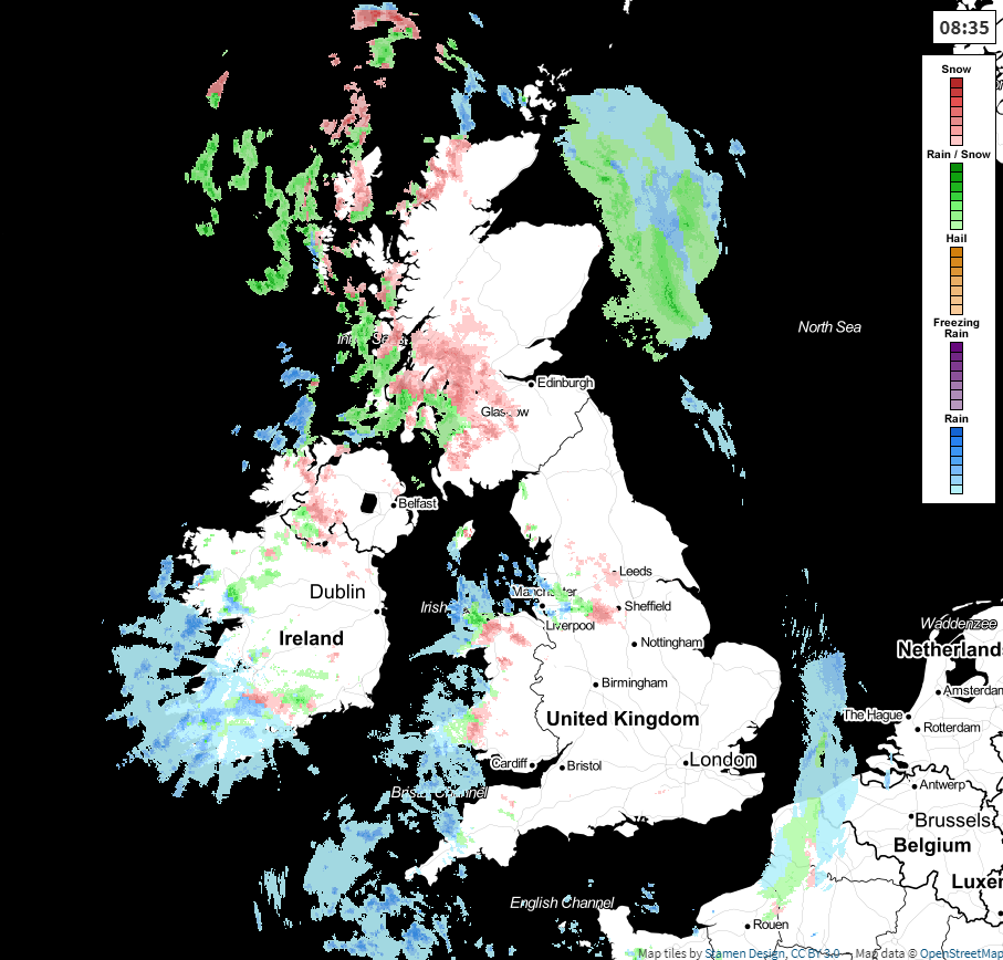 Check the live radar here for the latest 5-minute updates.
The wind is going to make for a cold feeling day today, especially in the west where it'll be strongest, it'll also be gusty and squally during any of the heavier showers which blow through. On the thermometer, temperatures will reach 5-7c in the south, 3-5c across much of the rest of England and Wales, and 2-4c for Scotland and Northern Ireland. Take the wind into account though, and most places will feel sub-zero, with eastern and central England just a touch above freezing in lighter winds.
The showers today, having started in the west will move east, organising into bands at times. They'll fall as rain, sleet and snow - the snow mostly limited to the hills across England and Wales, but falling to lower levels at times, and more regularly in Scotland and Northern Ireland.
Overnight, many of the showers will ease, but not all. They'll continue near to east, west and north coasts, with some running inland at times. It'll be a cold, icy night just about everywhere though, with widespread icy patches forming.
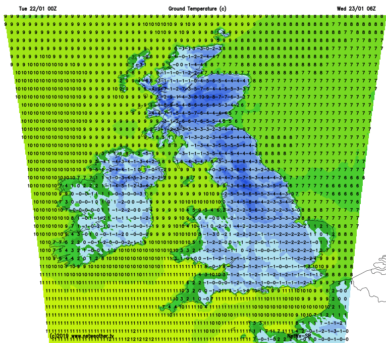
Wednesday will see a few showers continue near to those coasts, mostly. Elsewhere it's a cold, bright, often sunny day. After the cold start, temperatures will struggle to no more than a few degrees above freezing for most, with the wind still making it feel colder.
Another frosty, night follows, with temperatures dipping well below freezing once again - although extra cloud and a few more showers will affect western coasts, potentially keeping temperatures up here.
Thursday then sees a change start to arrive from the west, as some patchy rain (with snow up over the hills in the north, initially at least) pushes further east. That'll mean a lot more cloud around, and temperatures will be on the up from the west. Ireland will potentially see highs into double-figures in the afternoon. Friday follows suit, with some more rain at times, and staying mild.
Rain, perhaps turning to snow in places then looks set to move southeast as we end the week and move into the weekend, re-introducing colder air again, with wintry showers making a return from the north behind it.