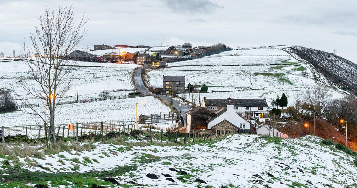
Rain, sleet and hill snow in places today and over the weekend, Sunday drier and brighter in the south. Cold with snow in places next week, perhaps turning bitterly cold by Friday.
Thursday saw much colder air arrive from the arctic, with quite a few seeing snow falling from wintry showers in the morning, with some settling in the northeast. Though the blue skies and sunshine partly compensated for the cold, particularly after quite a few days featuring anticyclonic gloom since Christmas. And the cold is here too stay today and through the weekend and if you think it’s cold the next few days, there is potential for the weather to turn even colder towards the end of next week, as easterly winds develop drawing bitterly cold air from NE Europe.
.png)
But for now, clear skies overnight and the arctic air that arrived yesterday means temperatures have plummeted overnight, widely below freezing away from the far west even in towns and cities in the south. Aboyne in Aberdeenshire was the coldest spot, with -10.7C, making it the UK’s coldest night of the year so far.
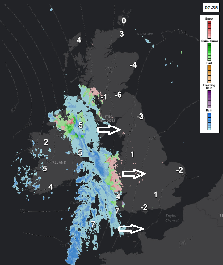
So, a cold, frosty and bright start across many areas, eastern areas will hang onto the sunshine the longest today. However, across N. Ireland, west Wales, Devon and Cornwall a band of rain and hill snow mixed in is moving in, this will continue to spread slowly north and east across Wales, SW England and SW Scotland through the morning, reaching NW England, Midlands and central southern England into the afternoon, perhaps with snow to lower levels inland for a time. Likely staying dry and bright across much of Scotland, away from the southwest, along with eastern England. Any snow generally not too disruptive, though over the hills of Wales it may cause some slippery conditions over higher routes, a yellow warning for snow has been issued.
Temperatures reaching 2-4C across Scotland and eastern England in the sunshine, 4-6C under the cloud, rain and hill snow, perhaps as high as 9-10C in the southwest.
Then tonight, the band of rain, sleet and hill snow along an occluded front will continue north and east across central and southern Scotland and eastern England, again generally snow hopefully not too disruptive, though higher routes may be affected by slippery conditions for a time. Rather cloudy following the rain and hill snow band, with showers of rain or sleet affecting mainly southern and western areas of England and Wales. Temperatures generally staying above freezing with all the cloud, though clearer skies across northern Scotland will allow a frost to develop.
England and Wales are looking rather cloudy but cold on Saturday with showery bits of rain, sleet and hill snow here and there moving slowly east or southeast, but generally fizzling out into the afternoon, as a weakening area of low pressure drifts southeast across the south. Scotland mostly dry and bright but cold with the best of the sunshine. Temperatures reaching 4-7C generally, mild across the far southwest – where 10C may be reached.
Sunday seeing another occluding front moving east off the Atlantic, bringing a band of rain, sleet and hill snow across Scotland and western areas south of the border, brighter but colder conditions across eastern England and following the front, with wintry showers across the northwest. Temperatures reaching 5-7C.
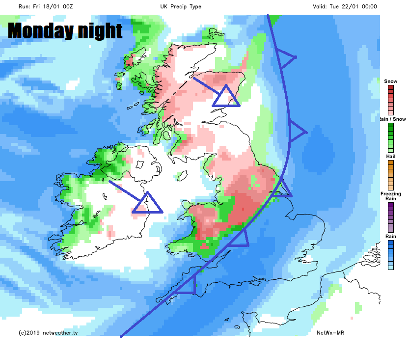
Colder polar air returning from the northwest on Sunday will bring a cold day on Monday following a widespread frost overnight, a brief ridge of high pressure keeping most eastern areas dry. However, trouble is brewing to the northwest, as a deep depression moving off the tip of Greenland and passing Iceland pushes an active frontal system southeast across the UK and Ireland on Monday night. Rather cold polar northwesterly flow sourced from a very cold Greenland and northern Canada following the front may cause some back-edge snow along the rain band sweeping southeast.
A cold and brisk northwesterly on Tuesday, bringing wintry showers to northern and western parts, though south and east perhaps dry and sunny. The low near Iceland Tuesday sliding southeast to the North Sea on Wednesday, filling and weakening as it does so, so probably a slack northerly flow with wintry showers around coasts.
Then from Thursday, most the major models are showing an increasingly cold easterly or northeasterly wind develop, as the low over the North Sea drops south into mainland Europe and pressure builds over Scandinavia. Deep cold could reach the UK over the North Sea by the end of the week, bringing an increasing risk of heavy snow showers to the east. But too far away to be certain on this outcome for now.