A quiet Friday before a windy weekend. High gusts for northern England and Scotland. Mild enough until Monday morning.
Today looks quiet as the patchy rain in the south clears away to France before a windy weekend across the UK.
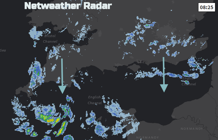
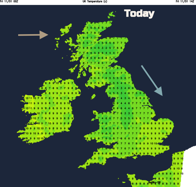
Co. Down and the Isle of Man reached 11C yesterday, mild enough for early January. Temperatures overnight have dipped to +2 or +3C again not especially cold for the time of year. Today there is still the cool N to NW breeze for England and Wales, but the wind is backing to a milder westerly for Scotland and Northern Ireland. It’s bringing a fair amount of cloud but with brighter breaks for eastern Britain. High pressure is lurking to the SW with air flowing over the top of it to the UK and later today a cold front will head in.
As this arrives the weather begins to change. SW Winds strengthen for the Western Isles as the cold front rain reaches western Scotland this evening and then Northern Ireland. For southern Britain it will be calm with clear spells for a time, so temperatures will dip away but the cloud will increase across the UK through the night as the winds pick up.
Saturday
As the cold front pushes southwards there will be brighter skies to the north. Southern Britain will be more cloudy and not too cold to start the weekend. The frontal band will bring light and patchy rain over southern Britain for Saturday morning with grey skies as the westerly wind freshens. Wales, NW England and western Scotland keep a lot of cloud and dampness whereas northeast England and eastern Scotland should be bright and sunny on a windy day. There will be strong gusts over NE Scotland if you are heading to the Grampians and also the Pennines. To the lee of the high ground will be sunny breaks and the highest temperatures. Northern Ireland will also be quite grey, with a little rain at times and a fresh west wind.
Temperatures remain around 8 to 10C but the wind will make it feel cooler. Even as the cold front reaches the English Channel and other system heads in from the Atlantic. It stays mild and windy during Saturday night as warm front rain moves across northern Britain.
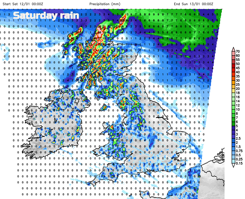
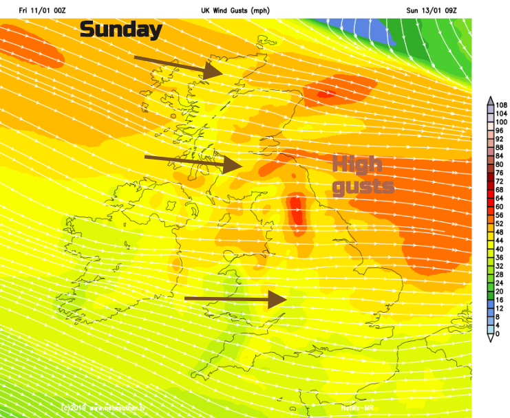
Saturday night a cold front gives an extra squeeze to the winds, but mild air manages to stay over much of the UK through Sunday. For NE Britain there will be gusts over 60mph and around 50mph for Northern Ireland, northern England and Scotland. There will be even more rain for the far NW of mainland Scotland on Sunday.
Sunday
A windy start for everyone on Sunday with a strong westerly wind over northern Britain as the high gusts continue. The low pressure driving this heads to the Baltic Sea and begins to draw down colder air from the north for the new working week.
It will be another mixed day, cloud in the south to start with but clearing skies and more brightness. Showery outbreaks from the NW with a wintry mix for NW Highlands, Cumbrian Fells and the Pennines. During Sunday the winds begin to veer to a colder NW direction and by Sunday evening a northerly as an occluded front arrives brings snow and hail to northern Scotland.
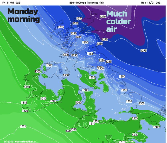
This push of cold Arctic air falters as another system heads in from the Atlantic by Tuesday but it does mean that there will be cold start on Monday, especially in Scotland where there could be sleet and snow showers running down the UK into NE England too. We’ll have to wait on the timings of the cold plunge from the north and the incoming milder system from the west to see what develops. It won’t be as windy thankfully.
More cold air could topple in next week Wednesday morning into Thursday looks chilly but still rather unsettled. No beast yet.