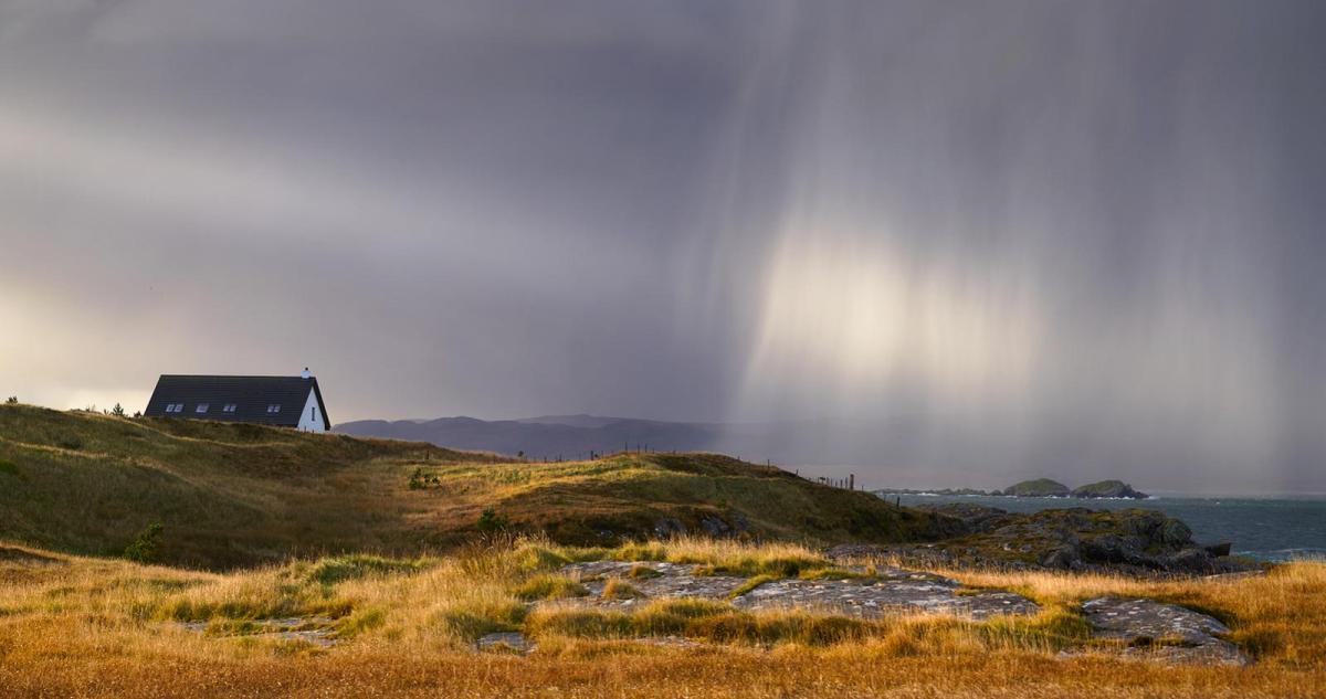
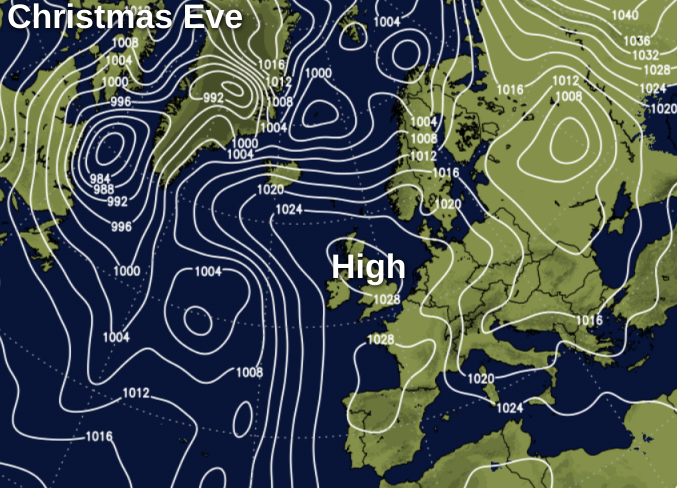
Some rain at times this weekend, but also some drier, brighter periods for any last minute Christmas shopping. High pressure then builds across the country on Christmas Eve.
The worst of the weather seems to be targeting central parts at the moment, with more than 30mm of rain falling at my station near Nottingham in the last three days. The next Atlantic system due on Sunday looks as though it'll follow a similar track but once this has moved away, a strong rise in pressure on Christmas Eve will eventually settle things down for the festive period. It'll also turn somewhat colder, but the only white stuff that you'll see in places on Christmas morning will be frost rather than snow.
Some parts are waking to showers this morning, mostly over Scotland, Northern Ireland, North Wales and in the West where a few are heavy. These'll tend to fade through the day allowing sunny intervals in most parts, but cloud amounts will vary making the sunshine rather watery at times. Across East Anglia, much of the Midlands and in the East and South the showers will be fewer, with a better chance of it staying dry in a reasonable enough day here to complete your Christmas shopping, despite the somewhat mixed conditions.
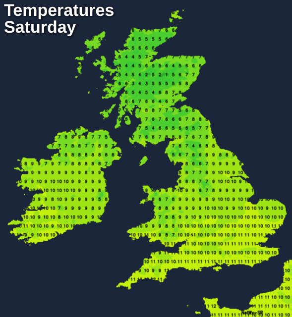
Northern Ireland, England and Wales become mild, with temperatures reaching 9 to 12C in a moderate or fresh West to South West wind. Scotland is somewhat colder in mostly lighter breezes, with a slight frost at first mainly in Highland glens and the East. There'll also be some mist or fog patches freezing in places at first, that'll linger in sheltered rural valleys mostly in the North. Here it'll stay cold, but for most, top temperatures of 5 to 7C won't be too far from normal for the time of year.
Remaining showers largely fade into the evening, that'll see something of a lull. Clear spells lead to another slight frost over parts of Scotland where a few showers in the North and West (wintry on hills), may keep going into the night. Winds'll be light or moderate West to North Westerly, with lowest temperatures -2 to +3C. Northern England, much of Northern Ireland, East Anglia, the South East and the North and East Midlands should also stay dry after dark, but with increasing cloud towards morning. Across the South West, much of Wales and southern England it turns wet overnight as more Atlantic systems move in, on a South West or southerly wind that may freshen a little towards dawn. Apart from the North East where it could turn cold enough for a ground frost in vulnerable rural valleys, most of England and Wales have another fairly mild night, with minimum temperatures mostly 3 to 8C.
Sunday starts thoroughly wet across Wales and in the South, this spreading to the Midlands, East Anglia, Cheshire, Yorkshire, Lancashire and probably to much of Northern Ireland for a while, but its northward extent is a little uncertain at present. Some of the rain will be heavy at first, but it should tend to become lighter and patchy later, with skies perhaps brightening over Northern Ireland into the afternoon. Winds become moderate or fresh West or South Westerly in the South but will be lighter and more variable in direction over a central swathe of the country.
Across Scotland and perhaps the far North of England it'll be a different story, with mainly dry, bright weather here on Sunday giving sunny spells once mist, patchy fog freezing in places and a slight frost in places have cleared.
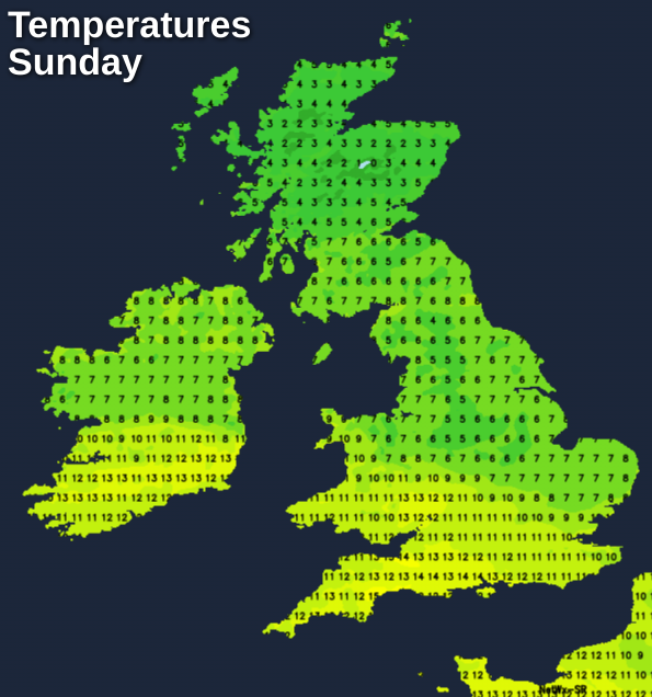
It'll be somewhat colder here though particularly where any fog lingers, with maximum temperatures mostly between 5 and 7C in just a light northerly breeze. It may also tun slightly colder across Northern Ireland and the far North of England through the day, but elsewhere it'll continue to be mild even very mild in the South, with temperatures in the range 9 to 12C for a while.
As pressure begins to rise strongly across the country after dark most places become dry with light winds, the exception being from the Midlands southward where it'll remain cloudy.
There'll also be further mostly light rain or drizzle in places this mainly in the South, but temperatures shouldn't fall below 7 to 9C. Elsewhere there'll be clearer skies and with light winds mist, patchy fog and a slight frost will form particularly in rural areas as temperatures fall to between -2 and +3C.