A quieter day today with sunny spells and just a few showers, but the next bout of wind and rain is already showing itself to our southwest.
It remains an unsettled start to December despite a decent day today that allowed a beautiful conjunction between the moon and Venus to be seen first thing, but it'll be all change again overnight and tomorrow as milder, wetter weather spreads North and East across all but Scotland. So make the most of today, as our crazy climate continues to show much variability in a short space of time.
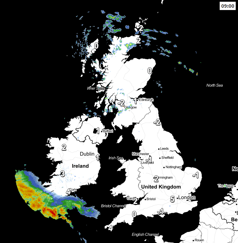
Most parts are waking to a frost this morning, but it's fine apart from a few showers, mostly over the North and West of Scotland, Fife, Lothian and Derry. These have been falling as snow on hills and as freezing rain here and there making it icy underfoot first thing, but the showers will fade as the day wears on. For most, though there'll be a fair amount of sunshine especially this morning. After the frosty start and with a West or South West breeze lighter than of late it'll be quite pleasant for a while, but through the day, the sunshine will turn milky from the South West, and it'll feel cold in any breeze, with top temperatures mostly in the range 5 to 8C.
Across the far South West, however, there are already a few showers, with thickening cloud bringing bursts of rain to the Isles of Scilly and the Channel Islands by mid-day, this probably spreading as far North as Hampshire, the West Country and South Wales by dusk in a freshening South Easterly wind.
Scotland and the far North and North East of England see clear spells after dark. Light winds allow it to turn frosty again and misty in places, with patchy freezing fog forming later in Highland glens and the Central Lowlands. Lowest temperatures here -3 to +2C. It could also turn quite cold perhaps with a ground frost over other parts of northern England and Norfolk for a while before cloud and rain across remaining areas move in to lift temperatures later in the night. The rain will be heavy in places, with snow likely over the higher peaks of the Pennines, in a mostly moderate East or South Easterly wind. Elsewhere it'll be mild or turn milder in a fresh Southerly wind, with temperatures mainly between 7 and 10C by dawn.
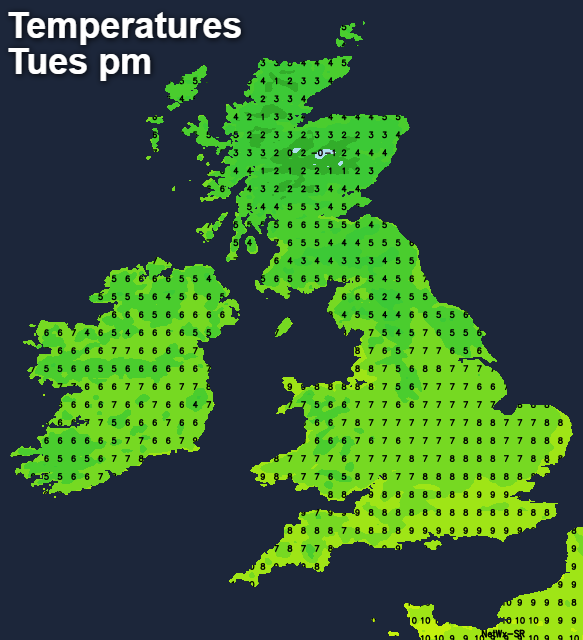
Wednesday sees huge contrasts across the country, with much of Scotland having a cold day. Highland and the Trossachs should be mainly dry and bright at times, while the East and South of Scotland are more cloudy with showery bursts of rain. These could be wintry on hills falling as snow on the Southern Uplands, in a light or moderate North Easterly breeze that'll feel raw with top temperatures here no more than 3 to 5C as a result. The far North of northern England, Derry and Antrim may also be rather cold and raw with bursts of rain, falling as snow on the higher peaks of the Pennines.
Across remaining areas, it'll be milder, but equally as unsettled. There'll be outbreaks of rain or showers heavy in places, but with a few drier, brighter intervals moving in from the West during the afternoon. Towards the South coast, a moderate South to South West wind could be quite fresh, with top temperatures from the Midlands southward mostly in the range 9 to 13C.
The rain and hill snow in the North clears away into the evening, leaving all but southern England with a lull after dark. Light winds and clear intervals may allow mist and patchy fog to form again mostly over Scotland, where some of it will be freezing as temperatures here fall to -2C to +2C. It may also turn quite cold further South with a ground frost for a while in rural areas as temperatures drop to between 3 and 6C, but it will remain mild in the South. Overnight though, more cloud and rain will be moving in from the South West, preceded by snow on Scottish hills.
The remainder of the week looks very unsettled and often windy with gales possibly severe, but most parts will be mild. After some heavy rain in places, it turns colder from the North next weekend, with showers turning wintry on hills before it becomes mainly dry and quieter by Sunday. Expect some frosty nights though into the new working week especially in central and eastern areas, where patchy fog in rural areas could locally become dense and freezing.