A lovely day after the chilly start but a large low pressure from what was ex-hurricane Oscar will influence our UK weather later today and this weekend. Not for everyone though.
This morning it is cold, frosty with clear skies and sunshine. With light winds, there a just a few fog patches about but if you are wrapped up warm, it is a lovely November morning out there.
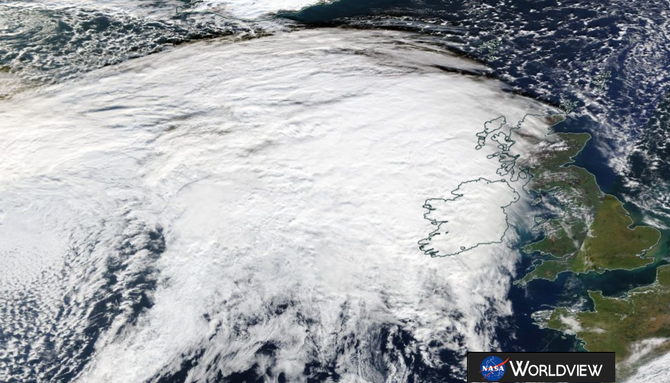
By tomorrow morning it will be more windy, with strong winds and rain over Northern Ireland, Scotland and Cumbria thanks to an incoming low pressure which formed from what was Hurricane Oscar. No longer a tropical system, this post-tropical low still has plenty of oomph and energy to bring gales in the far NW. And heavy rain to western Scotland.
Yesterday temperatures in southern England reached 15 C, in Wales 12C. Overnight Co Down fell away to -6C and many other spots in Britain went below zero. Powys, Oxfordshire and Aberdeenshire down to -4C.

Today
It will be a fine autumn day; sunny and dry with light winds and temperatures of 9 to 11C. High cloud appears from the west as the large deep low moves nearer. The ridge of high pressure which brought the fine, still conditions then gives way to the incoming fronts and the winds will pick up.
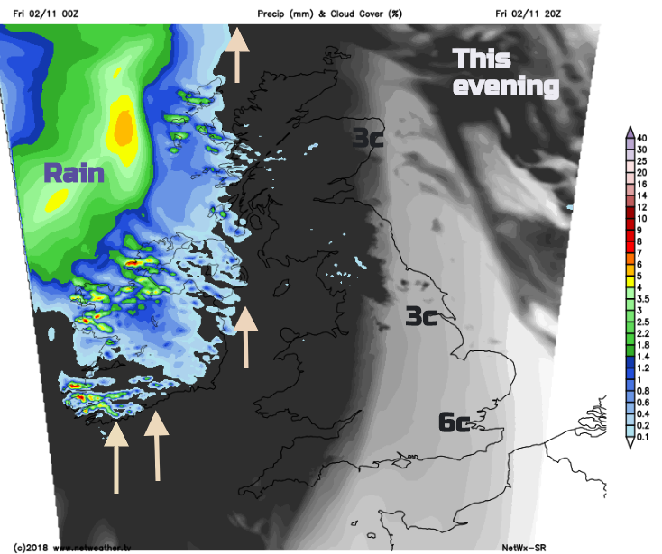
By Friday evening there will be a fresh to strong southerly wind for Northern Ireland and the west coast of Britain. Patchy rain will move over Northern Ireland in the evening and the west coast of Scotland before it turns wet over much of Scotland during Friday night.
Saturday
There will be a cool and breezy start for SE Britain but dry and bright. Elsewhere will be windy with more rain for Northern Ireland and Scotland. There is a Met Office warning for heavy rain on Saturday and localised flooding is possible. The rain, a cold front will move across the Irish Sea and bring wet weather to western Wales and NW England in the afternoon. Ahead of all this, another fine day, blustery but milder with temperatures widely 13 or 14C
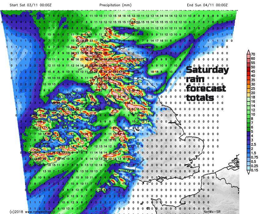
There will be gales, even severe gales for the far NW of the UK. A spell of high winds tonight and early Saturday, windy through the day and then another bout during Saturday night for the Western Isles. Not too cold overnight, out of the wind.
Sunday
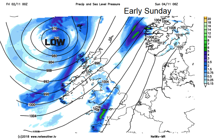
The cold front will begin to wave over England as another low pressure develops away to the SW. This will bring rain to southern Britain as the front fades moving eastwards during Sunday. As the second low pressure moves towards the Bay of Biscay it could throw more rain over southern or SW England later in the day,
The high gusts and gales move away from the Western Isles in the morning, Shetland in the afternoon as the main low pressure centre finally pulls away northwards.

By Sunday night a warm front will have pushed milder air over much of England and Wales with rain in the west and then cooler further north but with much lighter winds.
Will ex-Oscar's wet and windy weather interrupt my firework or bonfire plans?