
Temperatures on the rise for the rest of the week though turning increasingly unsettled with rain, potentially stormy in the north and west on Saturday.

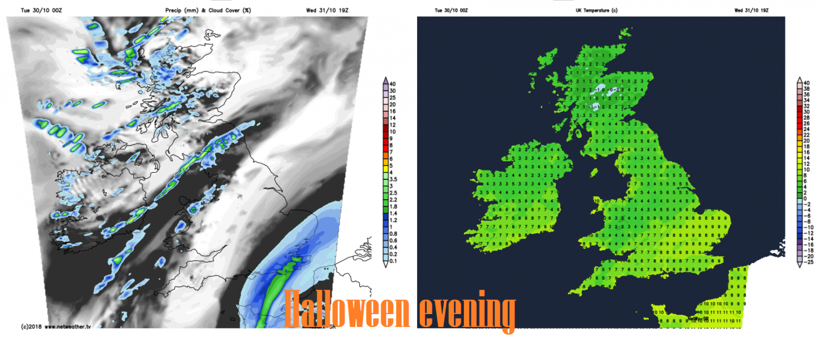
After a cold and frosty start to the week, temperatures will gradually creep upwards through the rest of the week, back into double figures tomorrow across the south. However, it will turn increasingly unsettled too, rain or showers affecting many parts over the next few days, particularly Thursday. But there will be some dry and bright spells too, more particularly tomorrow during the day, though it could turn into a damp Halloween evening for some. Friday is looking mostly dry and bright, but trouble is brewing out in the Atlantic for the start of the weekend, as the remnants of post-tropical Hurricane Oscar look to bring a spell of wet and windy weather to northern areas, as the deep low brushes the far northwest on Saturday.
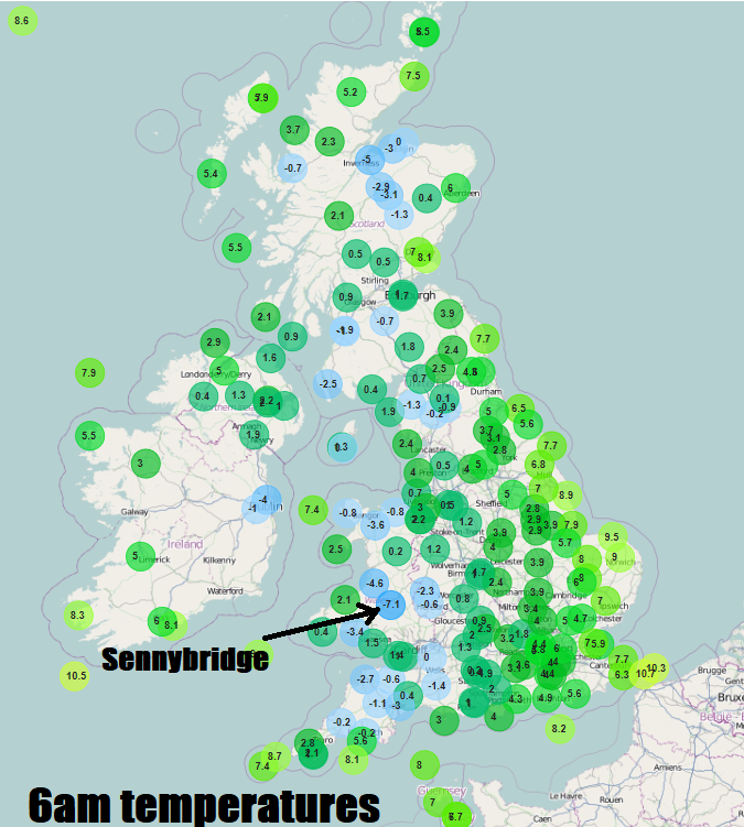
Last night we did not see the widespread cold and frost that Sunday night saw, however, clearer skies in the west have allowed temperatures to fall below freezing, along with some mist and fog patches forming. Sennybridge in Powys, south Wales, falling to -7.1C at 6am this morning, making it the coldest night of the autumn so far. Eastern areas of are starting Tuesday on a cloudy and breezy note, with a fair few showers blowing in on an easterly breeze across coastal areas of eastern Scotland and eastern England, with some outbreaks of rain glancing Kent and Suffolk.
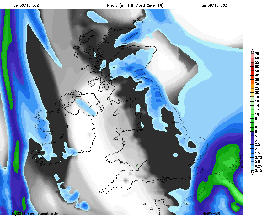
A low pressure system that brought heavy snowfall to the Alps and flooding to parts of northern Italy over the last few days, Venice particularly hit, moves north towards the North Sea today, bringing wet and windy weather to the Low Countries. Some of this rain affecting the far southeast of England for a time this morning then grazing the coast of eastern England into the afternoon, accompanied by a strong and cold northerly wind. Cloudier skies and a few showers will spread further west across the Midlands and parts of Wales this morning, but SW England and SW Wales staying mostly dry and sunny. Eastern Scotland seeing further showers in the afternoon, but western Scotland looks like staying mostly dry and sunny until a band of cloud and showers arrives from the west here and N. Ireland later in the afternoon.
Still on the chilly side today, temperatures reaching 8-10C at best, feeling colder than this down the east coast of England though in the strong northerly wind.
Northerly wind easing across eastern England overnight with any rain towards the North Sea coast tending to fizzle out, though probably remaining cloudy. Western Scotland, N. Ireland, Irish Sea and west Wales cloud with some showery bits of rain. Mostly dry with clear spells in between the far west and far east.
Mainly dry and bright or sunny in the east on Wednesday, cloudier in the west, with some showery rain in places at times. Thicker cloud and rain perhaps arriving after dark from the south across SE England in the evening. Milder in the south, temperatures perhaps reaching 10-13C, 8-9C in the north. Could be a wet evening for trick-or-treaters across SE England and East Anglia, with showers dampening those celebrating Halloween in the west too.
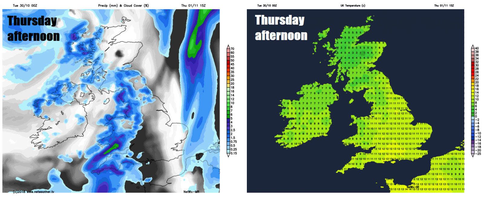
Generally cloudy and unsettled on Thursday, with outbreaks of rain affecting SE England and East Anglia first thing spreading north to affect parts of the Midlands and other parts of eastern England further north, while showery rain spreads northeast across parts of the west and north too. Mild again in the south, reaching 10-12C, 8-9C in the north.
Friday’s looking mostly dry, breezy and bright or sunny. However it will turn increasingly wet and windy towards the far northwest by early evening and the north generally into the night, gales or severe gales developing in the far northwest. Mild, with temperatures ranging from 9C in Scotland to 13C in the southeast of England.
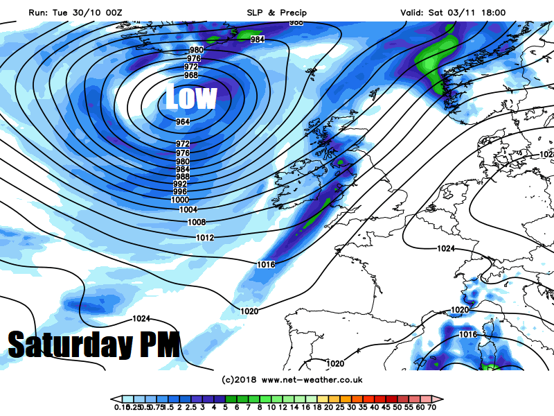
A deep low, formed by the post-tropical remnants of Hurricane Oscar, is forecast by weather models to track northeast between Scotland and Iceland on Saturday, bringing an increasingly wet and windy day across the north and west, with gales across the north and west. windy but drier and brighter for southern and eastern England - where it will be rather mild too.
A waving weather front trailing from Saturday's system may bring rain to parts of England and Wales on Sunday, but some uncertainty over detail for now. Scotland and N. Ireland perhaps bright and showery.


