Temperatures are on the rise this week, but with low pressures never too far away, there'll be rain and wind to contend with at times as well.
A taste of 'Indian Summer' is on its way, with temperatures perhaps reaching the low-mid twenties Celsius in places on Wednesday, despite the recent drop. So temperatures are on the up as very mild, moist air moves in from the South, but it won't last. By Thursday it'll be turning wet and windy from the West, with rain arriving in most parts by Friday and into next weekend.
It's begun cold towards Bournemouth and over some rural parts of Hampshire, Sussex and Kent where there was a ground frost in vulnerable valleys first thing. Morning sunshine, however, will soon lift temperatures and also quickly clear away any mist or fog patches. Much of England and Wales then see a fine day with sunny spells, although amounts of mostly and high-level cloud will vary. A South West wind will be light or moderate in the South, but fresher in the North with strong gusts likely over exposed coasts and hills of Cumbria. After the cold start in the South, it'll be milder than yesterday, with top temperatures 14 to 16C in the North and West and 16 to 18C in the South and East.
A meandering front is giving some rain over the North and West of Northern Ireland and central and southern parts of Scotland, but it's drier further North. Down, Armagh, Lothian and The Borders may see some brightness later where it'll become very mild. The front should tend to move a little further North through the day probably bringing some rain to Highland and Caithness during the second half of the day, where it'll be colder in lighter breezes.
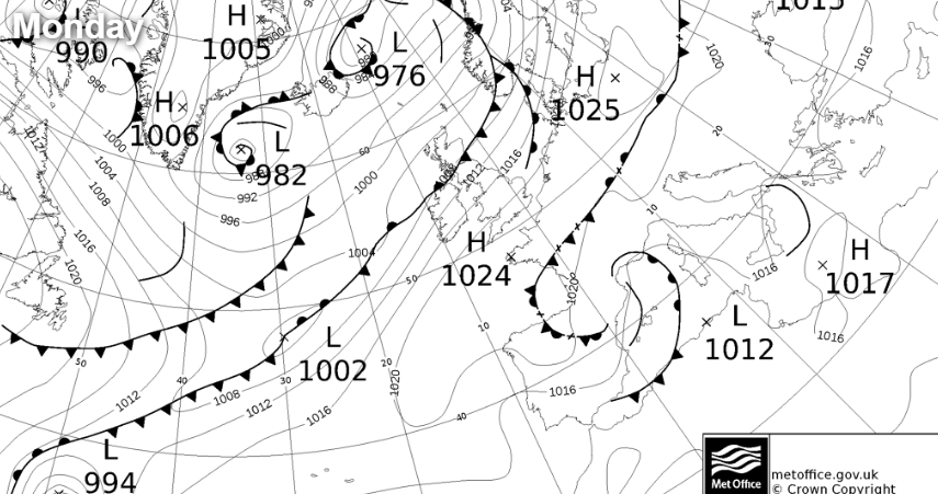
Elsewhere winds will be fresh occasionally strong South Westerly, with gusts in excess of gale force likely over exposed coasts and hills of Northern Ireland and towards the Solway Firth. Top temperatures 11 or 12C in the far North, 13 or 14C towards The Borders.
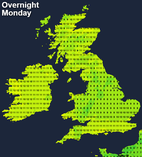
Northern Ireland should be drier after dark as that front moves to the North. So should central and southern Scotland, but there'll continue to be patchy rain or drizzle, particularly over coasts and hills exposed to a fresh or strong South West wind The North will see some rain where except over the Northern Isles it'll be a milder night. Elsewhere there'll be little change in a mostly dry evening and night apart from some patchy light rain or drizzle in the West. Skies will break at times to give clear spells especially in central and eastern areas, with a few mist and patches of low cloud or fog will form, but generally, there should be enough of a South West to Southerly wind to prevent the latter. It'll be a relatively mild night in most parts, with lowest temperatures mostly between 6 and 10C.
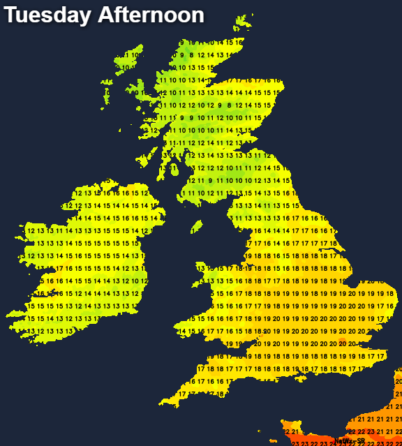
Tuesday across most of England and Wales should turn out to be very pleasant, once any mist or patches or low cloud have cleared. There'll be spells of sunshine between variable amounts of mostly medium and upper-level cloud, leading to an agreeable afternoon. The South and East of Scotland together with Northern Ireland should also see some brightness, but that front will still be hanging around bringing some rin to the North before hopefully and finally moving away. A South or South Easterly wind will be lighter over England and Wales, but still fresh locally strong over exposed coasts and hills in the West. Top temperatures 13 to 16C in the North West and 17 to 20 in the east and South locally 21 or 22C where you see the best of the sunshine.
Scotland and Northern Ireland keep a lot of cloud after dark where it becomes misty, with patchy light rain or drizzle in places. Across Northern Ireland and the West of Scotland, you're more likely to catch a passing shower. Over England and Wales, it'll soon turn misty, with patchy fog and low cloud forming again overnight. The West generally sees more cloud with eastern areas most likely to see skies clearing at times. A southerly wind will be lighter in the East but fresher in the West, in a very mild night in most parts, with minimum temperatures mostly in the range 6 to 11C.