
Cool and breezy conditions will persist for rest of the week, with some chilly nights, changeable in the north. Hints of very warm weather in the south and east next week.

Sunshine towards the south coast allowed the temperature to climb to 25.3C at Exeter on Tuesday, but generally England and Wales saw stubborn cloud and rain through much of the day, thanks to a slow-moving waving front. But today promises more in the way of sunshine for most and a fresher feel for the south, as the cold front sinking south eventually clears the cloud, rain, warm and humid conditions away. The rest of the week and into the weekend will stay breezy, with rain or showers at times but also periods of sunshine, with nights on the chilly side. Temperatures generally staying in the teens, but perhaps into the low twenties in the southeast. However, there are hints from the models that it will warm up early next week, particularly towards the east, with temperatures perhaps into the mid or even high twenties Celsius.
A cold front lying between the Severn Estuary and The Wash at breakfast time marks the boundary between a mild, cloudy and humid airmass to the south and cooler, fresher and clearer airmass to the north. A line of rain along the front will slowly sink southwards across south Wales and southern England through this morning with cloudy skies and patchy rain ahead of it across southern England ahead of it. To the north of the band of rain it’s a brighter and fresher picture this morning, though with a brisk westerly breeze which will blow in blustery showers across Scotland.
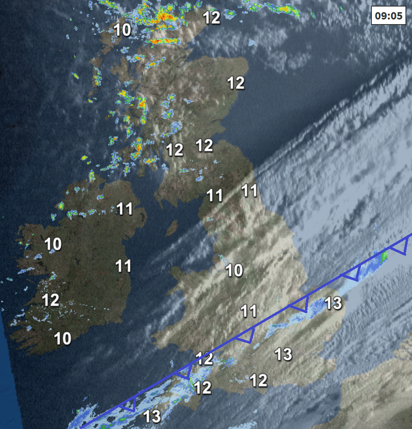
Morning cloud and rain will gradually clear away from southern counties of England into the afternoon, though perhaps lingering over the Channel Islands, then for most it will be a breezy afternoon of sunny spells, showers will continue to blow through Scotland, frequent and heavy in the west, a few showers affecting Northern Ireland and NW England too, mostly dry further south.
Feeling fresh across all parts in the westerly breeze, a different feel across southern areas after a warm and humid day yesterday, temperatures reaching 13-16C in the north, 16-18C in the south.
Cloud and rain across the far southeast and Channel Islands will soon clear this evening to leave most areas with a dry night and clear spells, which will allow the air to turn chilly overnight, with temperatures to dip into single figures in rural areas. Scotland and Northern Ireland will continue to see showers with a longer spell of rain of moving through for a time, perhaps heavy in places.
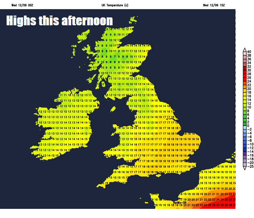
A fine but chilly start for many across England and Wales on Thursday, a band of rain along a cold front moving southeast across Scotland and N. Ireland, fragmenting into showers as it reaches northern England into the afternoon. Further showers following across western Scotland, but for many it will remain a dry day with sunny spells, though breezy. Temperatures reaching 12-15C across Scotland and N. Ireland, 16-19C across England and Wales, perhaps 20-21C across the southeast.
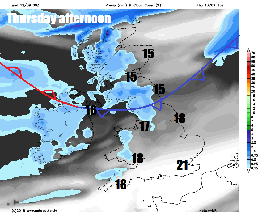
Outbreaks of rain will spread east across Scotland and N. Ireland Thursday night before clearing Friday morning to sunshine and showers for the rest of the day, sunny spells further south but also showers spreading in across northern and western areas of England along with Wales, but much of southern and eastern England staying dry.
Weekend
A changeable and breezy weekend in store, after a dry and bright morning for most on Saturday - cloud and rain will spread in across northern and western areas through the afternoon and evening, the south and east of England staying dry and bright. Outbreaks of rain through Saturday night across the north and west slowly sinking south across England and Wales towards southern areas through Sunday, sunshine and showers following across Scotland and N. Ireland.
Potentially warming up next week, as high pressure builds on the near continent while a potential storm formed from the remnants of Hurricane Helene may pass northeast somewhere near the west on Tuesday, dragging in warm and humid air, potentially sending temperatures in the south and east into the high twenties, but there could be wet and windy weather in the west as a result of that storm. A long way-off so this potential could change.
.png)
On the subject of storms, the UK and Ireland Storm Names have been released by the Met Office overnight, Jo Farrow has a blog on the #StormNames.
A more pressing storm is on everyone's minds along the southeastern seaboard of U.S.A., as category 4 Hurricane Florence continues to strengthen as it barrels towards the Carolinas for tomorrow, more on this in my blog here


