


A sticking weather front will bring some patchy rain and lots of cloud for some today. Tomorrow we have showers in both the northwest and southeast but sunny spells elsewhere. Then low pressure arrives from the east to bring an unsettled end to the week.
A three-way split for the UK today, as the weather front which arrived yesterday, sticks over the middle of the country creating the dividing line. The front will eventually clear later tomorrow; then we have an increasingly unsettled end of the week to look ahead to. As, unusually, we'll see low pressure moving in from the east, right over the top of the UK.
Underneath the front today, there's plenty cloud with a few patches of drizzle or light rain. The cloud will tend to thin and break as the day wears on though, with the front doing what it can to move further southeast before fizzling away.
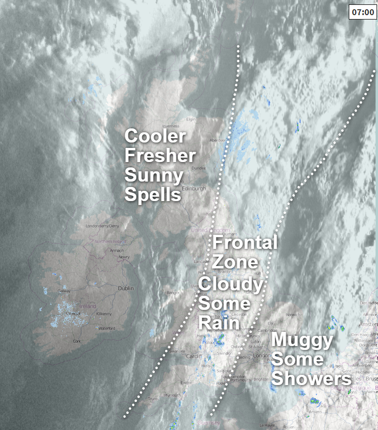
To the north is where we'll find the most sunshine today, with just an occasional shower here and there. After a cool start, temperatures won't shoot up by any means, with 15-17c the typical high. For warmth, you need to head to the southeast corner, as the muggy air is still in situ here with highs into the twenties. But, there will be a fair amount of cloud and the risk of the odd sharp shower.
Overnight tonight, with clearer skies from northern England northward, it'll be another chilly one here. Further south, with a bit more cloud, temperatures will tend to stay in double figures. We'll see the starting of a pincer movement from two areas of showers heading inland into the early hours as well - one in the far northwest and one in the far southeast.
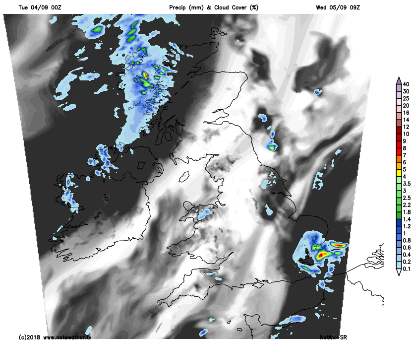
They'll be hit and miss, but it'll mean a wet journey to school and work for some by morning. But elsewhere, it's mostly dry with plenty of sunny spells coming through once any mist or low cloud has cleared.
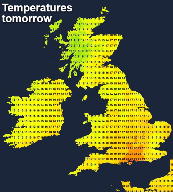
The northwest showers will tend to spread further south and east through the day, bringing cloud ahead of them. The ones in the southeast will continue but aren't likely to spread any further than the southeast corner and East Anglia. There could be some quite spicy ones in amongst them though, with maybe a thunderstorm or two as well. Temperatures tomorrow will be warmest during the sunny spells in central, southern and eastern parts reaching the high teens or low-twenties. Otherwise, 15-18c will be typical.
Overnight, the band of showery rain in the northwest will continue to move further southeast, clearing Scotland and sitting across northern England and perhaps north Wales by dawn. The southeastern showers will continue for a time but will shift away into the early hours and the first part of Thursday morning.
We're then left with a day of sunny spells and showers for most parts. The showers will be most frequent across the northern half of the country, becoming fewer and further between further south. It'll still be warm in the south and particularly the southeast, but cooling off again elsewhere.
Then, to end the week we have low pressure coming onto the scene. You'd normally expect a low to be coming off of the Atlantic, but not this time, as it's going to be heading in from the North Sea.
There is some uncertainty over the precise track of this one, so it may be a little further north or south of where it's shown. But the long and the short is that the weather is going to be cool and unsettled to end the week and start the weekend. By Sunday, the low should start to clear back from where it came from and into the North Sea, allowing high pressure to ridge our way, settling the weather down again.


