


Some cooler nights, a north wind, bands of rain and a more unsettled look to our UK weather as the week progresses.
What a weekend, the top temperatures was 26.1C on Sunday in Topcliffe, Yorkshire for the start of September and meteorologically the start of Autumn. The months are divided neatly into four segments for statistical reasons and summer 2018 was one of the sunniest, top 5 and the warmest on record for England. The top temperature this summer was 35.6C on the 27th July at Felsham in Suffolk." 96F. Later this week temperatures will settle between 15 and 20C with a touch of frost.
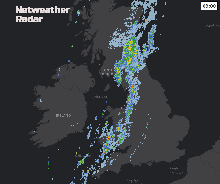
This morning a cold front is slowly bringing different, fresher air in from the NW. The warm humid air remains to the SE with blue skies and sunshine. With hardly any breeze the temperatures will rise into the twenties and it will feel close and muggy. Along the front there will be more cloud, a brisk north wind for a time and outbreaks of rain. This band moves from northern England and Wales into the west Midlands and SW England. The rain turns more showery this afternoon as it moves over the West Country so there could be some heavier bursts. The front gets a bit stuck as it begins to wave so the Pennines, Peaks and North York Moors could stay damp and grey into the evening
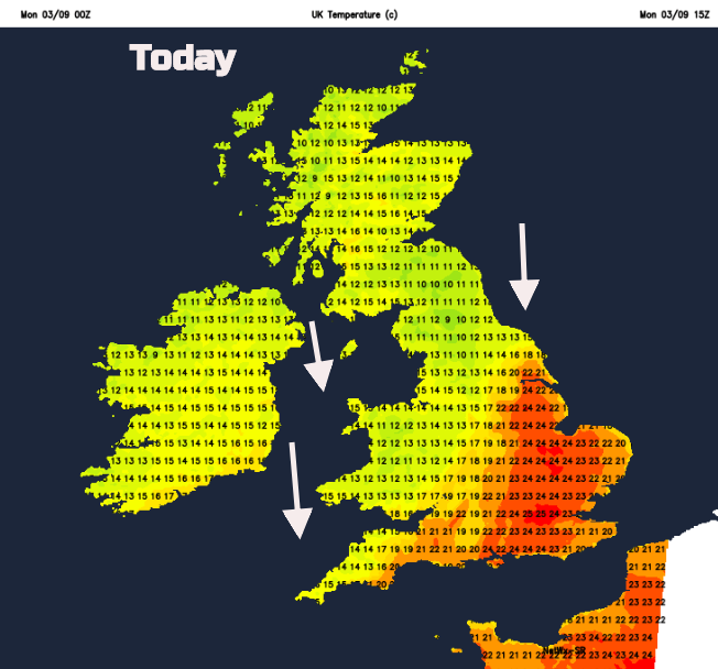
For Scotland and Northern Ireland air temperatures will only be 13 to 17C although it will feel pleasant in the sunshine with a light to moderate N to NW wind. In the rain temperatures will remain in the low to mid-teens. Still just like summer for SE Britain in the sunshine and warmth.
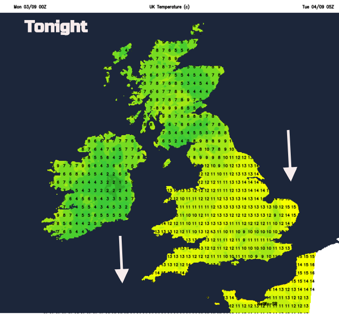
The north wind pushes the cooler air southwards tonight and there will be a touch of frost in the north, on the ground and an air frost for inland Scotland, maybe Northern Ireland with very light winds
For Tuesday the top temperatures will be subdued, between 20 and 22C for central southern England in a bit of shelter from the north wind. Tuesday overall is a rather quiet day. High pressure tries to build in but does a kind of bad miss.
By the middle of the week, it won’t be as warm anywhere and there will be another front heading into the far NW. Today’s waving front will still be over East Anglia and the far SE so could bring a few showers and more cloud. Don’t disregard and old front too quickly.
Wednesday night looks chilly, still with that cool north wind and the front begins its progress through Northern Ireland and northern Britain on Thursday bringing more unsettled weather. Still fine and dry further south.
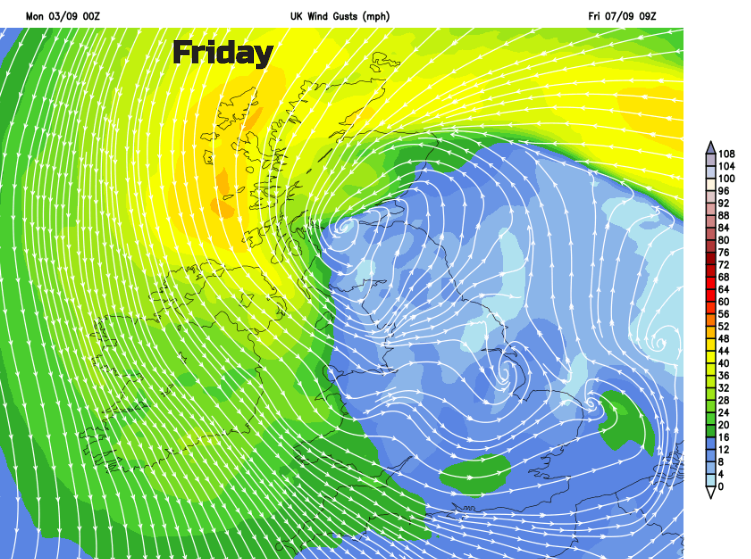
By the Friday the weather looks quite topsy turvy. A low pressure develops and heads from the North Sea into Scotland from the east. Strong winds tuck around this, but it contains some warmer air aloft and the risk of heavy and persistent rain.
So, as this week goes on our UK weather becomes more unsettled. There will be some cooler nights, front from the NW and then a potentially wet and windy end to the working week, for some.


