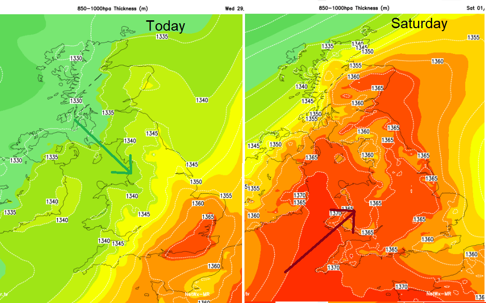
Once today's rain fades there will be a cooler, more settled spell. Warmer air returns on Sunday and overall there will be a lot of fair weather about.
Once today’s rain fades the air turns fresher and high pressure will build in for the end of August, the end of meteorological summer. However, by the weekend it looks like a series of weather fronts will run in from the Atlantic, bringing rain, blustery winds but a return to warmer air.
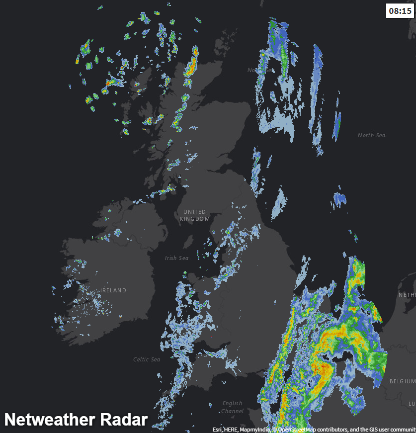
There is a cold front moving SE through the UK today and a low pressure over France. The cold front has cleared eastern Scotland but is still bringing patchy rain to NW England, Wales and SW England, it will continue to weaken. Behind this frontal band, is the fresher air with plenty of hefty showers coming in from the NW. So, some sharp bursts of rain, even hail and thunder mixed.
The rain over SE Britain could also include a few thundery bursts. This showery area will pull away eastwards this morning and leave clearer skies with sunshine. The cold front dries up but will move more cloud over England during the day. Most places become drier during Wednesday, but the sunshine amounts will vary.
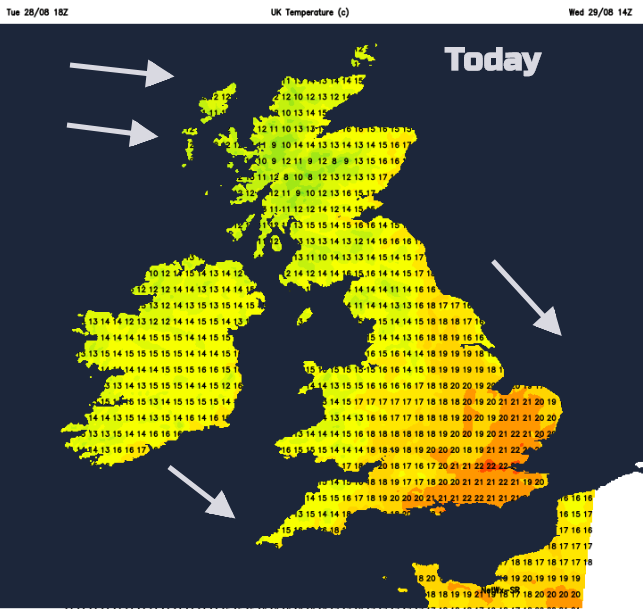
It was a cool start for inland Northern Ireland 3.5C Castlederg and Scotland 5.6C Dalwhinnie, well down into single figures. London was at 14C to start the day still in the warmer air. The winds veer to the NW as the front moves through and there will be clearing skies and a noticeable freshness. The sunshine will still be warm, out of the breeze but it will feel different. For SE Britain, still in the warm air, today temperatures will be 19 to 22C maybe a 23C for London.
The front continues to fade, reaching Kent this evening. Pressure builds in and tonight will be calm and cool. More of the UK will dip down into singles figures overnight. There could be a touch of frost for northern mainland Scotland and still a few blustery showers for the Northern Isles.
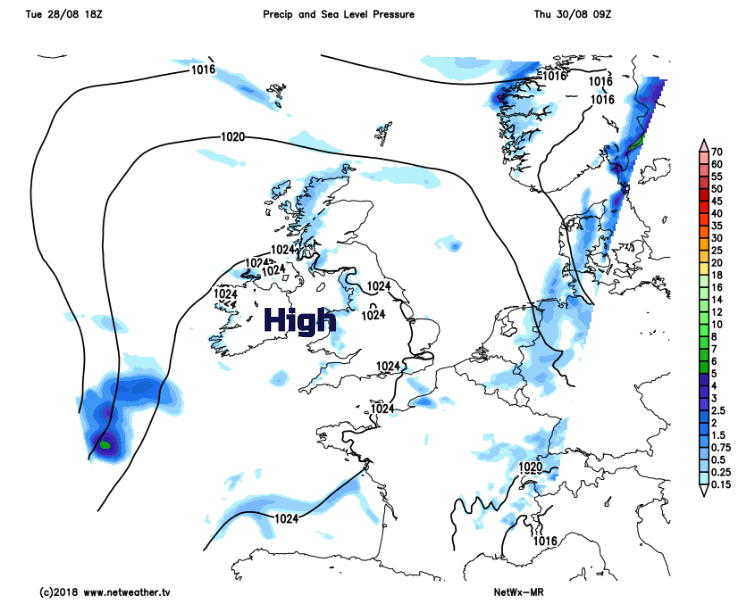
High pressure will be over the UK on Thursday and Friday but there will still be a few showers for western areas on Thursday. Winds will be very light with temperatures of 15 to 20C. Another cool night into Friday but an area of rain will be approaching Cornwall. The southerly winds begin to pickup for Northern Ireland and western Britain and it will feel pleasant with lots of sunshine, just more cloud in the far SW.
The Atlantic frontal bands struggle against the high pressure and although there will be rain for NW Scotland, otherwise the rain fades.
The weekend. There will be a lot of fair, bright weather about. Sunday looks the warmer day. Weather fronts will try to move in, mainly for Northern Ireland, Scotland and NW England, Wales but they weaken quickly to just more cloud and light patchy rain, mainly for western areas.
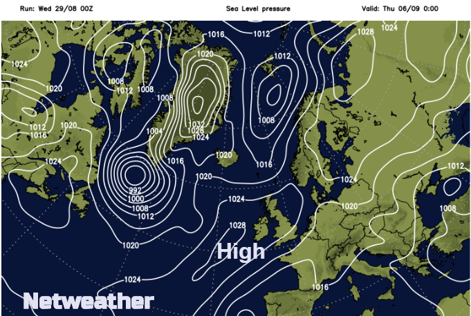
For the following week, it does look like high pressure will build in and could bring a settled week for much of the UK.
Butterfly image J Farrow