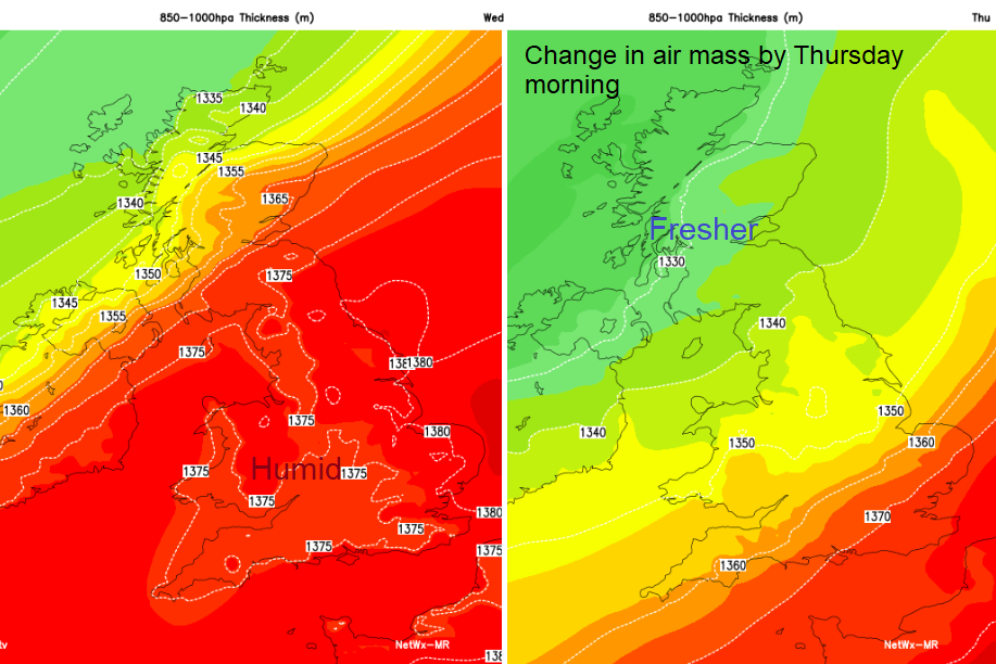
Still warm and humid over much of England and Wales today but a cold front bringing rain is introducing fresher air with cooler conditions for all by Friday.
If the humidity and mugginess are getting a bit much for you, then a welcome change is on the way. However, if you are enjoying the late August warmth a cold front from the NW will spill in cooler and fresher air today and tomorrow.
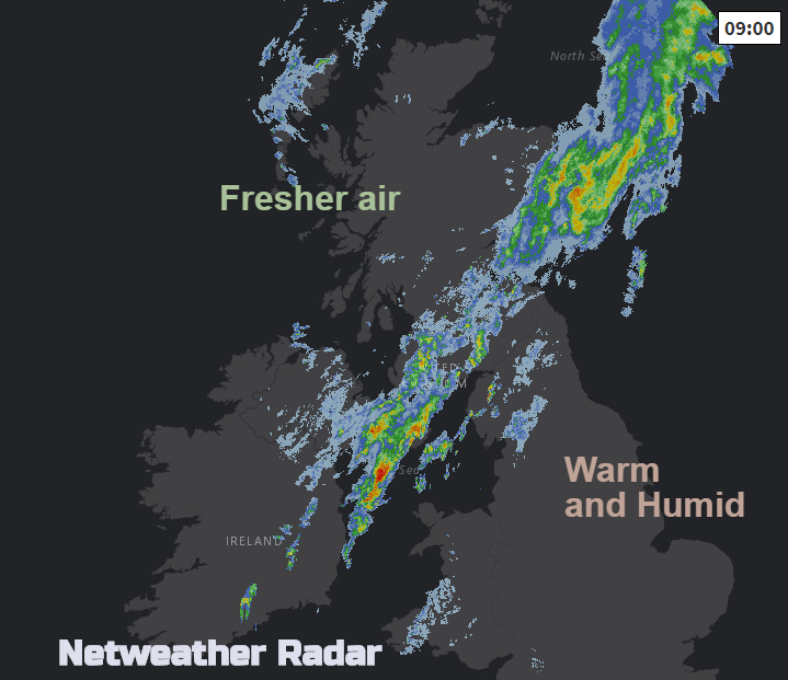
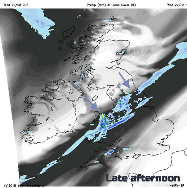
Over much of England and Wales, there is the humid, close, warm air with more cloudy, mist and murk and dampness for western coasts. Inland there are more breaks and more chance of seeing sunny spells today. Watch the movement of the frontal band on the radar today. There has been a grey, wet start for some this morning.
Temperatures will reach 27 or 28C for East Anglia and SE England with a light to moderate SW wind. Northern England, Wales and SW England will reach into the low twenties earlier in the day, maybe the mid 20sC for sunny areas such as eastern England. To the far north temperatures will stay in the mid-teens, with the Central Belt of Scotland reaching 18C. Once the rain band clears, there will be fine, bright weather with warm sunshine and just a few showers for the Western Isles.
This cold front moves steadily south-westwards but the rain on it fades and becomes patchy. For the far SE, it won’t be until early Friday, when an occluded front pushes through, that the air will finally feel cooler and fresher for London and the Home Counties.
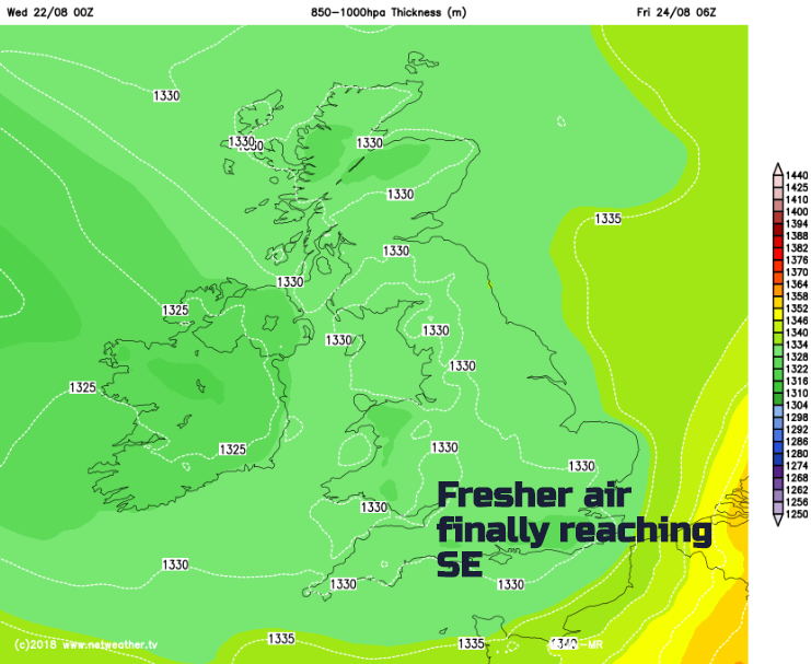
By Thursday morning the cold front will be clearing the SW and over central southern England into East Anglia. The occlusion will be over Scotland and Northern Ireland bringing some sharp bursts of rain as this line begins its progress south-eastwards This leaves a more showery, cooler flow with a blustery NW wind. This will be quite a change from how it has felt for the start of this week. Meteorological autumn starts on the 1st of September, there maybe a hint of autumn in the air by Friday. By Friday night temperatures will widely fall into single figures and again on Saturday night in the north, there could be a frost. That’s the 25th / 26th of August.
The forecast for the weekend (Bank holiday for most) has varied quite a lot. It doesn’t look hot with temperatures starting in the teens and peaking in the low to mid-twenties C. On current forecasts, winds should be light on Saturday as a band of rain sways into SW Britain. There could be heavier showers for eastern Britain. In-between not bad. Sunday also fair with warm sunshine but still cooler air. A low pressure will head into the far NW later, so just keeping an eye on that. Other models show more rain and wind from the west for Sunday day, so quite a variation. Monday brings sunny spells and showers from the west.