
It's been rather cool this weekend with mostly welcome rain. In a bizarre reversal of UK weather, we can say let's get back to the heat and sunshine.
Low pressure away to the NW keeps our UK weather unsettled and showery for the start of this week. However, the weather will become fine and sunny and warmer. By Friday and for the weekend temperatures will widely be back into the mid-twenties with the low thirties possible in the south once more. The cool weekend has been a bit of shock after the recent heat, but the rain has been most welcome by farmers and growers, and grass everywhere. Belfast recorded 99mm of rain and there was flooding in Northern Ireland as one low pressure cruised through. Parts of western Britain saw 50 to 70mm of rain which did spoil some summer events, bit gutting after the weeks of fine, dry, sunny weather but we do need the rain. Much of SE England and East Anglia hadn’t had any rain in nearly two months and although the dramatic thunderstorms brought downpours, other areas only got a few mm of rain.
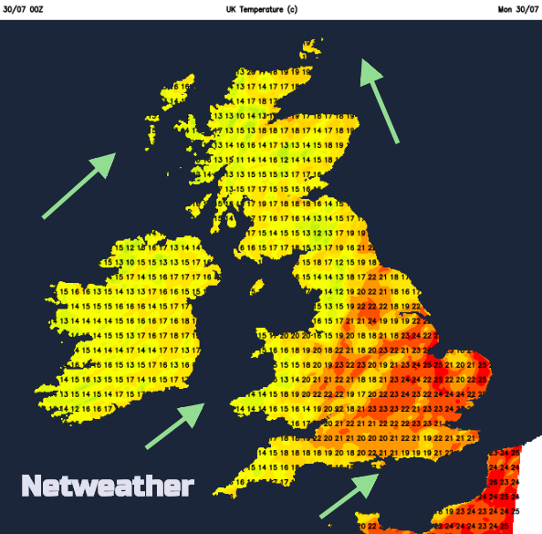
Last week the top temperature was 35.3C (96F) on the 26th, last night Highland Scotland dipped to 4.1C. Today we are looking at highs of 25C. Still warm and central Britain won’t be as windy so that it will feel better here. Other areas keep a moderate to fresh S or SW wind which will ease overnight. Today isn’t as windy as at the weekend for southern Britain but still breezy.
Lines of showers continue to feed in from the SW, so some areas get shower after shower and others miss most of them. There will be bright and sunny spells in between with SE Britain settling down this afternoon.
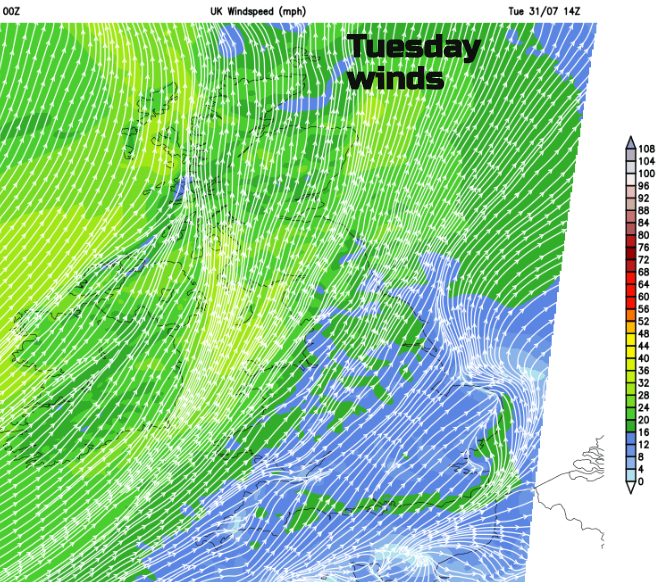
A scattering of showers continues for western Britain overnight with a fine sunny start for much of Britain on Tuesday. The low-pressure centre spins closer to western Scotland which will bring more clouds and showery outbreaks for Northern Ireland and then more persistent rain to the Western Isles and NW Highlands. It will be windy here with a fresh to strong SW wind. Tuesday looks to be the coolest day of the week with the SW winds but high teens, low twenties with perhaps East Anglia and London managing 25C with lighter winds.
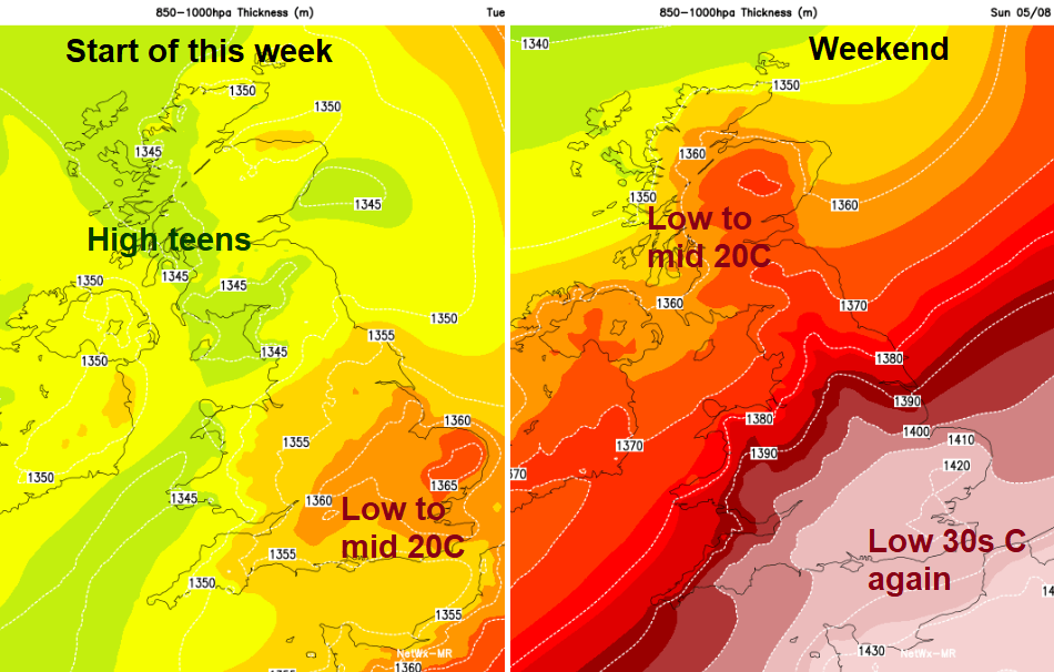
By Wednesday more rain will affect Ireland and NW Britain still with the SW winds. Temperatures begin to creep up in the SE into the mid-twenties. The rain spreads overnight into Wales, NW England and more of Scotland. Ahead of that on Thursday the heat begins to build with southern and eastern Britain beginning to hot up as the winds ease off and pressure begins to build.
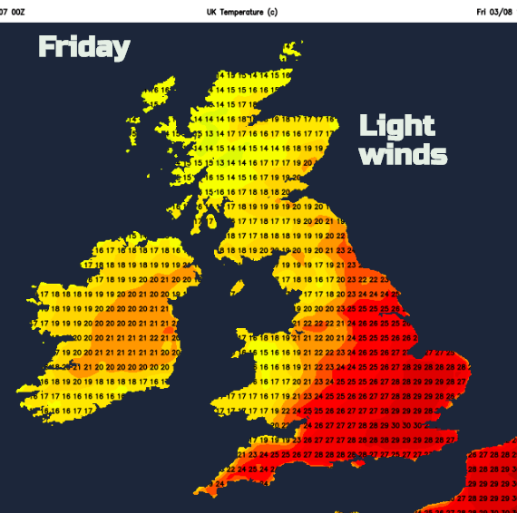
Later in the week, there will be more cloud for Northern Ireland, Scotland, especially the north and west and around the Irish Sea into Cumbria. Most places will be dry and warmer but there is the risk of the odd hefty shower, even thunderstorm, but nothing like the end of last week.
If you do have outdoor weekend plans it will be back to high summer, not like this weekend’s soggy, cold blip. I’m off to find a jumper.


