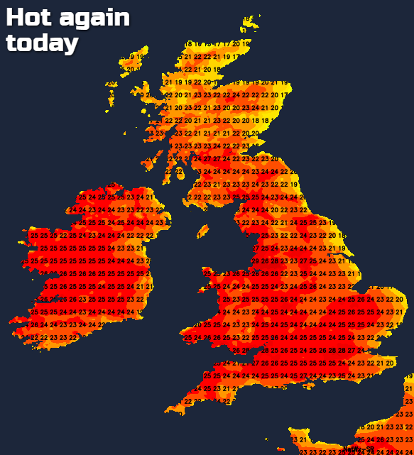
The heatwave continues through the rest of this week, with western and northern parts best placed to see the highest temperatures.
30.1c was the peak temperature yesterday, at Hampton Water Works in London. Today will see similar highs, but as we have a bit more of an easterly breeze, it's likely to be western parts seeing the highest temperatures - perhaps somewhere in northwest England taking the top spot.
For the most part, we have wall-to-wall sunshine again today, but there will be some cloud drifting up through Ireland (with a few splashes of rain here), into Scotland, and also some moving into eastern coastal counties from time to time. This evening and overnight, a bit more cloud drifts in from the east, making its way some way inland as temperatures cool off. Overnight lows will fall to 8-12c quite widely, 12-16c further north and west though.
Those temperatures will shoot up quickly again tomorrow morning, but with a stiffer east to northeast wind than today across much of England and Wales, temperatures may be a touch cooler, particularly down the eastern side of the country. That may well leave Scotland to take the honours with the highest temperatures - closing in on 30c or so in places.
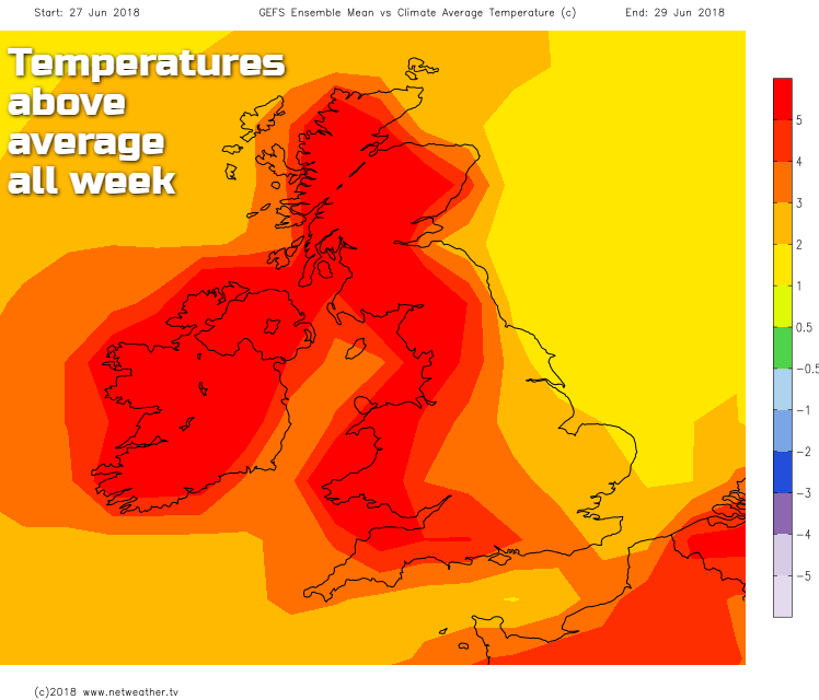
Through the remainder of the week, the easterly breeze will continue to keep a lid on temperatures in eastern parts, with western and northern regions seeing the highest temperatures each day. Despite this, everywhere will be much warmer than average, with western parts well into heatwave territory at 5c+ above the norm.
The forecasting models have started throwing a bit of a curve-ball in over the last 24 hours, bringing in an earlier than expected breakdown from the south this weekend. It's nowhere near nailed on at this point, and the most likely bet is still for the fine weather to last right through into the start of next week in most regions. But there is a risk of some thundery downpours starting to develop, initially in southern areas as low pressure nears.
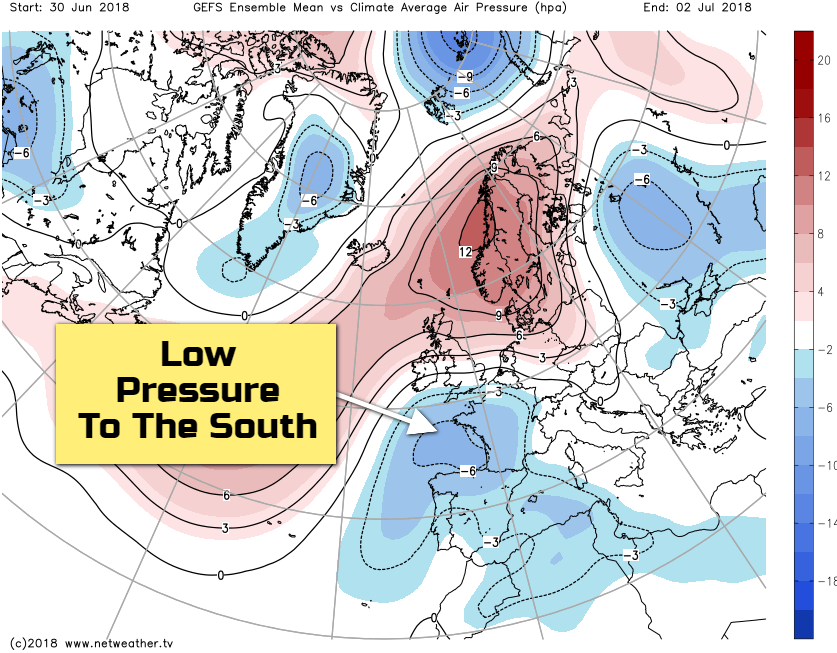
That's something to keep an eye on, but for many, it's a case of as you were this weekend, with plenty more sunshine and heat - with the highest temperatures still in the west. Should the low pressure near, it'll be southern counties seeing the initial risk of the thundery downpours, the humidity will also be on the up from the south.
Thanks to Duggee (Kicky Kicky Kick Kick) for the inspiration for the headline today - if you've not heard it, and don't want to have the song rattling round your brain all day today, I'd recommend not watching it!