#StormHector caused a stir yesterday and has left the UK in cooler, fresher air. Saturday looks wet for many with a better Sunday. Much warmer in the south next week.
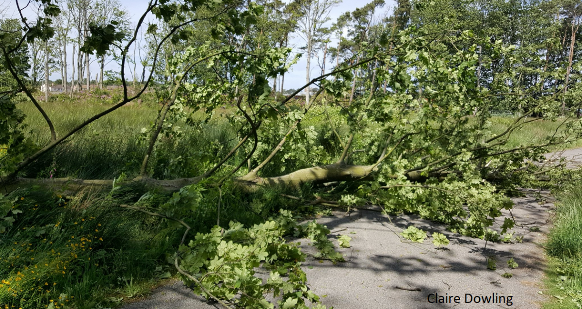
Well thankyou #StormHector for clearing awsay the cobwebs and creating a carpet of green leaves. It was a blustery day across the UK but for those in the gales and high gusts it felt quite strange. It looked and felt in some ways like autumn with strong winds and falling leaves, but they were bright green leaves and the air was warm and muggy. All very peculiar this summer storm. There were power cuts in Northern Ireland, disruption for parts of northern Britain as ferries were cancelled or delayed, debris on the train lines, and trees fell on roads, cars and pathways.
That low pressure has now moved away towards Norway and there is a succession of lesser lows out in the Atlantic ready to run across the UK in the next few days. So, the weekend forecast looks quite mixed, hefty showers, bright spells, feeling cooler and fresher and rather changeable. But much warmer next week.
Today
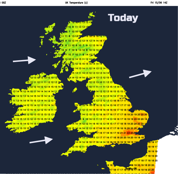
It won’t be as windy. In a west to SW breeze it will feel cooler. Temperatures will be in the low to mid-teens for many, but the SE will stay warm, up to 22 or 23C in London with very light winds and sunshine. A good deal of England and Wales will have a fine bright day with sunshine. There are a few showers appearing in the far SW this morning and a scattering will move in from the west, but most places will stay dry.
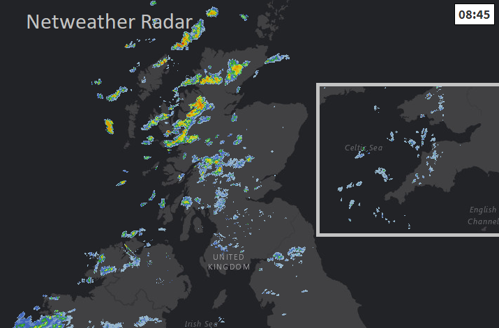
There is high cloud flowing in from the west and a peppering of heavy showers for the NW Highlands with a few more over western Scotland, just into northern England and Northern Ireland. There will be more cloud through the day and the showers continue to feed in from the west, so some areas fine and bright, others getting wet.
Tonight
The winds ease over Britain as temperatures dip away into single figures. Quite a cool night if you are off camping. Wind and rain will move over Northern Ireland in the night, not a repeat of Thursday but a spell of wet and blustery weather which will move over the Irish Sea on Saturday morning.
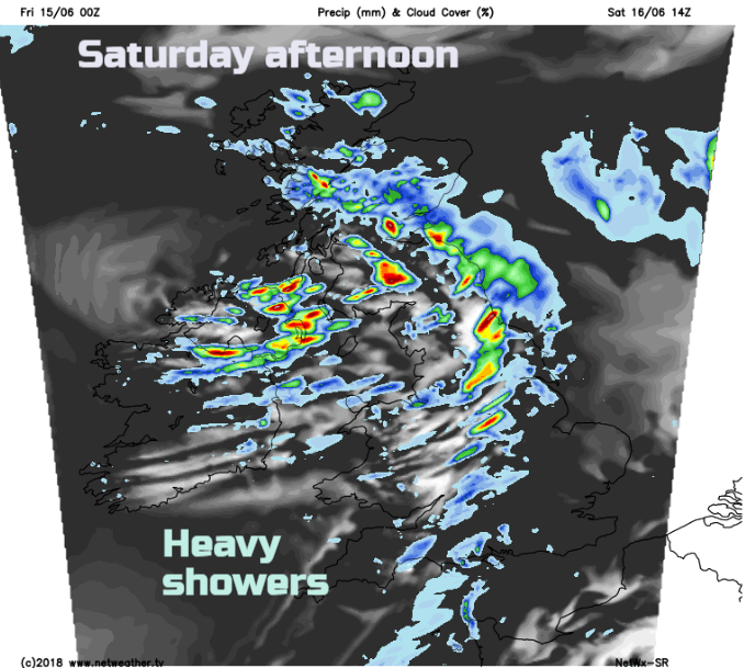
Saturday
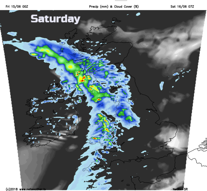
As a flabby low pressure moves over the UK this weekend, it will bring with it frontal rain which moves north-eastwards in the morning, and then hefty showers follow with the risk of thunderstorms. There will be bright or sunny spells in-between, so it will be a frustrating day. Winds will be brisk from the SW with temperatures around 14 to 18C. Parts of southern England, especially the SE could miss the rain altogether and the same for NE Scotland and the Northern Isles. Saturday evening looks cool with a scattering of showers, but many places will become dry as the mina shower band clears off into the North Sea.
Nippy for northern Britain overnight with light winds but Sunday will feel warmer, with temperatures lifting into the high teens for central and eastern Britain. It remains cooler further west with a SW wind and more showers.
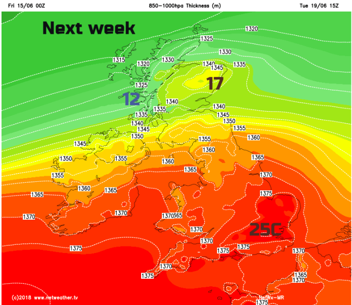
Next week looks the same, blustery showers from the Atlantic for western areas, pockets of frontal rain making their way right across certain parts of the UK. However, it will feel much warmer for southern Britain with temperatures back up into the 20s Celsius and becoming more settled as the week progresses.