Not much overall change in the weather during the coming days, with just the details of showers and cloudcover varying day to day.
The weather remains in much the same mood, as 'spring northerlies' common in May extend into early June. Once these winds become established they can last for weeks, so the current weather pattern comes as no surprise. As a result, there'll be little overall change for the remainder of this week and into next weekend with just subtle variations, mainly in the form of cloud cover and shower activity.
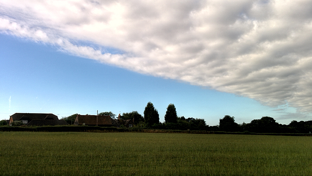
 There's a lot of low, grey cloud and mist again this morning that's giving a little drizzle in places, mostly over central and eastern areas. In the West, it's a bit brighter, with Northern Ireland, Scotland and northern England seeing the sun come through during the morning. North Wales, much of the Midlands and East Anglia should also improve through the afternoon, as the cloud continues to clear from the North. Elsewhere, the cloud may prove more stubborn, keeping the day largely overcast over central southern England and across parts of the South West.
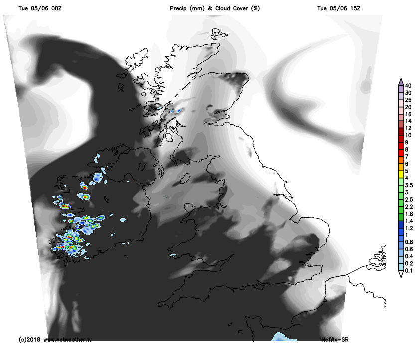
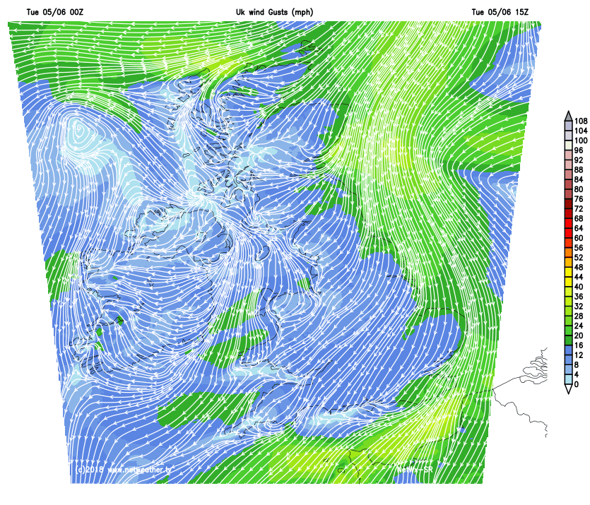
It'll be mainly dry, but with a few exceptions. The Channel Islands have already seen a few sharp showers, and further may occur through the day. As the sunshine lifts temperatures, Tyrone and Fermanagh, the West and South of Wales and the far South West could also see isolated showers developing later locally heavy with thunder, but you'll be very unlucky if you catch one. Mostly light winds will be from the North or North East, with top temperatures 19 to 21C in the sunshine, but only 13 to 16C where much of the day stays cloudy.
Apart from the Channel Islands where you'll continue to see a few sharp showers into the evening and overnight, it'll become mostly dry after dark. Clear spells are likely particularly in the West, across Northern Ireland and over much of Scotland, with southern England also seeing skies breaking. Many central and eastern areas, however, will see low cloud returning, making it misty in some parts by dawn. Winds continue mostly light North or North Easterly, with minimum temperatures mainly in the range 7 to 10C in a somewhat cooler night than of late. In a few sheltered Highland glens, temperatures could fall as low as 3 to 5C, cool enough for a touch of ground frost here briefly around dawn.
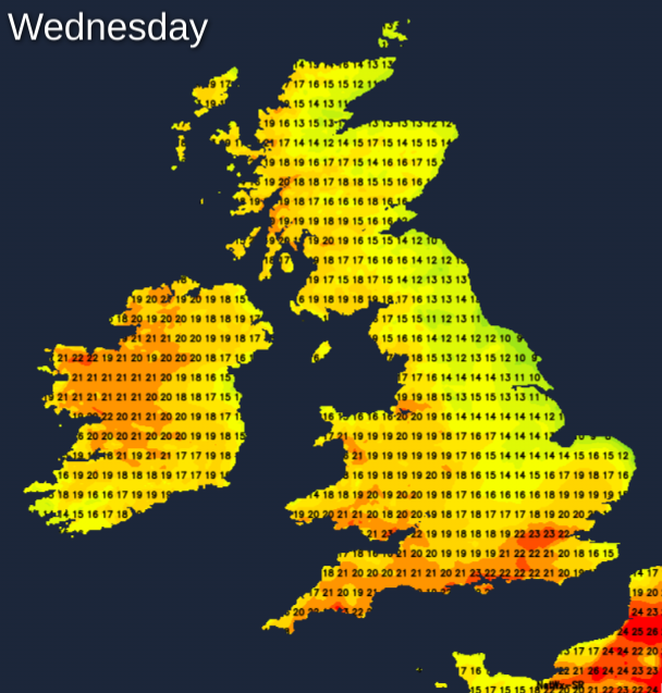
Wednesday remains much the same with the bulk of the sunshine in the West and South and over much of Scotland and Northern Ireland. Many central and eastern areas, however, will begin grey and overcast again, with the cloud eventually 'burning' back to North Sea coasts to give most parts some sunshine by the afternoon. It'll continue mostly dry, but like yesterday isolated showers could develop later. These seem most likely towards Donegal, over the far South and South West but more particularly over the Channel Islands where some will be heavy perhaps giving thunder, but they will be very much 'hit and miss'. A North or North Easterly breeze continues to be mostly light, with top temperatures 18 to 22C in the sunshine but only 14 to 17C where you keep cloud.
The far South and South West together with the Channel Islands remain at risk of catching further possibly sharp showers during the evening and overnight, but they'll be isolated. Across the bulk of the country, however, it'll continue to be dry. There'll be clear spells particularly in the West, while eastern and some central parts may see mist and low cloud 'rolling-in' again off the North Sea on a gentle North Easterly breeze. A few short-lived mist or fog patches could also form in some rural valleys in the West, but although turning chilly in places towards dawn. It's not expected to be a particularly cold night, with minimum temperatures mostly in the range 7 to 11C. In a few sheltered Highland glens, 4 or 5C seems more likely, perhaps with a touch of grass frost briefly around dawn again in the coldest spots.