
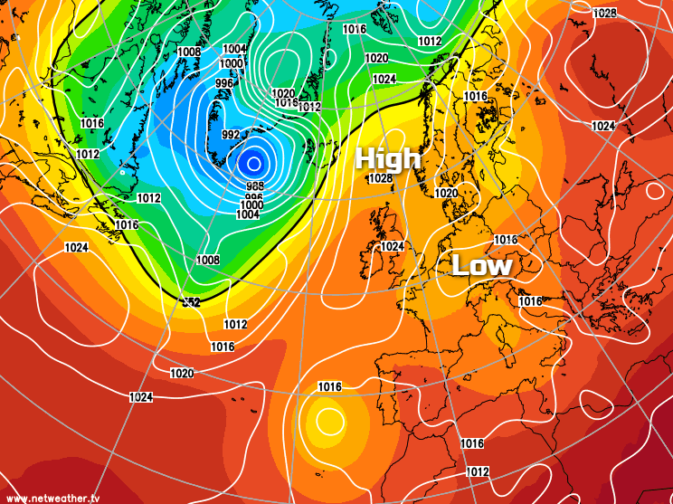
High pressure is in charge so warm sunshine is the main theme through this week, but with low pressure not too far away, there will be the risk of some thundery downpours in places.
High pressure is going to be the boss of our weather this week, so there's plenty more fine, sunny weather on the way. But with the high centred toward the northeast of the UK for much of the time, and low pressure never too far away on the continent, there is often going to be the risk of some thundery showers. Which, after today will mostly affect the southern half of the UK.
Today, we also have a weather front still affecting the northwest of Scotland and a good part of both Ireland and Northern Ireland. It's quite a stubborn one this one, having arrived Saturday, pushed a bit further southeast Sunday and having now retreated northwest again it's also pepped up a bit and is bringing some heavy, persistent rain at times. It should start to fizzle out later today to leave a drier day tomorrow though.
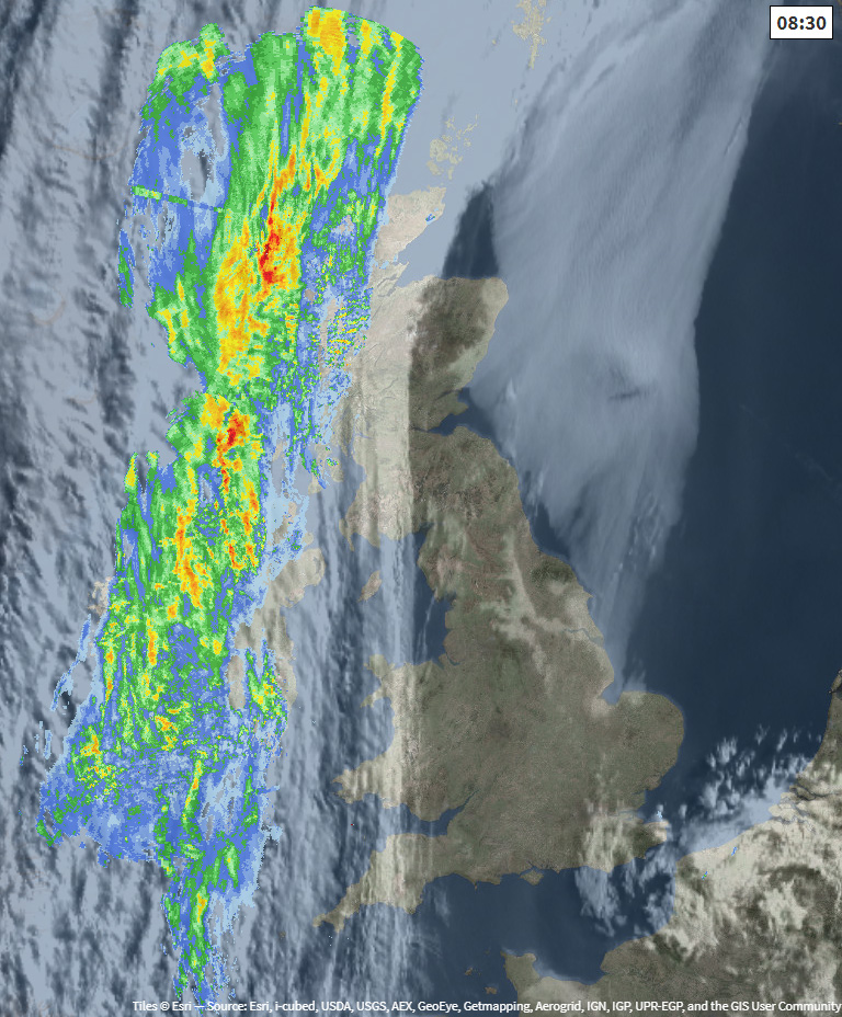
Elsewhere this morning, aside from a bit of low cloud here and there which will speedily burn off, it's virtually wall-to-wall sunshine. There is some more cloud coming into the southeast though, as you can see on the satellite image above, and that's the arrival of our first bout of less stable air this week. By lunchtime, we're likely to see a few isolated showers starting to pop up, initially in the southeast, but then moving further west and north, to affect central southern England, the Midlands, Wales and up into northwest England later. Not everyone will catch one, but they could be quite lively with hail and thunder if you do.
Temperatures today will widely hit 21-24c over much of England and Wales, 25-26c in London. Southern Scotland will head into the high teens, maybe low-twenties here or there, with much cooler temperatures, just into the low-teens under the rain across NW Scotland and Ireland.
Overnight tonight, many of the showers will die away, although a few more may move into the southeast corner. The rain across Ireland will have eased at this point, and there'll just be some patchy outbreaks affecting the northwest of Scotland, with one or two showers perhaps extending further southeast.
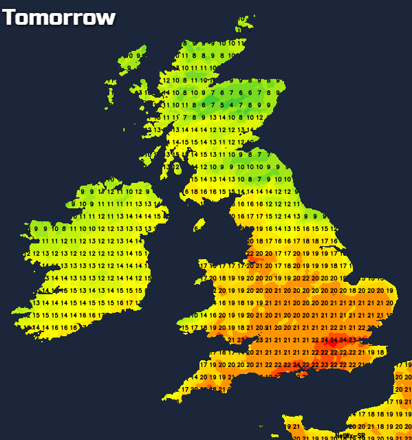
Tomorrow will see a fair bit of cloud affecting Scotland, there'll also be some low cloud drifting onto eastern coastal counties. Elsewhere there'll be more sunshine, albeit with a little more in the way of cloud drifting about at times. Like today, there will be the risk of some thundery showers, these running through southern areas of England, perhaps with a few getting going into the Midlands and Wales. They will be quite isolated though so that most people will enjoy a dry, warm day with highs again touching the mid-twenties.
From midweek, right through to the end of the week the pattern doesn't change with lots of warm sunshine for the majority of the UK and Ireland. With easterly winds blowing, eastern coastal counties will be prone to some low cloud and a chillier feel at times. And, there will always be the threat of thundery downpours affecting southern parts.
Looking ahead to the bank holiday weekend, not much is likely to change, so we're set to make it 2 out of 2 when it comes to sunny, warm bank holiday weekends in May - it's not too often you can say that!


