Much of the UK is bright, even sunny but SE Britain has heavy rain and a cold northerly wind to contend with. Hold out for Bank Holiday weekend, it's looking fine.
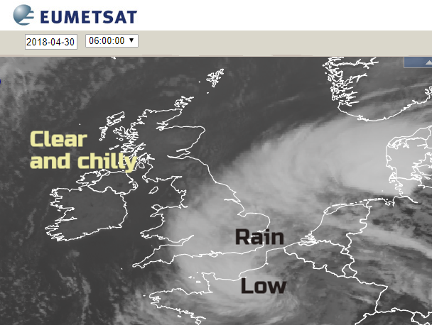
Usually, when much of the UK has sunshine and fine weather, it is NW Scotland that is wet and windy. Today the opposite is true. SE England and East Anglia are again being subjected to wet and now windy weather. There is heavy and persistent rain, on the higher ground you might even see sleet. A strong north wind is making it feel wretched and it looks wet for most of Monday, so there is the risk of localised flooding.

This area of miserable weather is associated with low pressure moving from France to the Low Countries. This is drawing down the brisk, cold northerly flow and throwing its occluding front’s rain over SE UK. Much of England and Wales will feel the effects of this wind today, reaching eastern Scotland later in the afternoon.

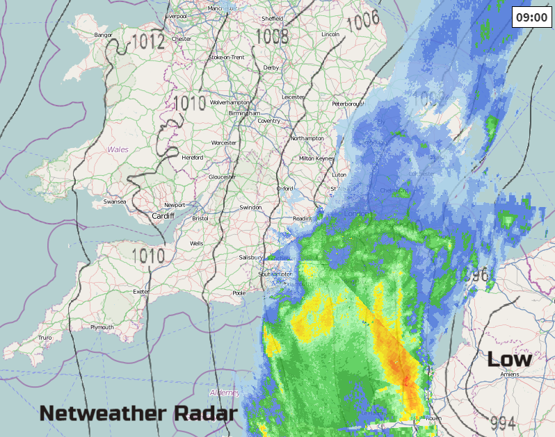
The rain pivots slightly, away from Hampshire and then West Sussex, but turning into Lincolnshire and more of Cambridgeshire. Under the rain area for eastern England with the strong winds, it will feel cold, temperatures struggling to 6 or 7C. Further west we could see 12 or 13C and again in the strong sunshine, it will feel warm even though the air is quite cool. The low pressure is throwing off a lot of high cloud so that is making parts of England bright rather than sunny, well away from the rain band.
Gradually the rain band will pull away into the North Sea tonight, taking its time to leave areas around The Wash. It remains windy from the Humber down to the Thames but leaves behind a clear, cold and calmer night for much of Britain with the risk of frost.
Next, an Atlantic frontal system will be heading in, throwing cirrus over Ireland and the Irish Sea by dawn. This will bring a real change for tomorrow. Brisk southerly winds for Ireland and western Britain with rain over Northern Ireland by lunchtime and then much of the afternoon. A fine bright picture for Britain and feeling milder in the east, 12 to 15C as the SW breeze picks up. The rain band will reach western Scotland, the Isle of Man, just into western Wales in the afternoon with a few showery bits ahead. Under the rain and in the wind, it will feel cool for Tuesday but a sunny improvement for SE Britain.
That rain will be over England on Wednesday with cooler air tucking behind on NW winds. Another chilly night then more settled on Thursday away from East Anglia.

Further ahead, for the Bank holiday weekend, it’s looking fine. High pressure is forecast to build over the UK, bringing settled weather and there will be warmer air for the UK. So, temperatures potentially in the high teens rising into the low twenties Celsius by Sunday.