Quiet enough today before a wet and windy spell midweek. The brisk southerly flow will lift temperatures but beware the easterly cold for this weekend. And some snow.
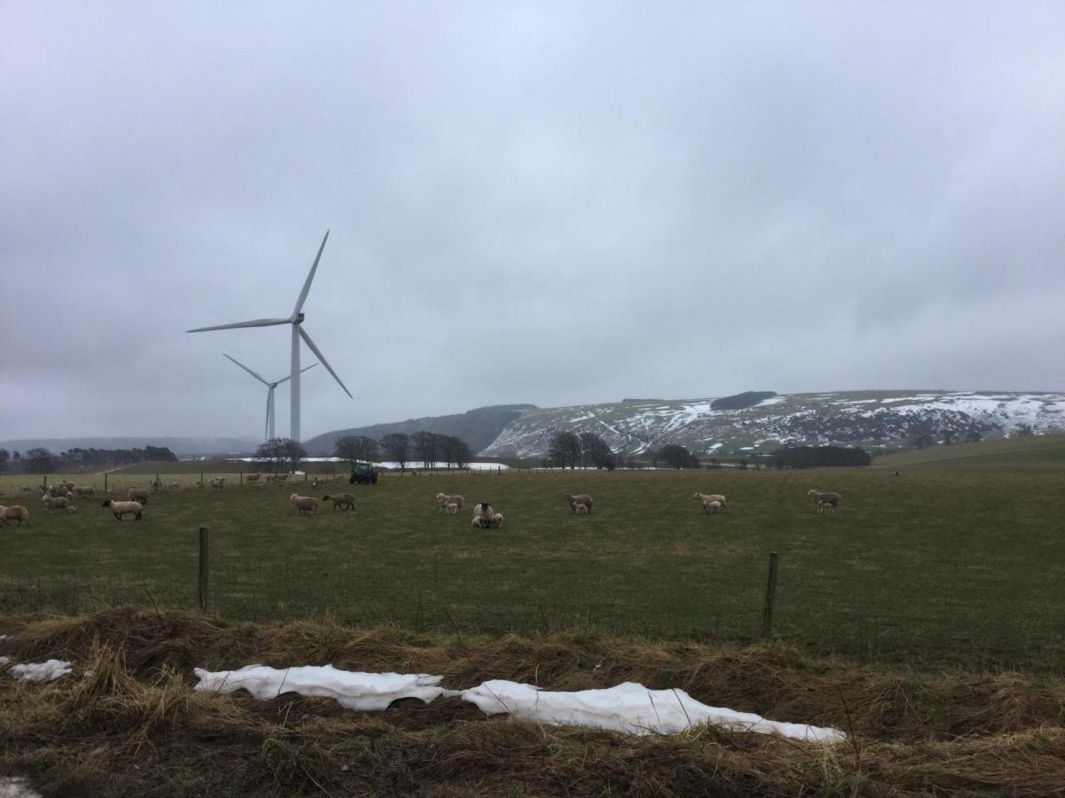
We have a better day after the recent rains. It will be mild again before an area of low pressure, out in the Atlantic, moves closer and brings wet and windy weather to western UK. The weekend is looking much colder. There are signs of snow now as well, which may mean excitement at a late taste of winter, or displeasure that we’re over all that now, bring on spring. Gardeners are not keen due to the frost risk. It’s not snow for everyone, but the air will be exceptionally cold for mid-March.
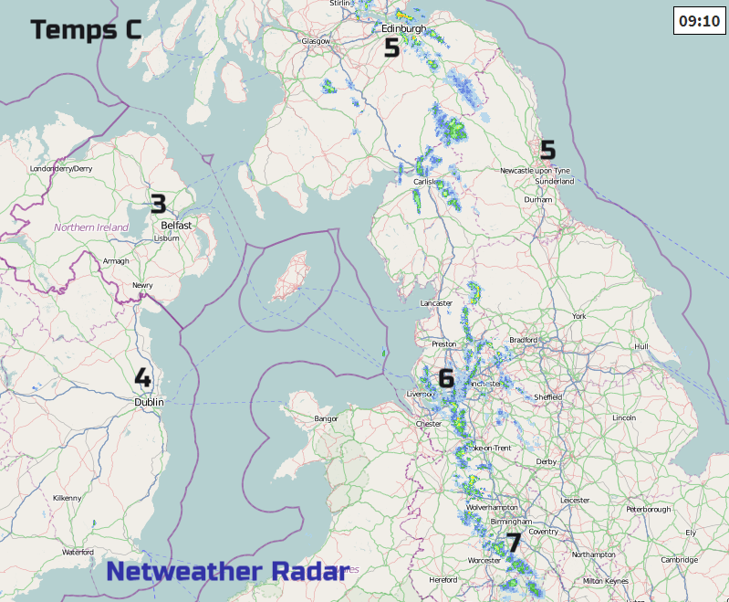
Back to midweek. Today there are lighter winds, with mixed skies. It is fine and bright, even sunny for Wales, Northern Ireland and SW England with a decaying occlusion bringing more cloud and patchy rain over the rest of Britain. Even here breaks are appearing and brighter spells. The cloudier band moves over eastern Britain with a few showery bits but overall not a bad day and certainly not the heavy rain that was around to start the working week. Temperatures of 9 to 12C.
Tonight
It will turn cold for a time over Britain tonight with a touch of frost. The southerly winds pick up over Ireland as cloud increases. By morning there will still be clear skies and sunshine for much of England and eastern Scotland.
Wednesday
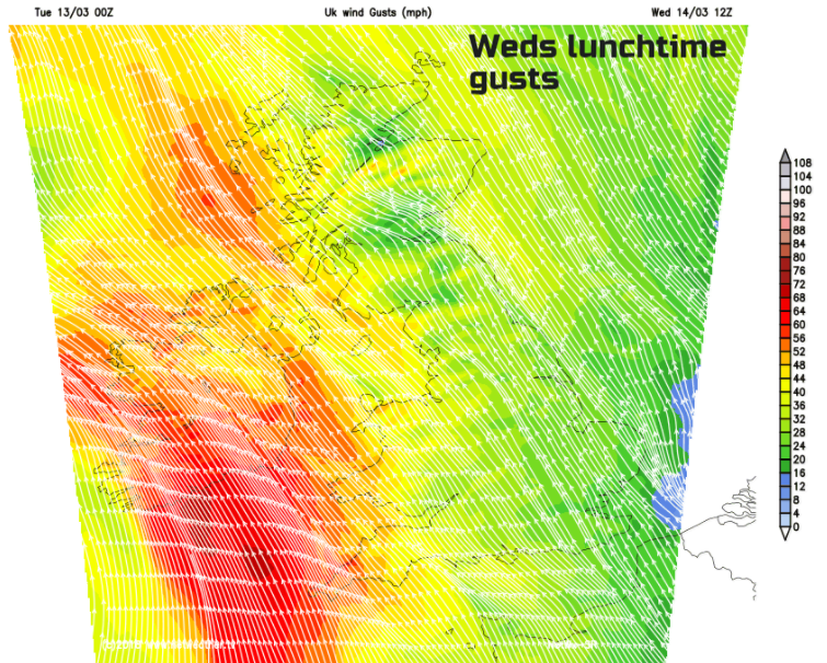
Fresh to strong SE winds will blow over the UK on Weds as the low-pressure hovers off SW Ireland. (known as Giselle in Europe). It will be very wet and windy for Northern Ireland and SW England. The ground is already sodden so flooding issues are likely. It will be mild, out of the wind and rain. Widely reaching double figures and 14 or 15C in the south. The frontal rain will pivot over Ireland and reach the West Country late Weds afternoon and through the evening. Then spilling over southern Wales and central southern England during the night. The strong gusty winds continue into Wednesday night with Wales and more of northern Britain being affected.
Colder air begins to creep into NE Britain with a brisk flow from the SE as the rain moves north through Britain. As it comes up against colder air, it will turn to snow over the Grampians and by Friday sleet and some snow will appear to lower levels of NE Scotland. Various low centres continue to swing around what was Giselle and throw a few showery rain bits over SW UK
A much Colder Weekend
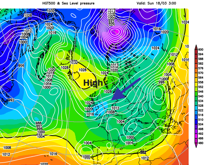
By the weekend, we see a shift in the flow. It’s more easterly, from the continent, it will be noticeably colder. Snow showers from the east could have started by early Saturday. It’s tricky to give amounts, locations and impacts at this point. The Met Office is likely to issue a warning. It’s the weekend, so not rush hour traffic or school journeys but plenty of people are out and about on Saturdays or travelling to events or sports.
Once again it will be very cold air travelling over relatively warmer seas setting off the showers, sea effect snow. Better with a longer sea track.
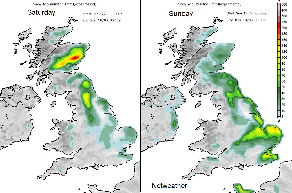
This gives an idea of areas that are more likely to be affected but don’t focus too much on the detail at the moment, just the general more prone areas.
With a brisk east wind, it will feel cold on Saturday and severe hard frosts will set in. Again, a bitter wind on Sunday and even colder Sunday night. Spring is on hold, prepare for the cold.
Cold Weather and Excess Winter Deaths, temperatures, illness and fuel poverty.