Red Warning for heavy snow, blizzards and freezing rain, amber alerts for snow and wind - welcome to spring!
We are experiencing exceptionally cold and snowy conditions for the first day of meteorological spring, perhaps the coldest March day for a long time or record-breaking, potentially crippling and even life-threatening conditions for some. The Met Office have upgraded the weather warning across SW England and Wales from Amber to Red for some areas, the area covered by the Red Warning includes parts of Devon, Somerset and south Wales, including Cardiff and is in effect between 3pm today and 2am tomorrow morning. There was a Red Warning in place for central parts of Scotland which was in effect for yesterday afternoon and overnight into this morning, but has now expired.
The Red Warnings mean there is a danger to life and pontential for signifcant travel disruption, so must be taken seriously by everyone, they are a trigger for emergency services and authorities to take immediate action and for the general public not to travel unless in an emergency. We have already seen the consequences overnight of not heeding the warnings or just being oblivious to them, with over 300 motorists becoming stranded on the M80 in central Scotland between Glasgow and Stirling, following frequent heavy snow showers through the central belt bringing large accumulations.
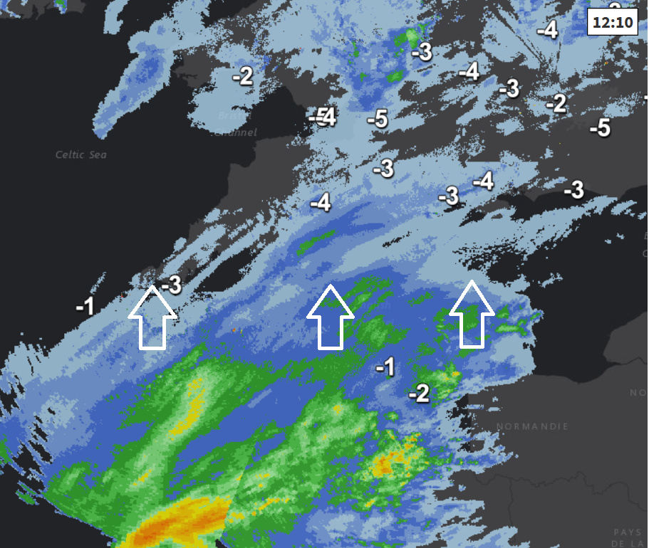
An amber warning is still in place for Scotland and northern England – as frequent and often heavy showers continue to blow in through today and tonight – driven in by a strong easterly wind gusting to 40-50mph towards the east, locally across NE England, winds have been gusting to 55-65mph. The heavy snow showers giving a further 5-10cm and where snow showers organise, perhaps 15-25cm. The drifting of these large accumulations in strong winds perhaps cutting off villages from Lincolnshire north along eastern Britain up to NE Scotland.
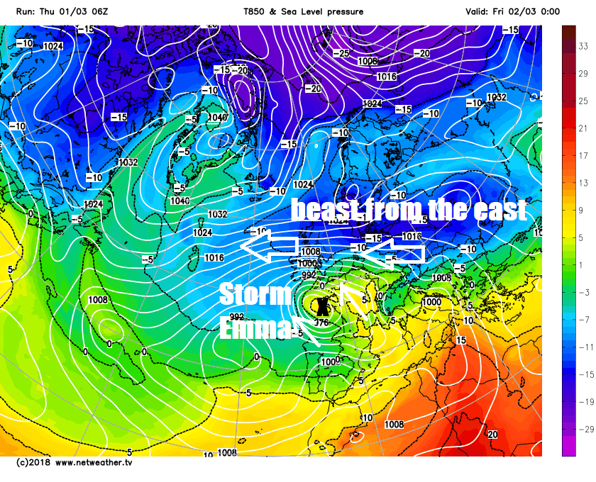
However, further south, attention turns to Storm Emma, named by the Portuguese Weather Service, but not by the UK Met Office or Met Eireann. The low is, at 11am, centred over NW Spain, but has sent an upper warm front north well ahead of the low pressure system, with moisture advection behind this warm front upgliding over still bitterly cold sub-zero air at the surface over southern UK bringing mainly light snow moving north this morning.
Behind this initial band of light snow moving north, is an area of heavier rain, sleet and snow across NW France. And it is this area of mostly heavy snow when it meets the freezing temperatures to the north over the UK, ahead of a surface warm front, which will push north across SW England and south Wales this afternoon ahead of Storm Emma drifting north across the Bay of Biscay this afternoon, evening and overnight – before swinging northwest and deepening towards SW Ireland on Friday.
The increasingly heavy snow pushing north across the southwest today PM will be accompanied by an increasingly strong easterly wind as Emma deepens, with gusts perhaps reaching 50-60mph across the west overnight. bringing blizzard conditions and drifting of snow. 5-10cm of snow are likely widely, but over the SW Moors and higher parts of south Wales, we could see 30-50cm, so drifting of these large accumulations will likely lead to road closures and risk of stranded vehicles.
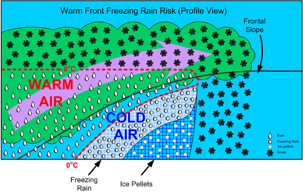
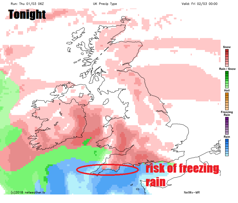
Less cold air trying push north on the southern edge of area of snow moving north over SW Britain may bring the additional hazard of freezing rain across southern areas of Devon and Somerset. A look at the cross-section profile of a warm front gives a general idea how it will be mostly snow but perhaps freezing rain on the southern edge of the area of snow moving north as milder air tries to push above surface air that is at or below freezing.
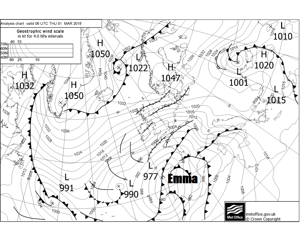
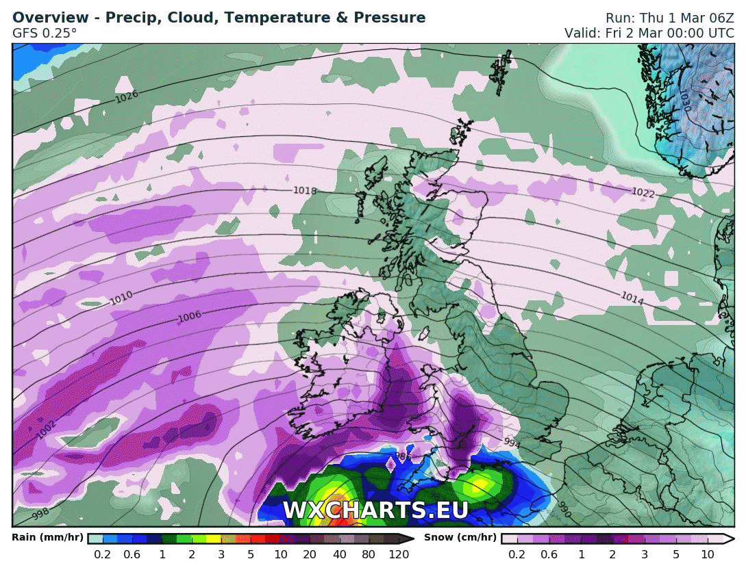
The deepening and change in direction of Storm Emma towards the northwest tomorrow from its track north today, is unusual in itself and is associated with a 500mb upper low / cold pool crossing the UK overnight and ending up to the SW of UK and Ireland on Friday. The upper low engages Emma into its circulation as it drifts north from Iberia, as surface lows tending to follow the 500mb flow.
Upper low in blues (500mb heights) and Storm Emma shown rotating around the upper low off SW UK.
After the heavy snow and freezing rain clears northwest from SW England and Wales overnight and into Friday morning, an occluding cold front associated with Emma will move N and NE across southern England and Wales on Friday afternoon and evening bringing another band of snow, the snow heavy in places, but less disruptive than for the southwest later today and overnight, but bringing 2-5cm widely, maybe 5-10cm in places, before the band of snow eventually weakens and peters out as it drifts north across the Midlands and East Anglia overnight into Saturday morning.
A strong and very cold easterly wind will continue to feed in heavy snow showers across northern areas on Saturday, further south, snow band fizzling out over central areas of Wales and England, perhaps turning less cold across the far south. A small low may track northeast in across the far south later in the day, bringing some snow inland across Wales and England and rain or sleet across southern counties of England. A recovery of temperatures across the far south on Sunday, perhaps reaching 6-7C for southern England, but for many colder than this further north, a band of sleet or snow spreading north, with another band of rain or sleet spreading in across the southern or southeast England in the afternoon and evening.