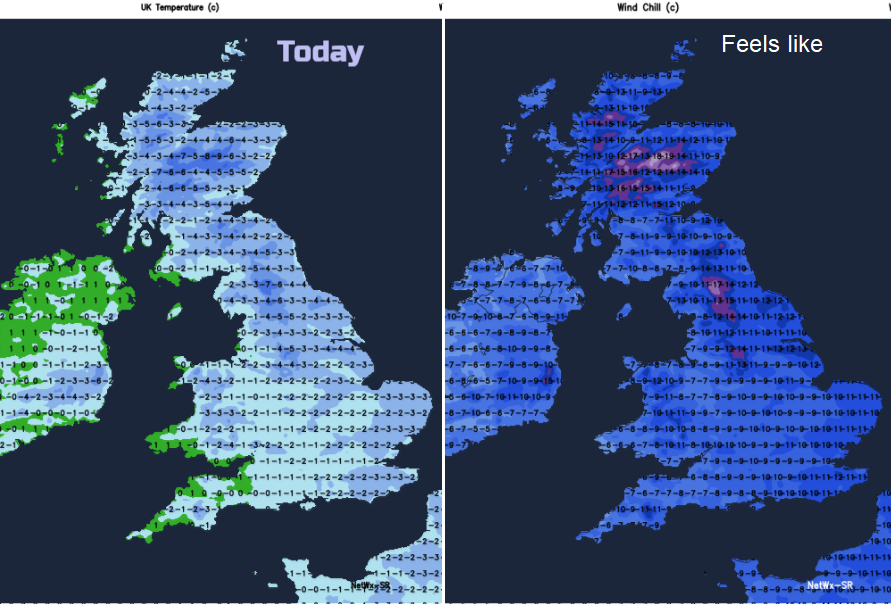
Today sees some of the coldest air over the UK for years. Do not underestimate the seriousness of the wind chill and extreme cold. Eastern snow showers continue. Next lot of snow from the SW Thursday.
Where ever you are in the UK today, it is going to feel bitterly cold. The coldest spell for ten years, we don’t usually get this type of air over the UK. Air Temperatures will be below freezing for most and adding on the wind chill, there is a risk to your health. If you must go out, be prepared that if you do get stuck or delayed you have the right clothing and kit. If children are out playing or sledging know the signs of hypothermia
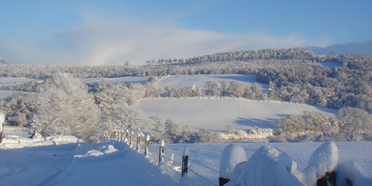
This is what all the Beast from the East fuss is really about, the origins of the cold air. It does also bring snow, East Anglia and parts of the SE have over 20cms lying in places. The snow showers piling in from the North Sea are set off by the temperature contrast as this intensely cold air moves in sea effect snow
This feed continues well into the weekend, particularly for NE Britain.
Snow showers from the east
Many areas are covered by a Yellow Be aware warning for snow showers and this bitter extreme cold.
There is an Amber Be Prepared warning over coastal East Anglia and SE England, further disruption is likely with further snow accumulations where the showers line up. This lasts until 10am, so through the morning rush hour.
Scotland and NE England into the North York Moors has an Amber warning lasting through today and Thursday. The snow cover varies greatly but there is blowing snow, drifting and often whiteout blizzard conditions. Schools are closed with plenty of disruption on the roads and railways, and NE England looks particularly prone to heavy snow. Those showers will just keep on coming.
Fresh to strong easterly winds will continue to make conditions difficult when travelling and the day (and tomorrow) feel perishingly cold. A severe frost tonight with sub-zero temperatures.
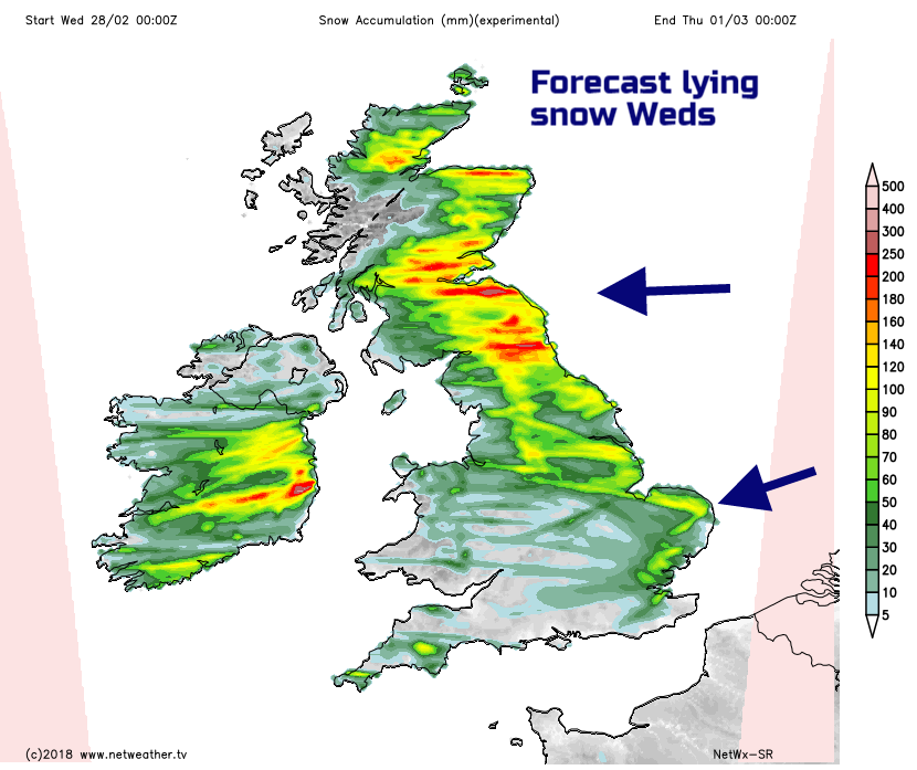
Widespread snow threat from SW
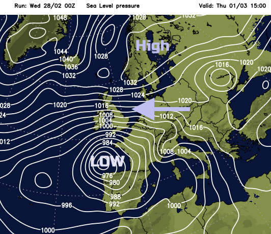
Thursday has a yellow Wind and Snow warning for SW Britain with an Amber warning for snow and Ice in the afternoon through until Friday morning. This is due to a deepening area of low pressure moving up from the south. Met Office:
As it comes into contact with the very cold air resident over the UK, it has potential to produce widespread snow, accompanied by strong to gale force winds. As less cold air follows from the south, there is a chance of snow turning to freezing rain bringing an additional significant ice risk. There is still uncertainty in how this system will develop, but there is a chance that the combined effects of snow, strong winds and ice will lead to severe impacts.
This low has been named by the Portuguese Met Service, so you may hear mention of #StormEmma, (Who knows what is happening with the UK/Eire Name our storms which would have called it Hector.)
There is still uncertainty about this situation, how much snow, will there be rain, will freezing rain develop. Freezing rain is of grave concern as it can lead to dangerous conditions suddenly developing on roads and runways, also to power cables being downed. With strong, even gale force winds blizzard conditions are likely. There is the potential for widespread disruption, also for southern Ireland too and for the frontal bands from this low pressure to fling snow across southern England
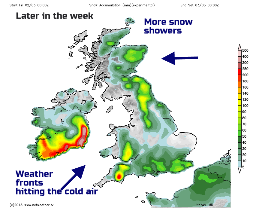
Through Thursday there could be a little snow in the morning for southern England as the shower streamers continue, then the frontal band edges up. Lee gusts for western Wales and SW England could reach over 60mph, it will feel bitterly cold. Snow will spread over Devon, Cornwall, the West Country, up into Wales. Conditions could be awful by rush hour on Thursday evening. The gusts for Snowdonia look intense, so that will affect people travelling. Further bands of snow will move up from the south into Friday, with further risk of ice, freezing rain and bitter cold.
Keep an eye on the forecast and stay warm and safe this week.