Not bad today with fine bright weather and milder air heading in. Rain from the west later but improving tomorrow and rain for Sunday. Have a good weekend!
We have a chilly, bright start for Friday, with ice warnings over Northern Ireland and Scotland. Temperatures are lurking around freezing but the winds are lighter today especially for southern Britain near to an area of high pressure. Further north there is more of a westerly breeze, giving a more wintry feel to the day and snow showers are still moving in from the Atlantic over the higher ground of western Scotland and the odd wintry one up the Bristol Channel.
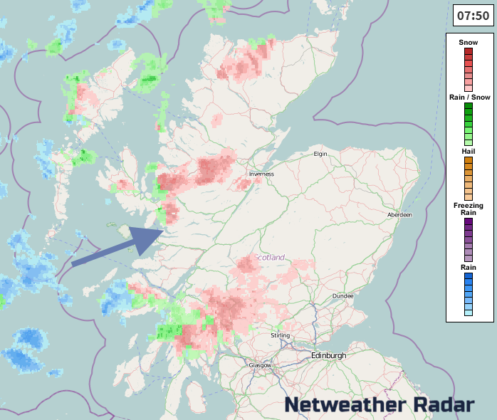
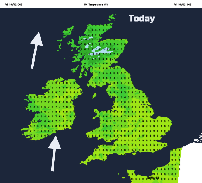
The showers are fading from Northern Ireland, easing over inland Scotland too, with rain and sleet showers along the west coast. Most of the UK will have a fine day seeing some sunshine. There is frost about to start the day, but temperatures will rise to 8 or 9C for England. The winds will remain very light in the SE but as the high pressure edges eastwards, it becomes more windy elsewhere. The flow of southerly winds will draw up milder air but the winds freshen through Ireland.
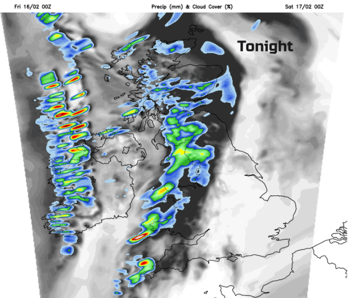
Though the evening a band of cloud and showery rain will move in from the west, over Northern Ireland and western Scotland. Ahead of this, there will be clear spells for the rest of Britain, some high cloud and temperatures falling near to zero. The showery band edges across the Irish Sea, bringing blustery winds with the rain, and snow over the highest ground. SE England with calm conditions will see a frost and mist forming. Ice will be a risk further NW after the night rain.
Saturday
Overall Saturday will be a fair day, bright, not too windy or too cold. Temperatures will rise to 8 or 9C in the south. The frontal band will still be heading east on Saturday morning but weakening. Early on Saturday morning, there will still be outbreaks of rain from the band across England but these become more scattered as they head for SE England middle of the day. Overall it is a dry picture for most of the UK
A rash of showers head into western Scotland once more with snow for the Highlands and later more rain appears for western Ireland as a new weather system arrives.
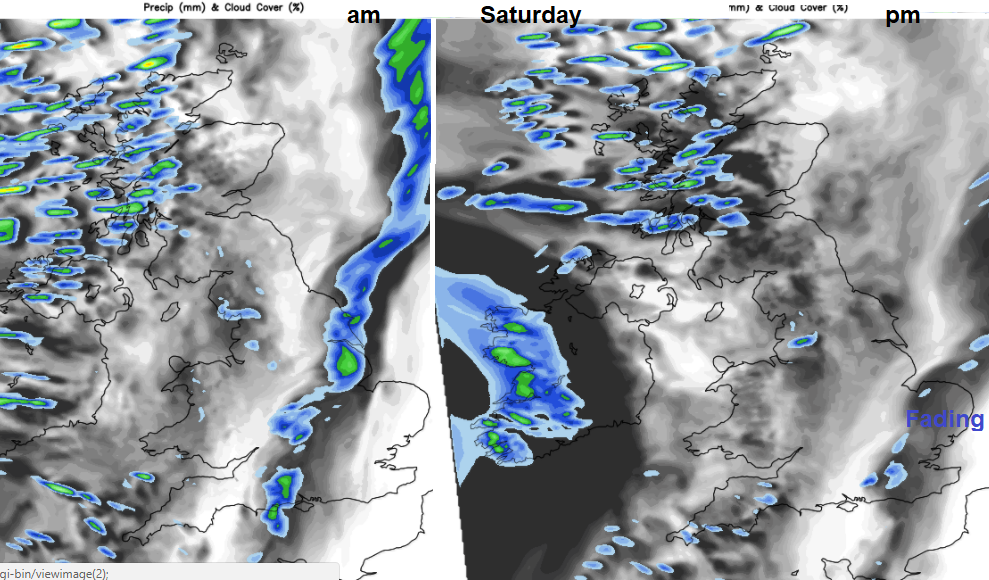
Through Saturday evening wet weather spills over Ireland and then western Britain overnight. Brisk SW winds pickup as mild air tucks in. For northern Britain, it will turn cold for a time with frost for northern Scotland. There is some uncertainty about the progress of the rain and its intensity.
Sunday
It will be milder with temperatures in double figures. Northern Scotland stays on the cool side of the fronts, so temperatures here will stay around 4 or 5C but for much of the UK, it will be 8 to 11C in a light to moderate west wind. Bands of rain seem to keep on toppling over the UK on Sunday. Looking for timings of wet and dry periods on a weather app won’t be worthwhile, as the models won’t be able to give that detail. Take the view that Sunday will see outbreaks of rain coming and going. The Northern Isles look fine until Sunday evening.
Similar temperatures and bright weather today in Beijing as start of lunar New Year, the year of the Dog
Next week
Drying up once Sunday’s rain fades during Monday morning, then more settled, drier conditions and the likelihood of it turning colder with winds from the continent. But there is quite a split in the model output, whether this easterly flow will take hold.
Nick Finnis looks at #SSW Sudden Stratospheric Warming and model uncertainty and will this bring the Beast from the East?
Read more and join the discussion Netweather Community Model forum