A cold wind today with wintry showers - especially in the west. A touch milder tomorrow, but potentially disruptive winter weather arriving later.
The weather remains in a changeable mood, with a blustery and very raw wind of polar origin, tending to blow through rather than round you, making it feel particularly cold.
So, 'wrap up' warmly if you are venturing out and beware of passing blustery showers, many of which will be wintry. As a result, there are yellow warnings of snow and ice for much of Scotland, Northern Ireland and the North, with widespread ice likely after dark when slush or surfaces left wet by showers will freeze.
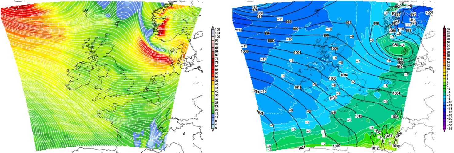
Last nights rain and gales have cleared into the North Sea, but in its wake, we have a cold, raw North West to Westerly airflow. This is bringing blustery wintry showers to Northern Ireland, the North and West of Scotland, North West England, Wales and the West where some will be heavy through the day giving local hail and thunder. Many will fall as snow, giving accumulations on hills from the Peak District northwards and blizzards in mountainous areas where drifting is likely in the fresh or strong wind, that'll gust in excess of gale force in squallier showers.
In the South and at lower levels the showers are more likely to be of rain, soft hail or sleet, with any snow that does fall during daylight hours, giving a temporary slushy covering in places. Many southern and eastern areas are in fact starting dry and fine, with just scattered blustery showers expected here today. There'll be good sunny spells, with the best of these where you have shelter from the fresh or strong and blustery wind. The sunshine will make little difference to the feel of things though, with top temperatures only 2 to 4C In the North and 5 to 7C further South.
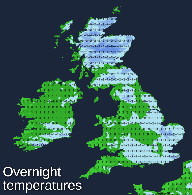
Sheltered central and eastern areas, in particular, see clear spells after dark, but a fresh, raw and blustery West wind will continue to bring wintry showers mostly to the North and West. There'll be further snow especially over Highland, West Scotland, Northern Ireland and North West England, with a 'dusting' perhaps as far South as the Staffordshire Moors and the Cotswold hills by dawn. The fresh and blustery West wind will continue to give gusts to gale force in exposed areas, with a frost particularly, where you have lying snow and shelter from the wind. This'll lead to icy stretches with minimum temperatures mostly in the range -2 to +2C.
Some places start Monday with a covering of snow, but as a still quite blustery wind turns into the South West and decreases somewhat, it'll become a little less cold with snow at lower levels melting.
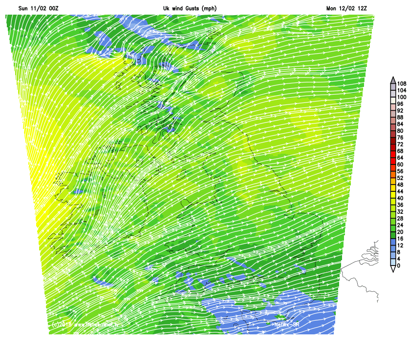 It'll still feel raw though, with hail, sleet and snow showers mostly over West Scotland and in the West turning to rain except on hills. Southern England may also see a few showers but for most, the start of the working week will be mostly dry with sunny spells, as a weak transient ridge moves in. During the afternoon though cloud will be increasing over Northern Ireland, ahead of the next Atlantic system running in from the West. Top temperatures 3 to 5C in the North, 6 to 8C in the South.
Central and eastern areas see a lull on Monday evening where it should stay dry overnight, but with winds freshening again from the South towards morning. Rain and mostly hill snow over Northern Ireland, however, will work its way into many western parts during the night turning increasingly as snow as it comes, bringing the threat of some disruptive winter weather on Tuesday as this spreads slowly eastwards.
Following on to Northern Ireland on Monday night will be clear spells but with scattered wintry showers. There'll be another frost in parts, with lowest temperatures mostly between -1 and +3C.
The remainder of the week continues unsettled, with a further spell of wet and windy weather preceded by snow in places on Wednesday. Following on will be sunny or clear spells and blustery showers, that'll be turning increasingly wintry again by the weekend as it becomes colder once more.