Wind and rain about today but temperatures in the south could reach into double figures. The February cold will return with more wintry weather and a cold wind.
We are in for a windy weekend, starting milder but turning colder and there are plenty of weather fronts about today, bringing rain.
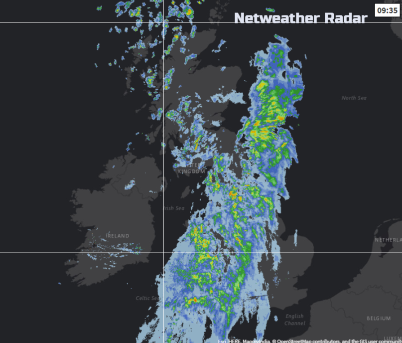
One band has already moved over Northern Ireland and Scotland with strong winds, linking down over Wales, heading across England this morning. Then another low pressure moves up from the SW bringing more rain over Wales, the SW and N.Ireland this afternoon and spreading over more of southern Britain this evening.
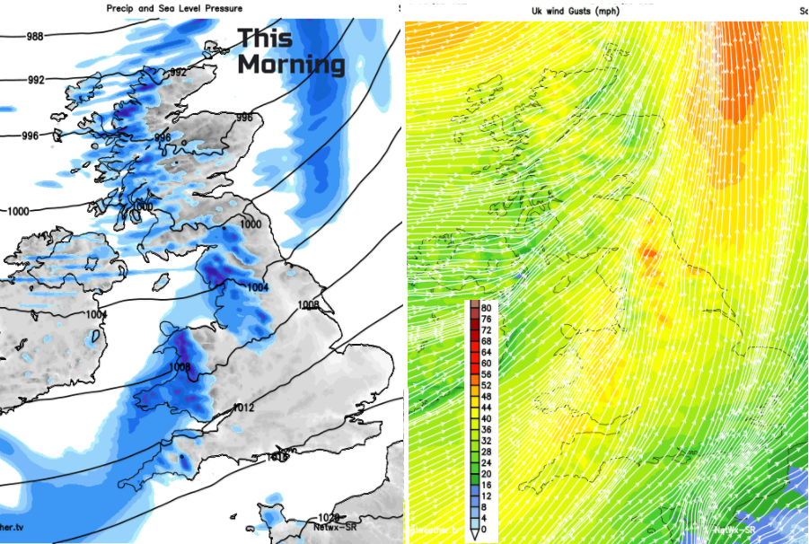
With the first front, there have already been gusts over 60mph, a wet and windy start to the weekend (and half term for some) in the north. Those were the strongest winds by day, but the SW winds will strengthen this evening as the next low approaches from the western Channel.
There is milder air caught up to the south of these frontal systems. Lifting the temperatures to 10 or 11C in the far south or southwest. It won’t feel that great in the wind and the rain but a change from the bitter cold, wintriness and ice.
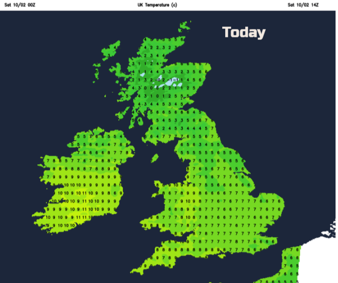
Further north it will be cooler for the second part of Saturday, with temperatures around 5C, rain, sleet and hill snow showers beginning to appear once more from the west.
It will turn colder in the north this evening and as heavier rain comes up against that cold air, it could turn to snow for a time. Northern Ireland, northern England especially Cumbria and over the Pennines and southern Scotland look prone at the moment. The snow showers continue to feed in for the far NW too with clear skies and a frost taking hold.
The heaviest rain looks like heading over the Irish Sea into Merseyside and Lancashire then across northern England. Strong and gusty SW then NW winds will move over Wales and southern Britain with mild air being replaced with colder air from the NW later in the night.
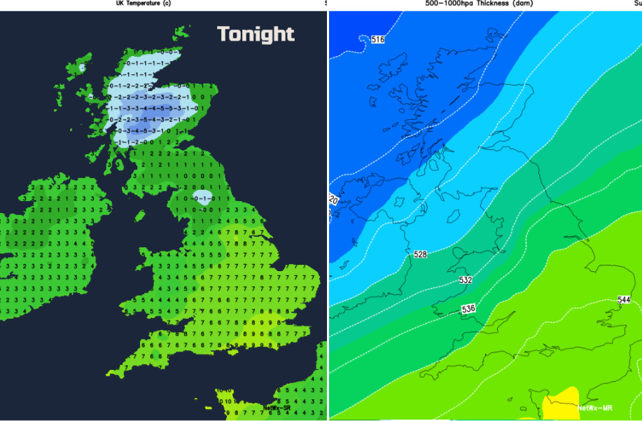
By Sunday morning the colder air and frost will have reaching into northern England and much more of a chill in the air elsewhere after the mild start to the weekend.
Sunday will feel colder for everyone, there will still be brisk winds, especially for southern Britain and picking up elsewhere through the day. Snow showers will rattle in from the Atlantic, mainly for Northern Ireland, western Scotland and across the Irish Sea, but some will make their way further inland. So, flurries, cold wind but with sunny spells too.
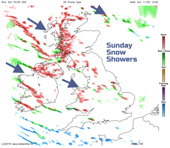
A widespread frost on Sunday night. The brisk cold wind will continue and some spots will begin to see quite a few cms of lying snow, where the snow showers just keep on feeding in. Others seeing nothing.
The bright, sunny but cold picture continues on Monday with further snow showers from the west. The showers ease later in the day as a new frontal system approaches from the Atlantic. This will bring more cloud, strengthening SW winds and a band of rain, sleet and snow overnight Monday into Tuesday. So, there could be problems on Tuesday morning before milder air creeps into the far south. It may take some time for the wet and windy weather to clear SE England on Tuesday and then it’s back to the colder air, brightness and a few wintry showers.
Longer term
Monthly forecast and SSW, potential cold after Sudden Stratospheric Warming event higher up in the atmosphere