
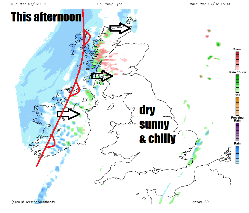
Mostly dry, chilly & sunny today. Cloud and rain moving through Thursday before clearing the east Friday morning.

Many northern, western and central areas saw some a little snow on Tuesday, as a weakening front moved southeast, the snow wasn’t too disruptive, but brought some nice wintry scenes. Showery light snow spreading into SE Britain overnight will soon clear this morning, to leave most areas with a dry, sunny but chilly day as a ridge of high pressure builds in. However, cloud, rain and hill snow will move in across Scotland and N. Ireland later, before moving down across central and western areas through Thursday, turning less cold across the south, before rain reaches southern and eastern England Thursday night before clearing Friday morning, followed by cold and sunny conditions from the northwest with wintry showers in the north.
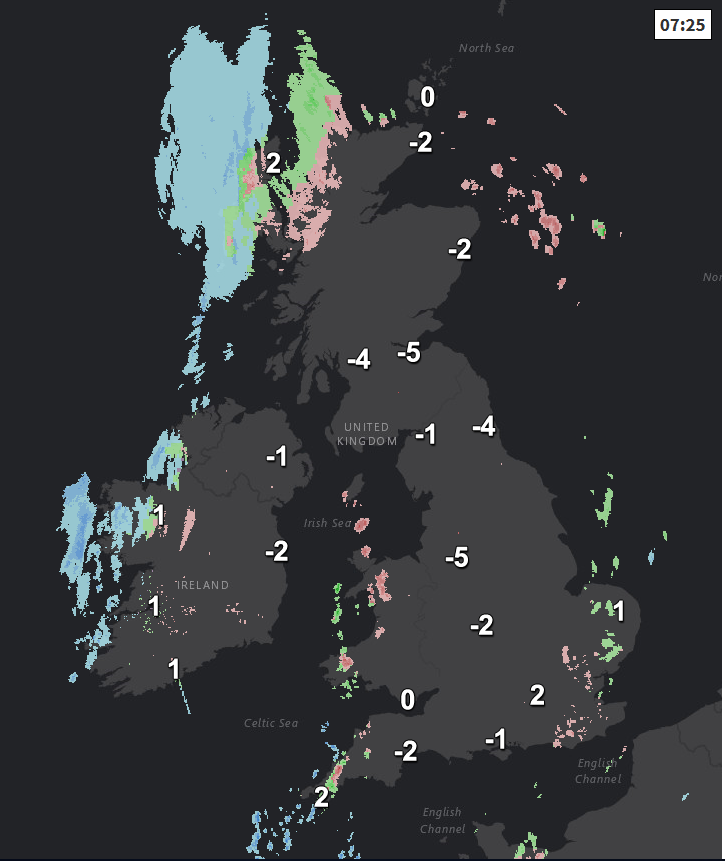
For many, this morning will probably be the coldest morning of the week, with a hard frost forming overnight under clear skies, most places widely below freezing, falling as low as -10C in the Scottish Highlands and -9C in Cumbria, so there is a risk of ice on untreated surfaces where snow has fallen. There are still some wintry showers across far SE of England, East Anglia, west Wales and Cornwall – which will add to the risk of ice in these areas, though these showers should ease away through the morning. Otherwise, it’s a cold, crisp and sunny morning for most.
Many places will remain dry and sunny but chilly throughout the day, however, cloud will thicken and the wind will strengthen across Scotland and Northern Ireland from late morning, with outbreaks of rain and sleet at low levels and hill snow moving from the west.
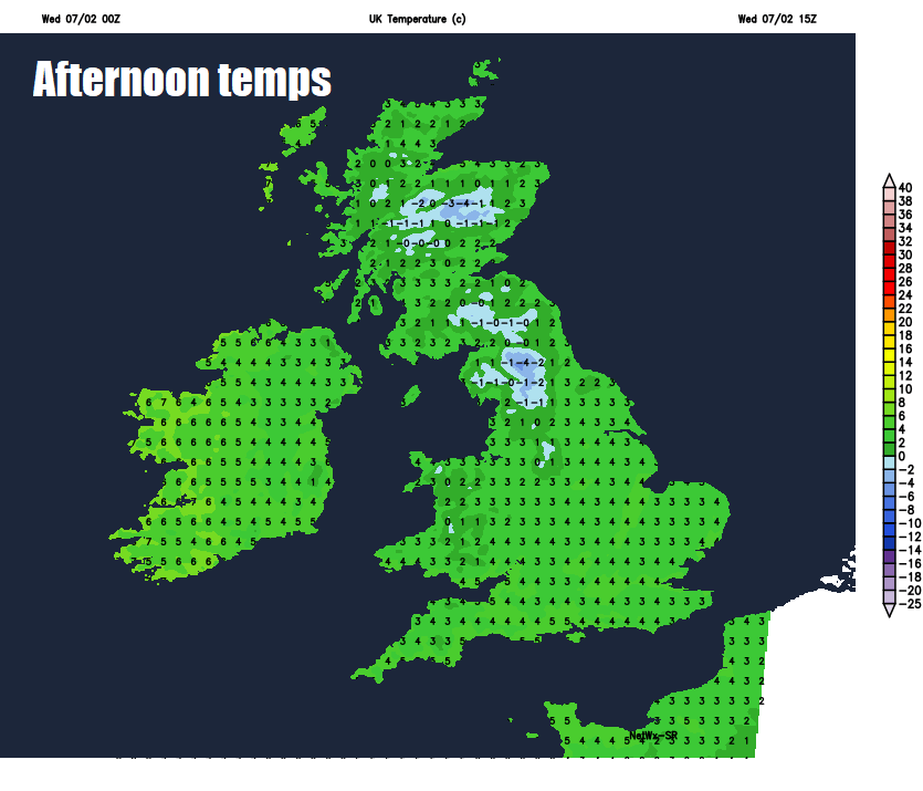
The mildest place today will probably the Western Isles as rain and milder air moves through, temperatures up here reaching 8C, but elsewhere still in the cold air, with temperatures reaching 3-6C generally, a little less cold than yesterday, when some central and northern parts only reached 0-1C at best.
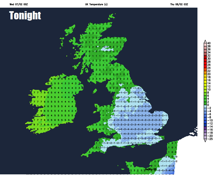
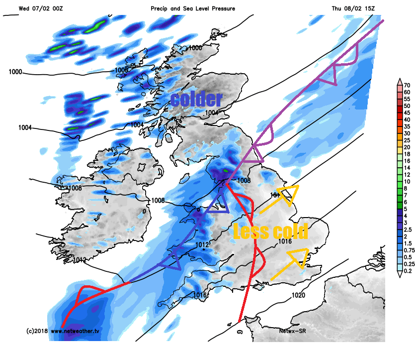
Rain and hill snow across Scotland and Northern Ireland this evening and overnight and edging south across northern England, north and west Wales by the end of the night. A wedge of less cold air associated with this band of cloud and rain, meaning temperatures will stay above freezing. But either side of the cloud and rain band will be colder and clearer conditions, leading to another frost forming across SE England and East Anglia and also across northern Scotland by the end of the night as skies clear.
Less cold tomorrow across England and Wales, as a southwesterly wind picks up. Cloudy skies with outbreaks of rain across northern England and Wales for much of the day, turning heavy towards the west, patchy rain gradually sinking across SW England and The Midlands too in the afternoon. Morning rain across southern Scotland and N. Ireland clearing to colder and clearer conditions to the north, with blustery wintry showers in the far northwest. Perhaps staying and bright across SE England and East Anglia after a frosty start, but turning increasingly cloudy from the northwest in the afternoon. Temperatures reaching 6-8C generally, perhaps 9C across the far southwest and west.
Rain with perhaps a little back edge sleet or wet snow clearing southern England, The Midlands and eastern England during the morning, to join areas further west to drier, sunnier but colder conditions in the afternoon, though there will be some sleet and snow showers affecting western Scotland.
A widespread frost Friday night leading to a cold, crisp and sunny start to Saturday. However, wet and windy weather will move in across northern and western areas by lunchtime, preceded by hill snow in the north, before mild air floods in across western areas in the afternoon. Wind and rain looks like spreading east across most parts through the afternoon, though on the chilly side in the east still.
Overnight rain across England and Wales clearing SE England first thing on Sunday, followed by colder and clearer conditions from the west, with most places dry and sunny in the east, but wintry showers look to affect western areas, driven in by a strong westerly wind in the north.


