
It's cold and there is a widespread risk snow. Nothing much for SE Britain but the cold remains into the middle of the week here.
There is snow and ice about this morning, I’ve got some at my house so I’m excited. For others, it just means travel problems and it is chilly with temperatures around freezing.
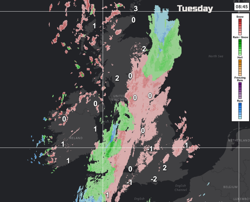
A frontal band divides the UK NE to SW. This is bringing the snow and is heading SE but will weaken through the day. Ahead of this, there is a good deal of cloud, outbreaks of snow with sunny spells for SE Britain and central southern England. Behind the front, there are now clearing skies with wintry showers blowing in from the NW of hail and snow.
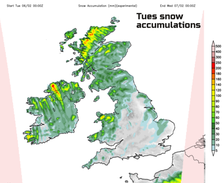
There are a few Yellow Be Aware warnings from the Met Office about the snow and Ice with the showers continuing to push in from the NW through Tuesday night.
Today
There are problems on some of the higher-level routes with drifting snow but for most at low levels, the roads are quickly turning grey again with slush. Eastern England looks like it could still see a few cms today. There will be clusters of wintry showers moving down from the north towards the Wash and the frontal band will fade over central and western Britain but keep going in the east. It is forecast to move through Lincolnshire and East Anglia late evening with the chance of snow showers still feeding in by dawn, even reaching Greater London.
The frontal band isn’t moving very fast just pivoting away from eastern Scotland, fading as it moves eastwards over Wales into the Midlands and the West Country. There has already been snow for these central areas and there will be pockets of further snowfall or sleet but quite patchy. It will be a cold day with temperatures of 2 to 4C. Ahead of the front there is s keen NE wind, especially around Kent and the south coast, this backs to a northerly today. Behind the front, the cold NW windows veer to a northerly and will make it feel bitterly cold as they freshen.
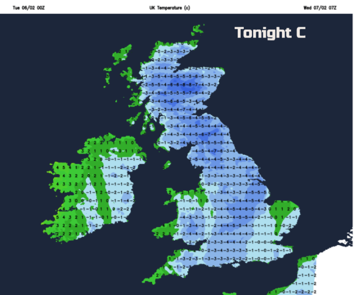
Overnight pressure begins to build and the showers fade. It will be a cold night with temperatures well down below freezing. A warm front then approaches from the Atlantic and it will be less cold midweek. A band of rain, sleet and hill snow will move over Northern Ireland in the morning with temperatures rising up to 5C. It then becomes a grey, damp day. There will be snow for western Scotland as the front moves up against the cold air. There will be a fresh SW wind for the west coast.
Tomorrow
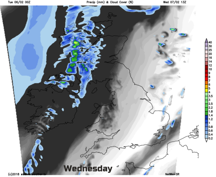
For much of Britain, it will be a fine day and feel okay with light winds. There will just be the odd wintry showers lurking by the coasts. It will be fine and sunny for the SE half of Britain, with more high cloud further north. Temperatures will only be 3 to 5C but the sunshine will cheer the skies.
SE Britain will have a cold Wednesday evening with an early frost. A rain band takes its time through Thursday to move down through the UK with a wet and windy spell. This rain band will be clearing London around dawn and colder air takes hold with more snow showers from the far NW.
The chill and wintry picture continues for February.


