Low cloud and grey skies have taken hold overnight with just a few parts of the NW still seeing the sunshine. A band of rain will move in from the Atlantic later today but overall it's a quiet few days.
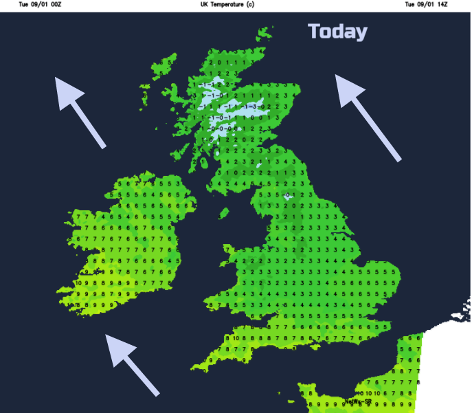
Cloud cover has taken hold overnight, spreading from southern Britain northwards. It is a grey, gloomy start for most with breaks remaining in the NW for Gwynedd, Cumbria and NW Scotland. Here there are bright or sunny spells with temperatures below freezing and frost. Under the cloud cover, it is just above zero inland and about 5 or 6 around the coasts.
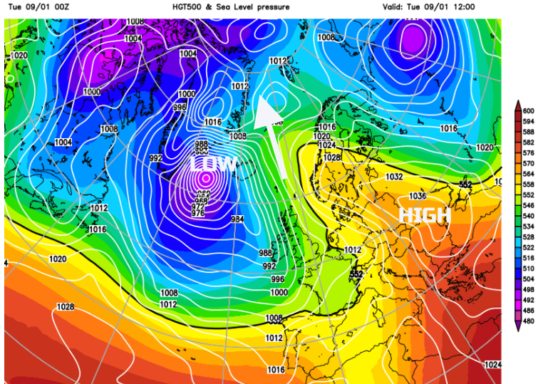
High pressure over central Europe is blocking the progress of an Atlantic weather front. The low attached gets pushed northwards towards Greenland today, but its trailing fronts will slowly move across the UK bringing rain from the west.
Before that, we stick with the cloud, some dampness in the air and an SE breeze which will be fresh over Northern Ireland. This stratiform cloud will bring drizzle, particularly to northeast Britain. In the colder air, on the hills inland this could freeze resulting in snow grains.
Snow grains are solid drizzle and look like white grass seed or tiny grains of rice. Drizzle only comes from stratus, not in showers (convective cloud).
Temperatures vary greatly across the UK, with inland northern England only around 2 or 3 and western coastal parts up to 9 or 10C.
Western areas and the far north become windy this afternoon as frontal rain edges into Fermanagh and Cornwall. In the SE wind, to the lee of high ground, sunny spells hold on for parts of western Britain. Most of the UK stays grey and dull.
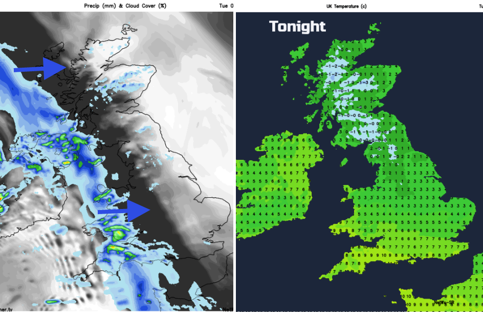
This evening the rain sets in for Northern Ireland and SW Britain with some milder air as the air gets stirred up. Ahead of the front inland northern Britain will be cold
The rain band continues creeping across Britain, with some heavy burst of rain and snow over the Scottish mountains and the Cumbrian Fells. The main band of rain is heading over eastern England and Scotland by Wednesday morning, followed by a scattering of showers from the SW with brighter skies. So, the damp, cloudy conditions are rotating towards the NE, and it will be a better day as today’s weather clears away into the North Sea. Timings of the clearance have low confidence with northeast Britain staying dull and damp longest on Wednesday. The winds veer to the SW and milder air moves up into southern Britain. More areas will be 7 to 9C. There is another low pressure dancing up towards SW England midweek. This will have hefty showers around it and these could stray over SW England, maybe into Pembrokeshire later in the day. The winds will strengthen around this circulation too.
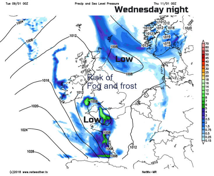
A brisk NW wind remains for Grampian and the Northern Isles but across much of the UK there will be light winds for Wednesday night and fog will begin to form. Frost is possible for inland northern Britain and Northern Ireland.
Then Thursday looks settled and fair as pressure builds in.
Keep an eye on the rain approaching from the Atlantic today, on the Netweather Radar. It's already appearing over Kerry, Cork and Mayo and there is a Radar App