Storm Dylan arrives tomorrow morning, but will clear in time for New Year's celebrations.
The general theme as we end the year is an increasingly mild, windy and unsettled one, ahead of Storm Dylan, which will sweep east across the far north early on New Year’s Eve, bringing a spell of rain tonight, then severe gales across the north tomorrow morning. Fortunately winds will ease and the rain will clear in time for New Year’s Eve celebrations, though there will be a few passing showers across western areas. New Year’s Day is looking generally dry and bright away from Scotland and western coasts, but general theme next week is to stay unsettled with wet and windy weather at times.
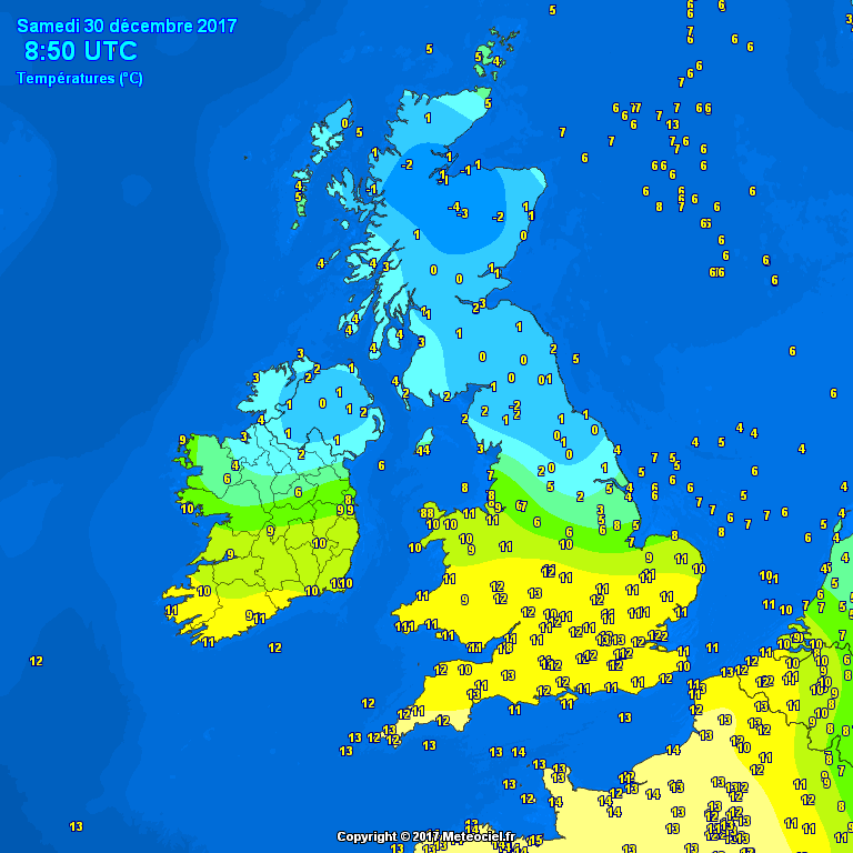
Following yesterday’s snow across Scotland and northern England, there is still cold air hanging on here this morning, temperatures falling to -4C in the Highlands and close to freezing elsewhere across the north. So, there is a risk of ice on untreated surface where we saw snow fall and accumulate or melt into slush and also some hill fog too. In contrast, temperatures have been rising through the night across southern parts, with a very mild start across parts of south Wales and southern England, with temperatures as high as 13C already at 7am in numerous spots.
North-south contrast in temperatures this morning
Many places are starting with a lot of cloud this morning, with some patchy light rain, sleet and hill snow spreading northeast across northern areas this morning after a cold and frosty start. Brighter and drier conditions developing further south but windy with gales in the west and southern coasts, with the general theme of drier, milder, brighter but windy conditions spreading north through the morning.
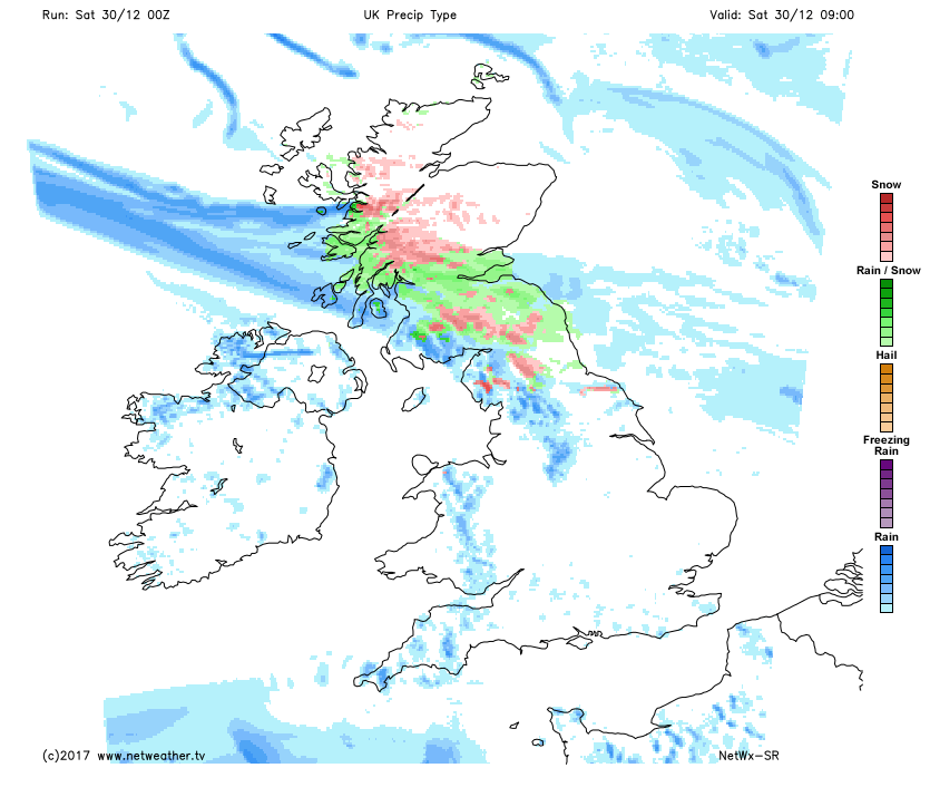
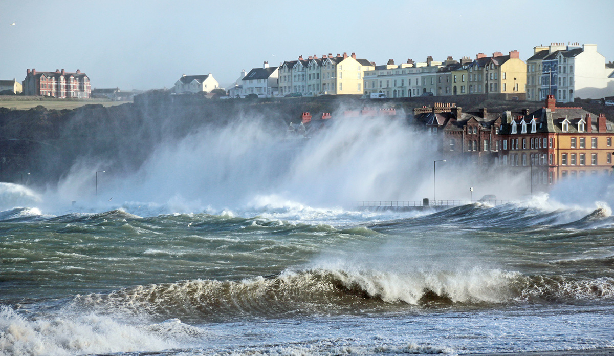
Colder air becoming confined to Scotland into the afternoon, with cloudier skies with patchy light rain, sleet and hill snow across northern Scotland. Brighter but breezy with sunny spells this afternoon for southern Scotland, Northern Ireland, much of England and Wales, mostly dry too bar a few showers in the west. However, clouding over across southern counties of England in the afternoon, with rain not too far away by dusk. The wind will be a notable feature across the south today, with gusts of 50-60mph across exposed western coasts, 40-50mph inland.
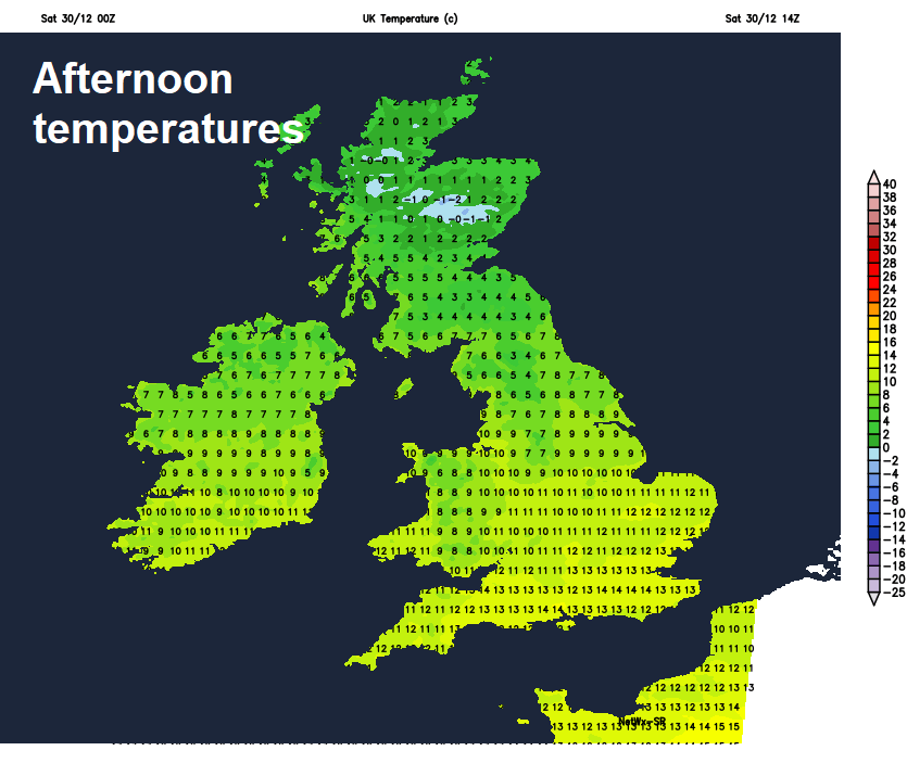
Temperatures a mild 13-14C across south Wales and southern England this afternoon, 8-12C elsewhere across England, north Wales and Northern Ireland. Colder across Scotland, with 3-6C the highs.
Heavy rain spreading northeast and southwesterly winds increasing across all areas as we head through the evening and overnight, with gales developing in the west and along southern coasts, severe gales developing in the early hours across the north of the Republic of Ireland and Northern Ireland, as Storm Dylan tracks just north of here, 70-80mph gusts possible here by dawn. A mild and frost-free night for most too away from northern Scotland.
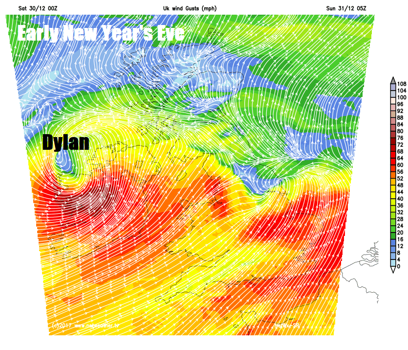
New Year’s Eve starting stormy across the north of Britain, as Storm Dylan crosses northern Scotland, potentially bringing gusts of 70-80mph across Northern Ireland first thing, then across central belt and southern Scotland along with far north of England through the morning, before winds ease into the afternoon. Windy with gales with exposure over hills and coasts further south. Overnight rain will clear east from most parts during the morning to brighter conditions but with squally showers from the west, rain lingering across Scotland, with snow over the mountains.
For those heading out to welcome in the New Year, tomorrow evening is looking mostly dry across eastern areas, showers in the west, but with some dry spells in between the showers, perhaps some rain and hill snow lingering across northern Scotland. But it will be windy everywhere and feeling chilly in the westerly wind, temperatures by midnight falling to 4-5C in the north, 5-7C in the south.
Then on Monday, another area of low pressure moving across Scotland will bring windy and showery conditions here and across Northern Ireland along with western coasts of NW England and north Wales. But for the rest of England and south Wales it’s looking like a mostly dry and bright but breezy day, with just the odd passing shower. Perhaps cloudier along the south coast, as rain spreads east through the English Channel including the Channel Islands. Temperatures reaching 4-6C in the north, 7-9C in the south.
Remaining unsettled through the rest of next week, as a strong jet stream running west to east across the UK brings further low pressure systems bringing wind and rain at times, though with some drier weather in between systems. Generally on the milder side next week compared the week past, with any snow confined to Scottish mountains.