It's a very mild start to Christmas for many, but colder air will be arriving from the west behind a band of squally rain - turning to snow in places.
It's Christmas day, and there's a whiff of snow in the air, not that you'd know it across much of England and Wales for the time being.
For most, the majority of today will be mild, breezy and dry. But there is a squally band of rain edging through from the west which has colder air behind it which will arrive in many parts by the end of the day. As of this morning, it's cleared the northern half of Scotland and is sat across southern Scotland, much of Ireland and just squeezing into the far north of England. It'll move slowly until after lunch, just edging a bit further southeast in the north, and grazing into Wales before that point. It gets a kick after lunch though, speeding across the remainder of England and Wales to clear the east coast around midnight.
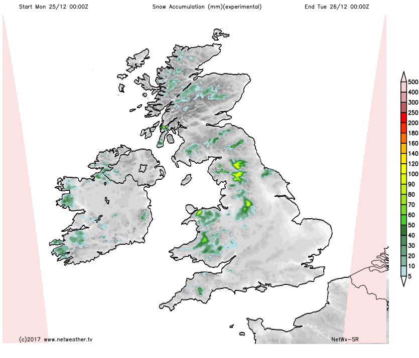
As you can see on the animation, it's the higher ground which will be the first to see some snow, but there could be some wintriness lower down later this evening, especially in the showers in the north. In terms of lying snow, it's those hills and mountains in the firing line.
 Temperatures ahead of the rain band will be very mild today. Getting into double figures widely across England and Wales, but just 3-5c behind it, so quite a drop as it moves through. Winds will be squally as it moves over as well.
Tonight, there'll be some wintry showers left over in the west and north, but otherwise, it's dry with temperatures dropping away to bring some icy patches in places. Boxing Day then starts fine for most, with a scattering of coastal showers - falling as sleet and snow over the hills.
Complications arrive later in the day as low pressure heads toward the south of the country though, bringing strong winds and rain with it. That rain is going to turn to snow as it meets the cold air though, initially over the high ground of Wales but then potentially down to lower levels before moving across central England. Away from that, it's a cold night, with a widespread frost and just a few showers near to coasts.
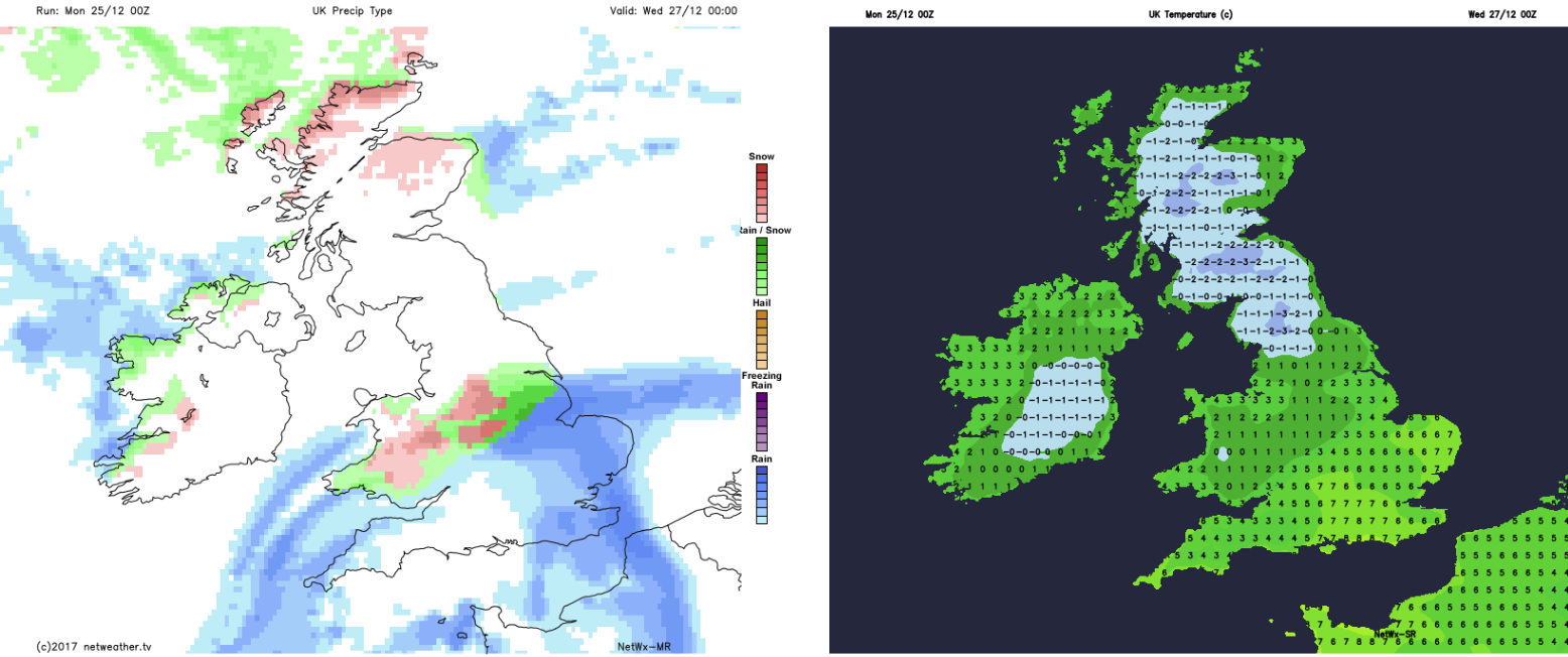
Wednesday sees the rain sleet and snow eventually clear the south of the country. Elsewhere, it's still chilly, with some wintry showers in coastal regions, but plenty of sunshine elsewhere. A cold night follows, with a frost for most. Thursday then starts crisp and bright, but the next band of rain will be making a move in from the west through the day, which'll again be turning to snow in places. That'll take well into Friday to clear east.
For more info on the change to colder, unsettled weather during Xmas week, take a look at Nick's latest blog.
On behalf of the whole team here at Netweather, wishing you a very happy Christmas.