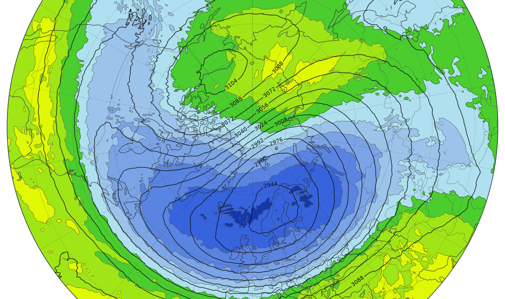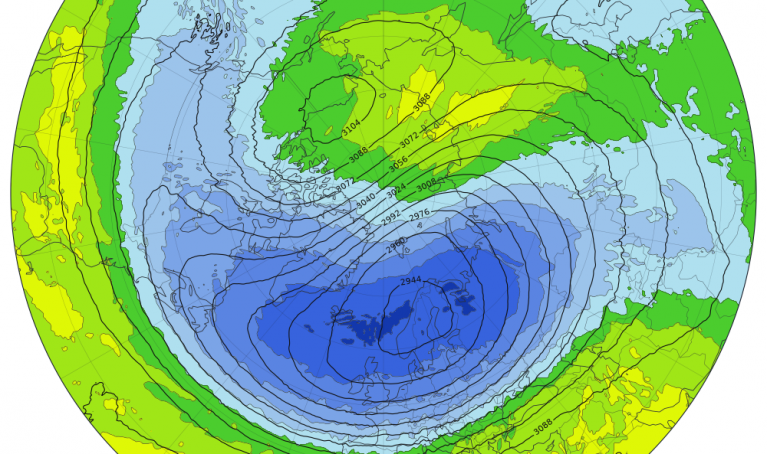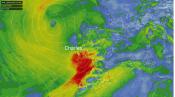

An unprecedentedly early sudden stratospheric warming (SSW) event is currently unfolding high above the Arctic, disrupting the stratospheric polar vortex weeks earlier than ever recorded.
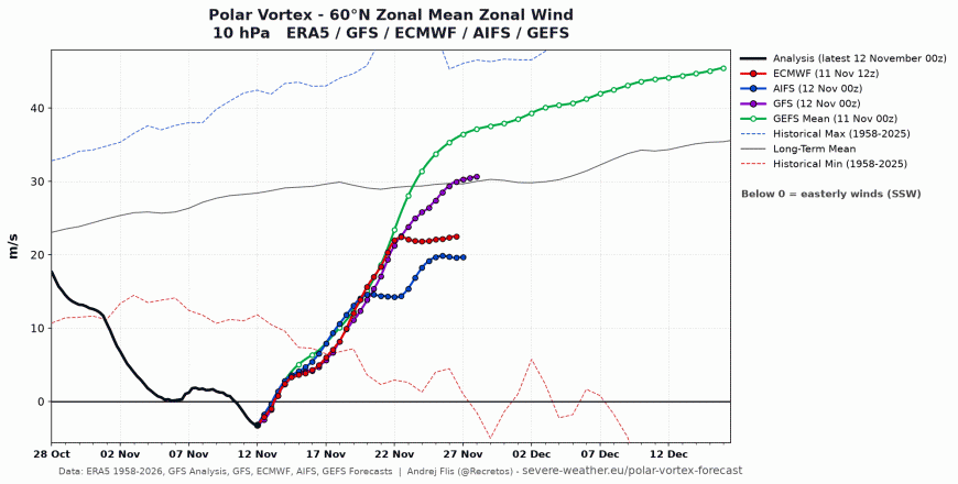
A major Sudden Stratospheric Warming (SSW) was confirmed by weather models yesterday, the earliest zonal wind reversal at 10mb at 60N in November observed in the satellite era, prior to that was 28 November in 1969 & 2025. So this SSW beats it by about 18 days.They normally occur from mid-winter.
All ECMWF and GEFS ensemble members confirm a wind reversal has occured, the earliest on record. It is forecast to be brief, with the zonal winds recovering by mid-November.
This year's exceptionally strong El Niño may be amplifying atmospheric waves to trigger the disruption to the polar vortex. Though a record-breaking high-pressure system over Scandinavia and northwestern Russia pushing energy upward into the stratosphere may also be part responsible.
The stratospheric polar vortex looks to quickly rebound in late November and become strong again through December.
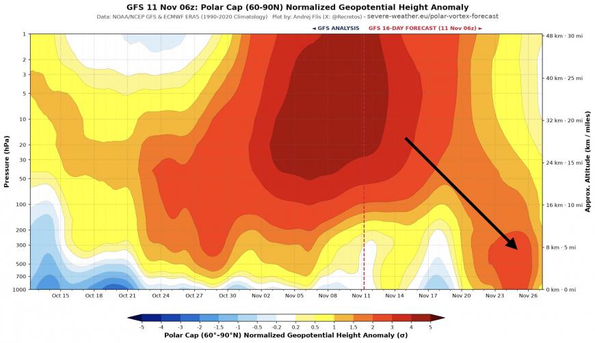
However, the current reversal looks like it may ‘drip’ down to the troposphere later this month, with strengthening signs from ECWMF and GFS of stratosphere–troposphere coupling later in November that may boost high latitude blocking, negative North Atlantic Oscillation (-NAO) and greater chance of cold incursions to infiltrate the mid-latitudes of Europe as we head into early December.
This second half of this week's shift toward frost, clearer skies, and wintry showers is caused by local high-pressure systems in the lower atmosphere—not the stratospheric warming. The dry, settled and colder conditions will be temporary, with unsettled and perhaps eventually increasingly stormy weather arriving off the Atlantic starting from Sunday.
Because stratospheric changes can take weeks to work downward—and because this disruption is forecast to be short-lived, the increased potential for deep cold and wintry spell is not guaranteed. Also, forecasts are for a displacement of the polar vortex rather than a split, splits cause an immediate barotropic response in the atmosphere, whereas displacements take 1 to 2 weeks longer to manifest near the surface. However, some model runs are beginning to show signs of blocked high-pressure patterns developing in higher latitudes in early December, which could still bring colder spells.
The ECMWF subseasonal weekly mean anomaly updated yesterday did indicate higher heights / high latitude blocking signal to the north in early December after 3 weeks of troughing / low pressure dominating UK weather.

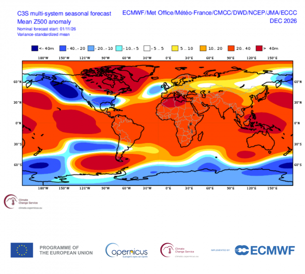
Also the C3S multi-model seasonal outlook signals high latitude blocking potential over Canada and Greenland with low heights anomaly close to the southwest of the UK for December. So a strong signal for low pressure systems off the Atlantic to be in charge of weather, which is consistent with previous early winters featuring a super El Nino. But potential that high latitude blocking may have some influence, though the latter become a stronger signal through January and February, which perhaps suggests the polar vortex may be susceptible to further weakening through the winter.
The Netweather Winter 2026-27 forecast will be issued at the end of the month, so by then it may be clearer whether the current SSW will have some influence on weather patterns as we head through early December, though we may update before then if there is likely to be signs of this happening.
Loading recent activity...