Polar air is bringing a cold end to November with ice, a significant wind chill and even some snow.
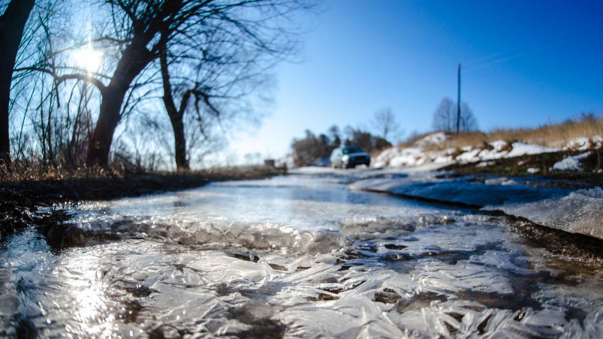
Wintry spells in late November are not unusual, as winds of polar origin bring cold weather for much of this week. Warnings of snow in the North and ice will no doubt be issued, but it's ice that'll be the main danger as showers leave wet roads and pavements that'll freeze overnight. This'll result in slippery surfaces and black ice, so be extra careful when you're out and about this week.
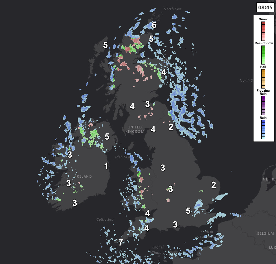
We have icy patches first thing this morning where skies are clear and where you have shelter, but most parts start just above freezing. There are a few showers in the South that'll move away, with others locally heavy and wintry over Northern Ireland, Wales, the South West and the North and East of Scotland, giving hill snow. Elsewhere it's mostly dry, with the distribution of the showers primarily of rain or hail changing through the day. They'll move into eastern England and later Norfolk and will keep going across Northern Ireland, the North and West of Wales, the South West and the North and East of Scotland. Further snow likely over Highland, the Grampian mountains and on high peaks further South.
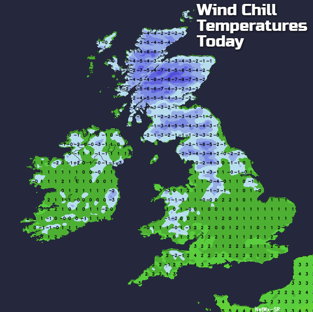
Where you have shelter from the North West or northerly wind that'll be fresh and blustery at times, there'll be fewer showers and spells of sunshine. Best places to see these will be across parts of Dumfries and Galloway, North West England, South Wales eventually and central southern England. The exception will be around Liverpool Bay and across the West Midlands, where showers will filter through the 'Cheshire Gap'. It'll feel cold and raw in the wind, with the top temperature only 3 to 6C in the North and 7 or 8 locally 9C in the South.
After dark showers, some heavy and wintry, continue to affect North and East Scotland, Northern Ireland, eastern England particularly towards the coast, West Wales and the far South West. They'll fall as rain, hail or sleet, with mostly hill snow. Further accumulations are likely on Scottish mountains and over the Pennines, with a 'dusting' possible on hills perhaps as far South the Cheviots, North York Moors and maybe the Lincolnshire Wolds by morning. Showers wintry in places will also continue to come through the 'Cheshire Gap' into parts of the West Midlands, with a 'dusting' of snow possible on the Staffordshire moors by dawn. Remaining parts should be mostly dry with clear spells, leading to a slight frost in places and some icy patches particularly where showers have fallen. A North West or northerly wind will continue to feel raw, with lowest temperatures mostly between -1 and +3C.
Wednesday will be somewhat colder still, with that raw North West or North wind continuing to blow. This'll bring further showers of rain, hail, or sleet, with mostly hill snow. They'll continue to be most frequent across the North of Northern Ireland, in the North and East and towards coasts exposed to the raw and occasionally blustery wind. Further accumulations of snow are likely on hills but other than across parts of northern Scotland, any that settles at lower levels will be short-lived. Across central and southern England where you'll have shelter, it'll be finer with sunny spells and only isolated showers. The sunshine will make little difference the temperature though on a raw day, with the thermometer getting no higher than 2 to 4C in the North and 5 to 7C in the South.
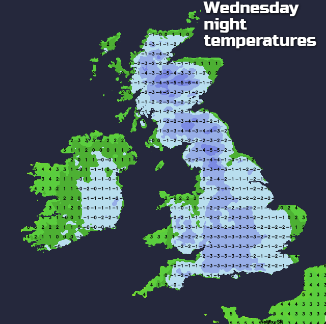
It remains cold and raw during the evening and overnight with further rain, hail, sleet and snow showers, mostly over the North and East of Scotland, Northern Ireland, eastern England and towards coasts exposed to a raw and blustery at times North West or northerly wind. Elsewhere clear intervals will lead to a slight frost, with icy patches again forming on surfaces left wet by showers. Further accumulations of snow are likely on hills, as temperatures mostly fall to between -2 and +2C.
Tune in later for the release of the winter forecast for 2017/2018.