Rain will edge southeast today, with colder air behind it bringing some wintry showers to the far northwest, and a fairly widespread frost overnight.
The weather remains in a changeable mood, with a cold front moving eastwards across England and Wales today giving rain. It's slowing down as it comes though and will take a while to reach East Anglia and South East, before the by now fading front virtually grinds to a halt tomorrow.
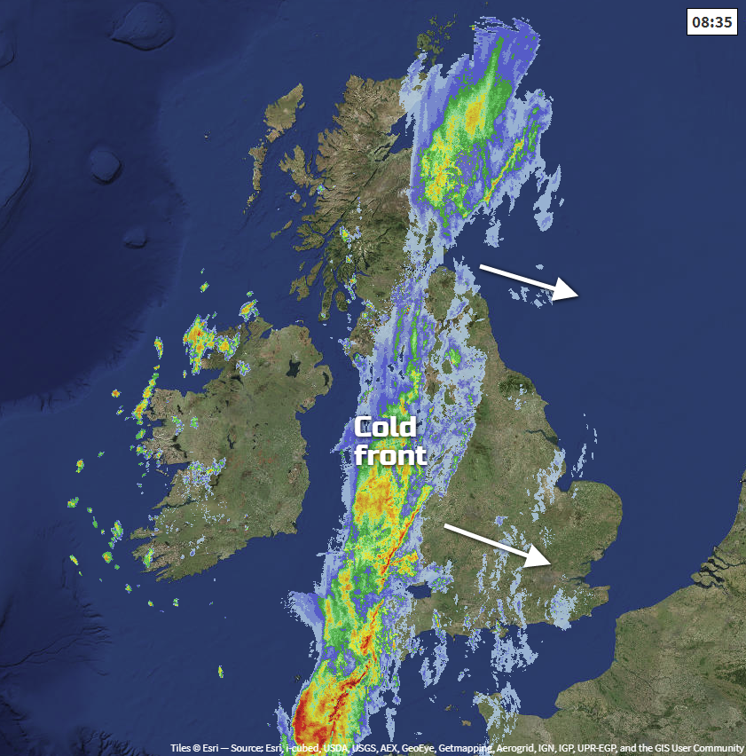 Keep up with the latest position of the front on the live weather radar.
The front has already cleared from Northern Ireland and the North and West Scotland though and after a wet start will move away from the East and South of Scotland through the morning, leaving a bright but rather cold day in these parts. There'll be sunny spells, but Northern Ireland and the North and West of Scotland will see a scattering of showers locally heavy and wintry on hills.
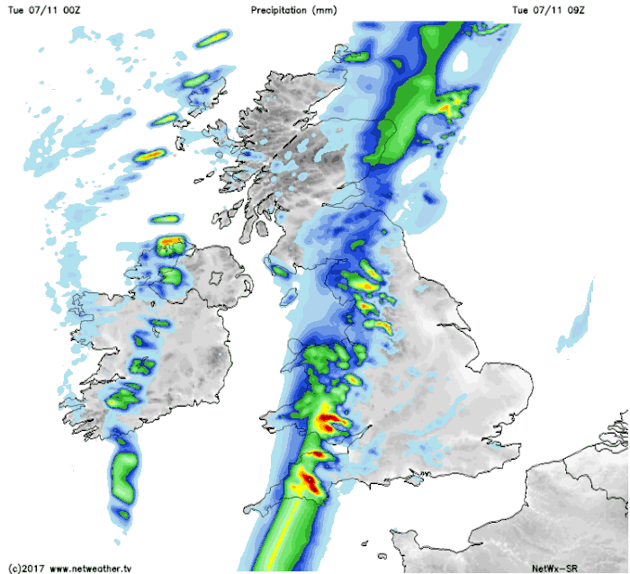
East Anglia and the South East are waking to a dry morning even with some sunshine here and there, but cloud will thicken through the day bringing outbreaks of rain from the West by or into the evening. There'll also be a few showers across the Midlands and central southern England this morning ahead of the rain, but elsewhere it's a wet start. There's some heavy rain across North West England, West Wales and the South West that'll move slowly East followed by clearer weather, that should have reached northern England, Wales, the South West and West Country by dusk.
There'll be a fresh and blustery southerly wind ahead of the rain, but it'll be mild with temperatures between 10 and 12C. In the clearer weather however, it'll be somewhat colder in a lighter North West or westerly breeze, with top temperatures only about 7 or 8C.
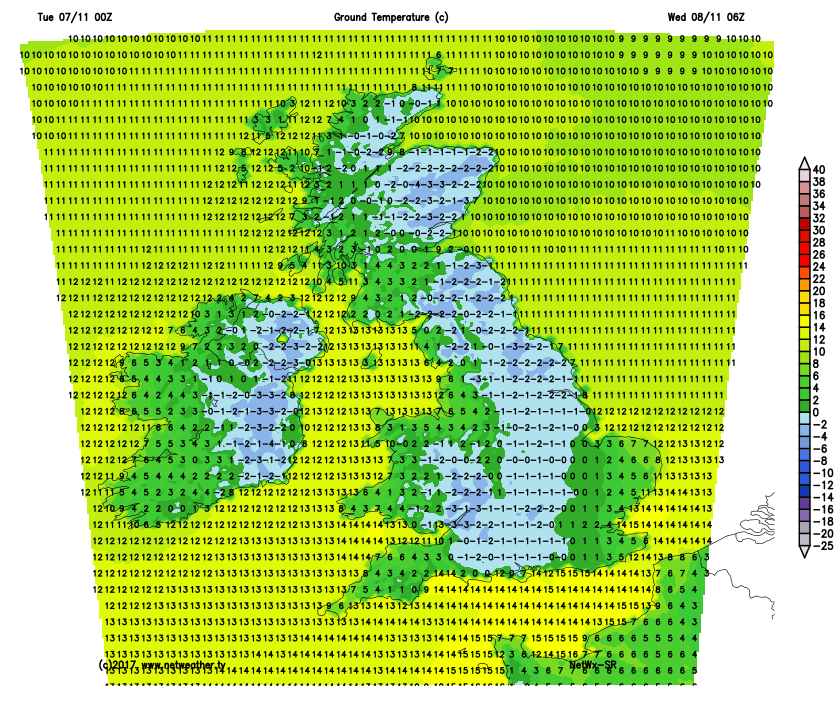
The East Midlands, East Anglia and the South East see further rain into the evening, but that'll become lighter and patchy overnight, slowly clearing to the East as winds decrease to become light. The North and West of both Northern Ireland and Scotland together with the South West and West facing coasts will see scattered showers after dark, but elsewhere it'll be dry with clear spells. A mostly light North West or West breeze will allow it to turn cold, with mist and a few fog patches possible in some rural areas by morning. There'll also be a slight frost in some rural areas with lowest temperatures mostly -2 to 3C, but over East Anglia and the South East, the thermometer shouldn't fall below 6 to 8C.
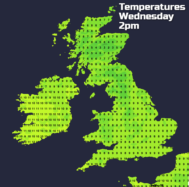
 Wednesday sees further patchy light rain across East Anglia and the South East, but it should eventually become mainly dry here and brighter from the West. Over the rest of England and Wales, it'll be a fine but cold start with a frost in places. There'll be some sunshine, and it'll remain this way in central and southern parts in light breezes, but with cloud and freshening winds moving into North West England through the afternoon. After a bright start in the East, Scotland and Northern Ireland will also see cloud and some rain running in from the West in a freshening South West wind. Here it'll be turning milder, but it'll feel cold in the wind in most parts, with top temperatures mostly in the range 8 to 11C.
The East and South should broken skies into the evening, but England and Wales will become mostly cloudy overnight. There'll also be some rain in a light or moderate West or South Westerly wind, but any rain in the South before dawn is likely to be light and patchy. Scotland and Northern Ireland after further rain should see a clearance moving down from the North West, but Highland and the Northern Isles, in particular, continue to see scattered blustery showers in a fresh Westerly wind. Although probably turning quite cold over some sheltered parts of Scotland and across Down and Armagh towards morning it'll be a milder night generally, with minimum temperatures mostly in the range 4 to 8C.
Looking further afield it remains changeable and windy at times in the North. In the South however, there should be less breezy with fewer showers and more in the way of sunny spells.