
September 2015
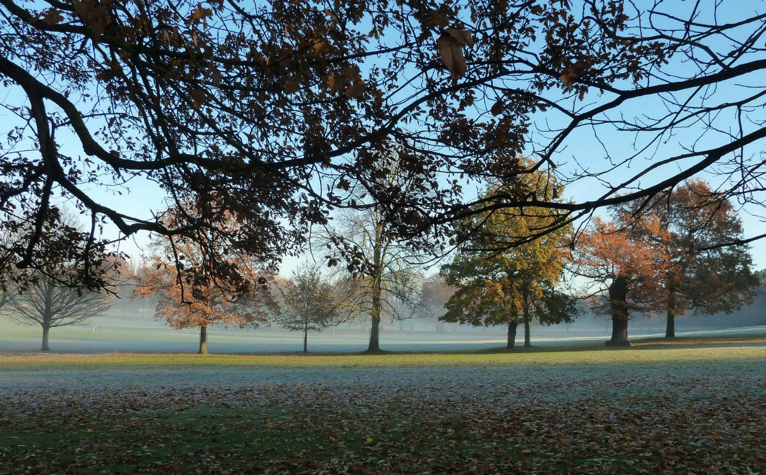
This run of fine, sunny settled days has been accompanied by chilly nights and some stubborn radiation fog. SE England has been too breezy this week to see any problems at its airports, luckily, but parts of Yorkshire have kept the murky conditions until lunchtime, before the warm sunshine appeared.
The official definition of fog is "Visibility of less than 1,000m". This limit is used for shipping and aviation, but for the general public and motorists an upper limit of 200 m is more useful. If visibility falls below 50m, severe disruption to transport can occur. In public service warnings the levels of 1000m/200m/50m correspond to aviation fog, thick fog and dense fog. The Met. office issues yellow and Amber Fog warnings for the UK
When is it foggy or just mist?
FOG is lots of tiny water droplets suspended in the air, reducing visibility below1000m. Relative humidity would need to be at or very near to 100%
When visibility is 1000m or over and relative humidity is at least 95% = MIST
Continuous, Patchy or Shallow fog and other visibility obscurates
CONTINUOUS = less than 1000m in all directions and a depth of at least 2m above the ground
If visibilities vary in different directions, 700m one way, 1400m another then the fog is in PATCHES
SHALLOW fog does not extend above eye level
HAZE – reduction in visibility due to suspension of tiny, dry particles in the air. Often occurs in High pressure making the view in the distance seem pale. This haze often results in stunning sunsets.
SMOG – mixture of Smoke and Fog, named from water particles and remnants of coal burning from the 1900s which reduced visibility. Nowadays, most smog is from sunlight reacting with car exhaust fumes
Ingredients for fog formation
The air needs to cool, down to a point where the air is saturated and can’t hold the water vapour any longer. This temperature (the dew point) is when dew begins to appear on the ground. The formation of dew takes water vapour out of the air, which leaves a drier layer for a time just above the surface. As the night continues, the air temperature falls further and fog will eventually form at Tf (fog point). Tf can be calculated and compared to the forecast minimum temperature of the coming night, to work out if fog is likely and if it will be thick enough to cause problems.
Fog clearance
There are 4 main ways of clearing fog:
Once the sun gets to work, it will ‘burn away’ the fog, it can also set of turbulent eddies, mixing up the air. High pressure days with light winds rely on this, when a murky grey morning turns into a spectacular sunny day, eventually. This method of fog clearance isn’t as effective in the winter (weaker solar radiation)
If the wind picks up, mixing occurs and the fog lifts into Stratus, then can break up, or in drier air the fog dissolves away from the top.
Cloud can move in over the top of the fog bank, this can clear fog more quickly. As low cloud moves over the top of the fog bank, the cooling is reduced, as heat is added from the surface
Drier air adverts in and there is a gradual change.
Fog is quite difficult to forecast due to local effects, forecast models often aren’t much help. Areas such as the Vale of York are very prone to thick lingering fog at this time of year, but this is radiation fog.
Types of fog
Radiation – this is the traditional autumn fog that sits over fields and looks pretty on the satellite pictures. Often you can see the little branches of fog filling valleys on the first visible satellite image of the morning. This forms in-situ as the overnight temperatures fall and condensation occurs. If conditions are the same each night, like this week thanks to the anticyclonic spell, then fog will often re-appear. It clears from the edges as the day warms, or a breeze picks up. Checking on the VIS satellite pictures each hour shows how it disappears. A temperature chart will also show large comparisons from sunshine warmth to under fog coolness.
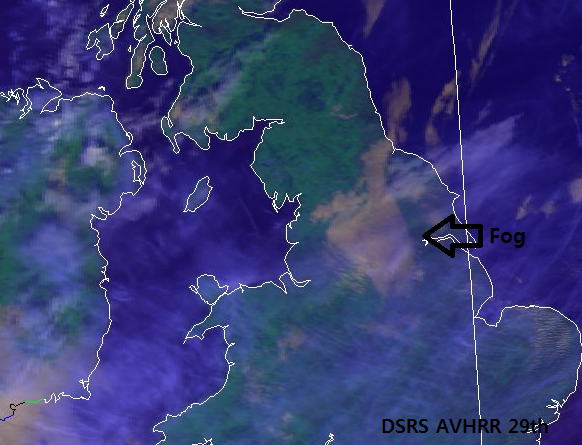
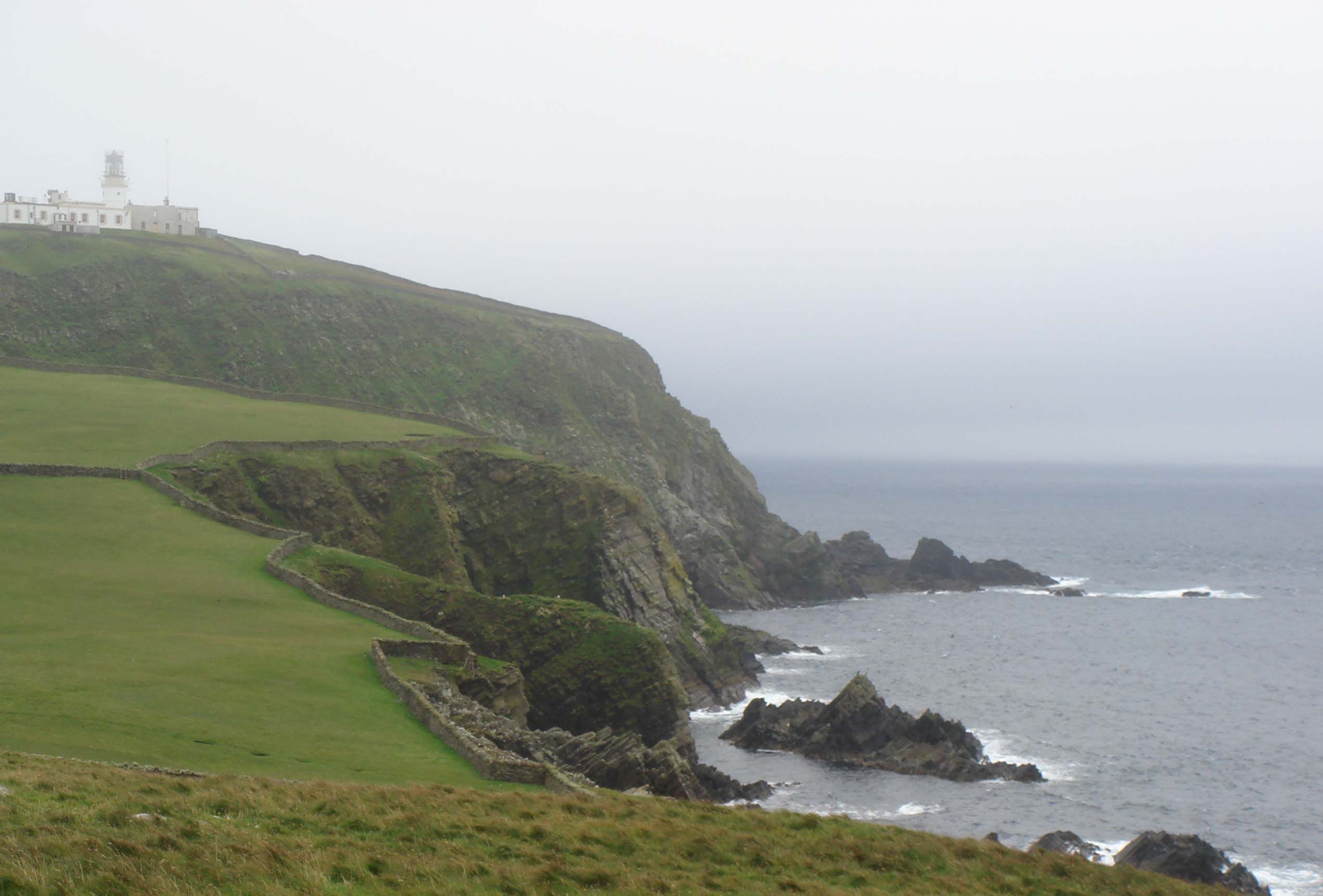
Advection – fogs like Sea fret or the Haar are advection fogs. Moist (relatively) warmer air moves over a cooler sea. You can watch its approach on the satellite pictures, often as it heads towards the east coast of Britain. This can hang along the coasts or have crept far inland overnight, giving a cool grey, murky blanket. This kind of fog can also form when a warm front passes over lying snow
Upslope/hill fog- This oocurs when the cloud base is lower than the tops of the hills. Anyone hill walking will know you can walk up into the clouds and the visibility is greatly reduced. Upslope motion can cause air to become saturated as it is forced to rise by the land
Frontal fog – If rain from warm air falls into very cold stable air below, the rain evaporates and a low level fog can form, often for higher ground
Recording Fog
Observations – Station circle Present weather symbol, to left of cloud circle
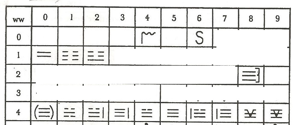
04 Vis educed by smoke (localised source such as industry/forest fire)
05 Haze
06 Widespread dust in suspension in the air, not raised by the wind
10 MIST – vis in all directions must be > 1000m
11 Patches of shallow fog
12 more of less continuous shallow fog
28 Fog cleared in last hour, Vis must now be 1000m or greater
All of below must be at least 2m deep, not shallow fog
40 Fog at a distance
41 VIS less than 1000m in some directions but not in others (patchy)
42 Fog getting thinner in last hour (sky visible SV)
43 Fog getting thinner in last hour (sky not visible)
44 no change (SV)
45 no change (SNV)
46 fog getting thicker in last hour (SV)
47 Fog getting thicker in last hour (SNV)
48 Fog depositing rime (freezing fog) SV
49 Fog depositing rime (freezing fog) SNV
Loading recent activity...


