
This weekend will be more unsettled, blustery, cool with rain at times. Two areas of low pressure will move our way but neither are linked to Tropical Storm Henri, currently near N.America
I'm deflated to read "a deep low pressure will be bolstered by the remnants of Tropical Storm Henri currently charging across the Atlantic"
Are there just commas missing "A deep low pressure, will be bolstered by the remnants of TS Henri, currently charging across the Atlantic."
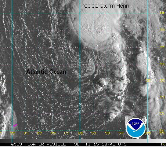
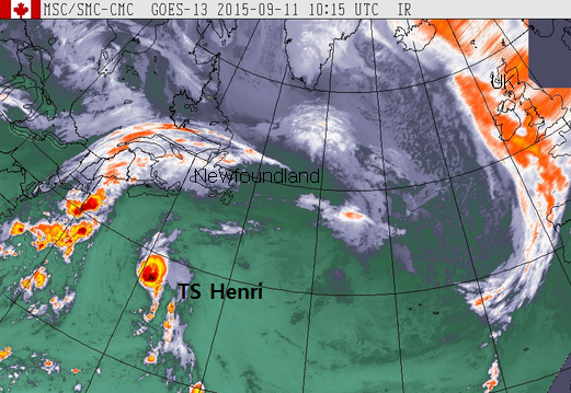
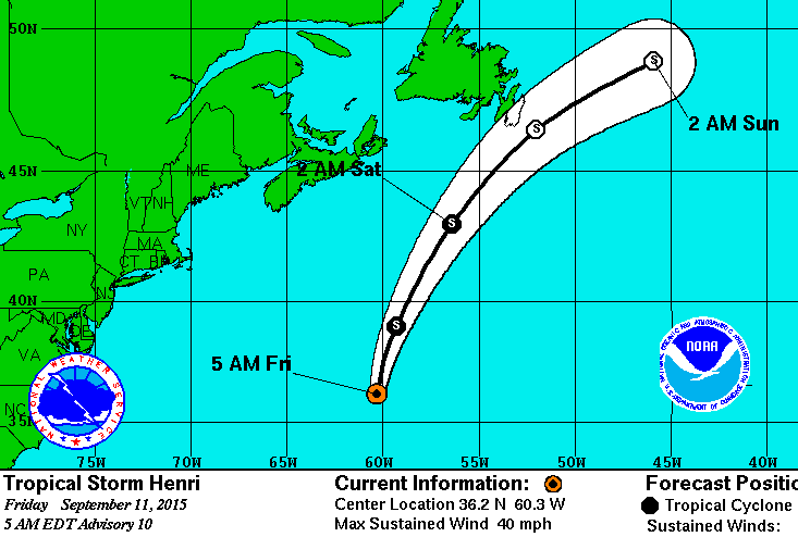
Tropical Storm Henri is not currently charging across the Atlantic, it is heading near to Newfoundland. It is moving northward away from the seas NE of Bermuda, not really troubling anyone. The Canadian Met Service does have a tropical cyclone warning out for the far eastern areas. “For tropical storm Henri.The next statement will be issued by 9:00 AM ADT. Weak tropical storm Henri forecast to affect offshore waters tonight and Saturday. There is a possibility that the system might dissipate as it moves away from the warm Gulf Stream waters which would result in very little impact.”
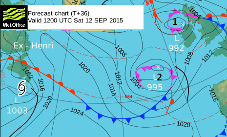
After brushing the eastern tip of N.America, extra tropical Henri will then turn eastwards and may interact with our UK weather next week
What isn't helpful about the dramatic Henri declarations is that it's nearly the weekend and many people have things planned, someone asked me yesterday about their outdoor wedding weather on Saturday. Confusion is possible as there are two low pressure heading to the UK this weekend. Yet this is before Henri even leaves Newfoundland.
These other two low pressure will (and already are in N.Ireland) bring a real change in the weather. High pressure with its fine, settled spell will disappear and the next few days look blustery,cool and wet at times. Bands of rain and showers move across Britain on Saturday, N.Ireland is going to have quite a lot of wet weather this weekend and the 2nd low will bring more wet and windy weather from the SW to end the weeekend.
None of this is linked to Henri.
The NOAA National Hurricane Centre track shows post-tropical Henri beginning to head over the Atlantic on Sunday
Any heavy rain or winds vaguely linked to Henri won't be near the eastern Altantic until Wednesday at least. There are great model variations in what will happen to the remnant low. Will it move across towards France not amounting too much or will it turn NE and bring heavy rain to the UK midweek? Other solutions show strong winds heading our way. Adding tropical cyclone energy into our forecast models is always a big stir for the pot. There are no certainties or warnings out yet, 6 days ahead. So enjoy the more unsettled weekend and we'll keep an eye on ex-Henri next week


