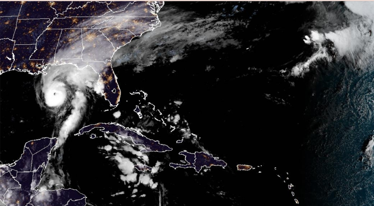
As the Gulf States of the US prepare for the arrival of Hurricane Isaias during "Friday night or early Saturday", the remnants of this tropical cyclone might infleunce our weather on the other side of the Atlantic later next week.
No, that does not mean that a hurricane is on the way but the far northwest of the UK looks to see several bouts of wet and windy weather for mid October.
At this time of year, the North Atlantic can provide cooler air and plenty of showers. Depending on where the jetstream is, we can also experience deep low pressures, even storms, as autumn progresses.
The Arctic regions are getting colder with less sunlight, which contrasts with residual warmth further south. This strengthens the jet, which can lead to significant development of our usual (extratropical) low pressure. Sometimes an ex-hurricane is added into the mix. A hurricane or tropical storm that might have impacted regions in the Caribbean or the United States and ends up moving eastwards towards western or northwestern Europe.
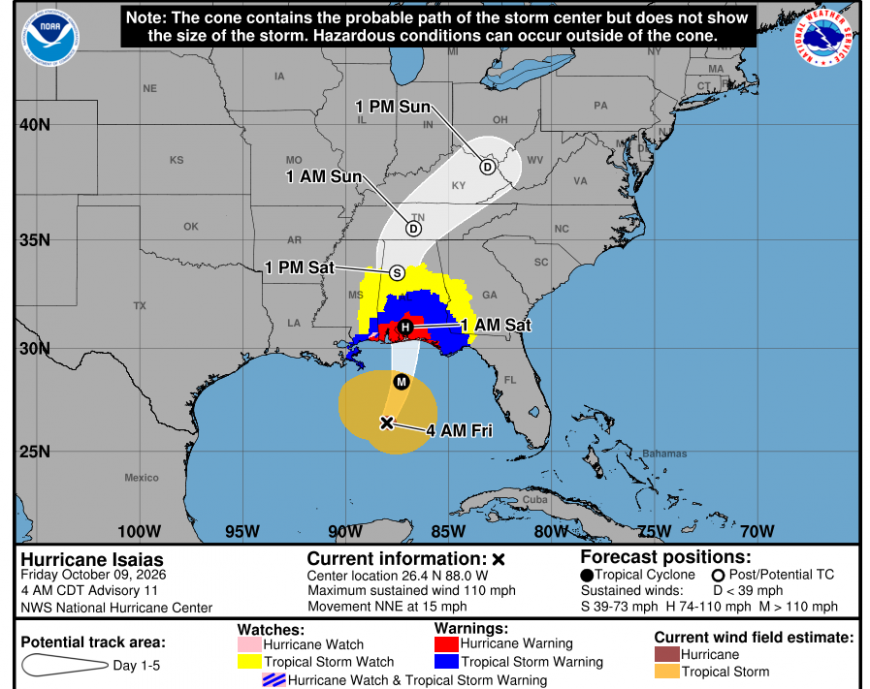
“Damaging hurricane-force winds are expected over portions of the Florida Panhandle, southern Alabama, and southern Mississippi… residents should prepare for the possibility of long-duration power outages.” NHC
Hurricane Isaias
The US National Hurricane Centre (NHC) has warned of hurricane conditions by Friday night into early Saturday (local time) with tropical storm conditions developing on Friday. Also forecasting a dangerous storm surge, large and dangerous waves, torrential rainfall through the weekend with the risk of flash flooding and significant river and urban flooding. There is also the risk of tornadoes.
“ Isaias is expected to produce rainfall amounts of 4 to 8” across southern Alabama, the Florida Panhandle and Big Bend, and southwest Georgia. Localised totals up to 15” are possible, particularly within banding across the Florida Panhandle and Big Bend. Across the coastal Carolinas, rainfall of 3 to 5 inches, with localised totals up to 8” are possible.” NHC
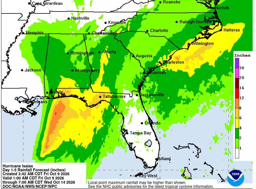
Preparations are underway in the southeastern states of the US as the first hurricane of the 2026 season approaches the Florida Panhandle and SW Alabama on Friday night. NHC forecasters have warned not to focus on the likely area of landfall, as the impacts will be wide-reaching from Isaias. There are warnings and watches across much of the Southeast, with rainfall concerns likely for many days. Governor Kay Ivey has issued a State of Emergency for some Counties with the mandatory evacuation of coastal tourists and visitors.
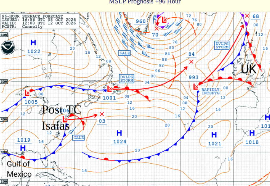
Post-Tropical Isaias
As Isaias changes from a tropical cyclone to post-tropical, it should move out of the eastern seaboard and head across the Atlantic. This does not mean that a hurricane is heading our way, even if it will be 39 years next week since the October Storm that hit SE England and blighted Michael Fish ever since. However, the tropical energy will be wrapped up in a low later next week.
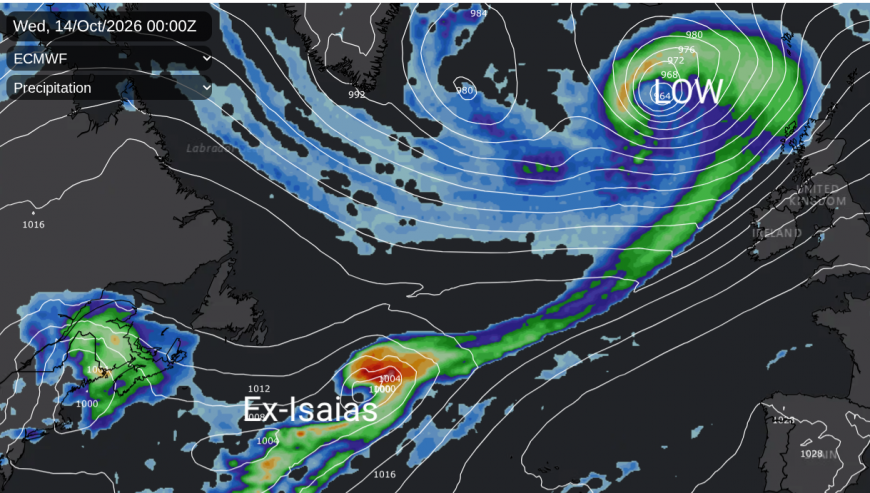
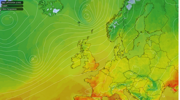
There are several low pressures on their way, and some warm air. To end the weekend and on Monday, frontal rain, linked to a low pressure close to Iceland, will sweep over the UK, with a secondary low developing for Tuesday. The ECM model has this passing to the NW of Scotland with gales likely here before the frontal rain band moves across the UK. Another Atlantic low pressure could develop in the middle of the week and again skirt past NW Scotland, this time early on Tuesday night. This could bring the risk of gales, even severe gales, to the far northwest.
During Wednesday, a rather elongated system will move over the mid-Atlantic towards the Western Isles by Wednesday night. This will have the extra tropical oomph from ex-Isaias mixed up in it.
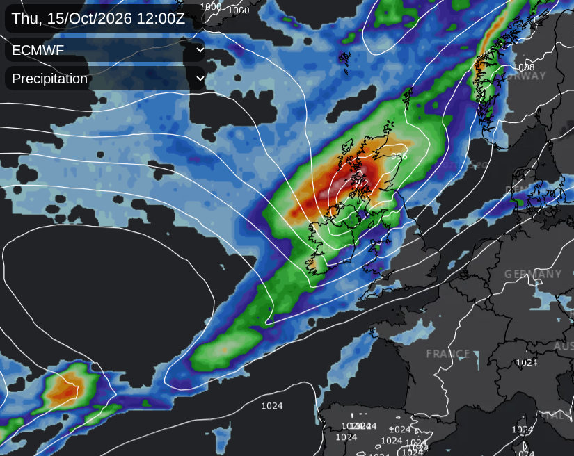
The ECM model has a significant low pressure moving over the Scottish Islands early on Thursday, which could bring impactful wind and rain to northern parts of the UK, before it heads off to Scandinavia.
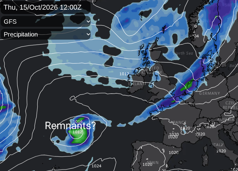
The GFS model shows ex-Isaias struggling to progress across the Atlantic, coming up against areas of high pressure. A different Atlantic low pressure could bring wet and windy weather to Northern Ireland, Scotland and later the Irish Sea on Wednesday, but this is not linked to Isaias, which seems to flounder mid-ocean. Plenty to watch over the coming days.
To the southeast of these low pressures, there will be times of fine weather and warmth when temperatures could return to the low 20s Celsius in Britain. There is a lot of uncertainty about the developments and tracks of these various low pressures from the Atlantic but the autumn energy is gathering. And parts of Britain really need the seasonal rain.
More Isaias chat in the Netweather community forum. Top satellite image 09 Oct 2026 10:20Z NOAA/NESDIS/STAR-GOES19
Loading recent activity...