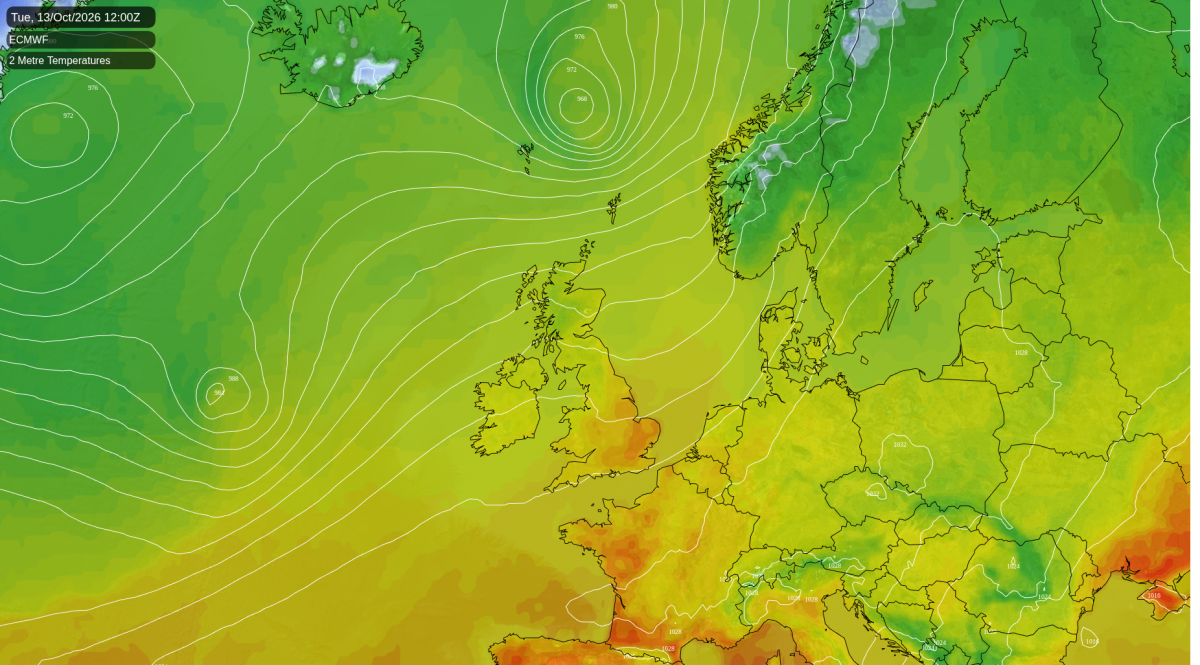
Southern parts of the UK will see a rollercoaster of temperatures over the coming days, a little below average today, back to slightly above as temperatures reach the high teens for a time in the south tomorrow, following a warm front moving through overnight, before temperatures fall slightly below average this weekend. But warming up again early next week, a few models forecast 22C in eastern England on Tuesday, just when we thought we'd seen the back of summer temperatures!
For the north of the UK, temperatures won’t see such wild swings and will generally stay close to or slightly below average from now and through the weekend, though will rise above average for a time early next week too.
Rollercoaster of temperatures over the coming days
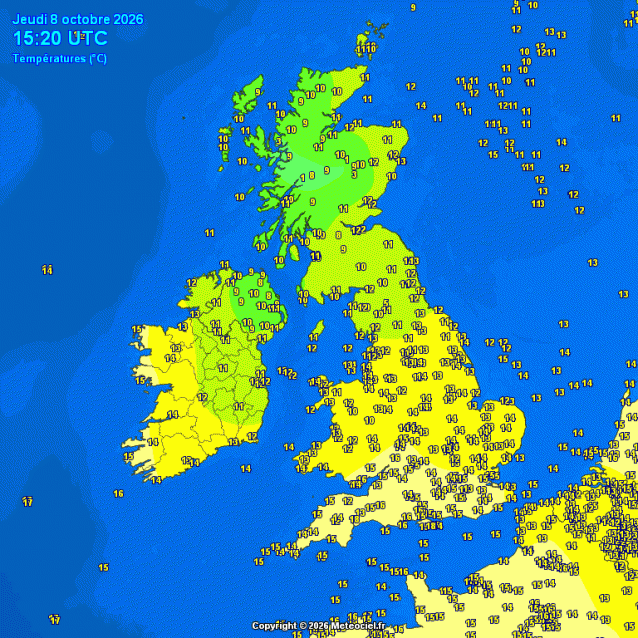
It’s turned noticeably cooler across southern UK mid-week, after more summer-like temperatures earlier in the week when temperatures reached 24C on Monday and 23C on Tuesday, closer to the average high of July!
Temperatures this afternoon are a little below average for early October. Average highs at this stage in October are around 13C in Edinburgh, 14C in Manchester and 16C in London. However, highs this afternoon are a few degrees below these average highs.
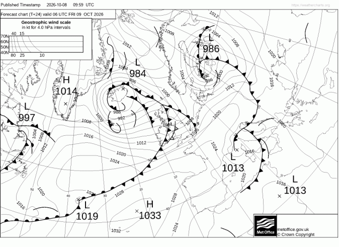
However, a warm front moving east overnight - bringing outbreaks of rain across many areas, will introduce warmer tropical maritime air across England and Wales for a time, with highs reaching 18-19°C in SE England and East Anglia Friday afternoon, a degree or two above the early October average. However, a cold front will also be moving southeast across England and Wales through the day, bringing a band of squally rain, with temperatures falling again from the northwest through the afternoon and evening.
Warm front moving east overnight will introduce warmer air in the south for Friday
So the weekend will see temperatures dip again, as west to northwesterly winds establish behind the cold front clearing southeast tomorrow, bringing in cooler air. Highs on Saturday and Sunday reaching around 14–15°C in London and 12–13°C in Manchester, a touch below average. Scotland will be closer to normal with highs of around 12–13°C. The nights stand out more, with lows around 7°C in the south, so mornings will feel properly autumnal.
So it's a slightly below-average weekend rather than a cold one, and it doesn't last, since everywhere is back above average from Monday, as a warm front, accompanied by cloud and rain, moves east and introduces warmer tropical maritime air in its wake, as winds turn southerly. Monday night may see minimum temperatures fall no lower than 17-18C in the south and west, according some models, slightly above the average daytime high for mid-October! Then on Tuesday, the latest run of ECWMF (06z run) shows temperatures reaching 22C across eastern England, with some sunshine, some 6C above the average high for this stage in October.
Forecast to be very warm for mid-October in E England on Tuesday
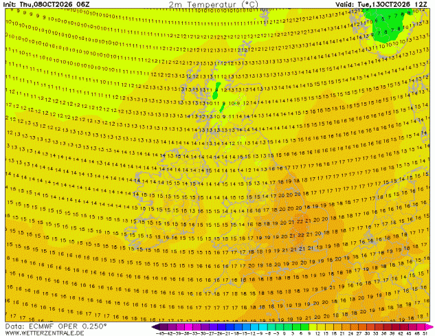
Although not as high, temperatures are forecast to still reach the high teens in the south on Wednesday, before cooling off for the rest of the week to more average values for mid-October. There could be some rain or showers around from the middle of the week, perhaps a spell of wet and windy weather followed by cooler and showery conditions later in the week.
So, don’t put away the summer clothes just yet those who live in the south, it could turn summer-like next week, aka an Indian Summer, as we have seen frost this week across parts of England and Wales too.
Loading recent activity...