If this muggy and strangely warm weather is all a bit too much (for late September) a change from the Atlantic is on its way.
Tuesday 29th September was a day of sticky warmth and strong winds for parts of the UK and Ireland.
With a large, deep area of low pressure nearby, Ireland experienced a wild day as strong winds and heavy rain caused significant disruption. There were fallen trees leading to blocked roads and many ongoing power outages showing on the ESB Networks website (Irish electricity distributor). Autumn has certainly arrived in Ireland
ESB “We apologise for the loss of supply. We are currently working to repair a fault affecting your premises and will restore power as quickly as possible.”
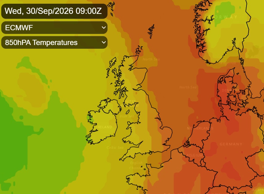
Across Britain, it was more like summer. Tuesday was a warm day, but in parts of England it was a bizarrely hot and humid late September day. The top temperature was 28.1C at Kew Gardens thanks to a surge of very warm air from Iberia.
After a warm night across Britain and a muggy night for eastern Scotland and central & eastern England, temperatures were above 20C in SE Britain around 5am. 21C in places with exceptional warmth.
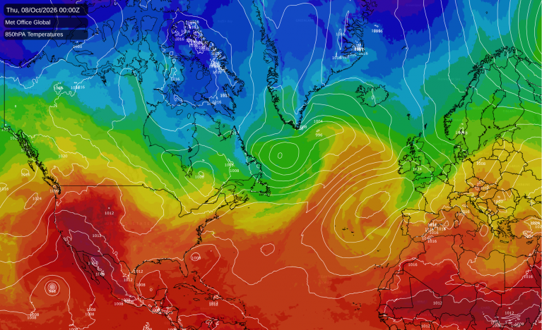
That plume of very warm air will be over Germany midweek, cleared from the UK by a lengthy cold front running north-south. This opens up a fresher southwesterly flow from the Atlantic as the low centre heads for Iceland. High pressure will build over southern Britain from the Bay of Biscay, but other weather systems will bring cloud and rain from the west.
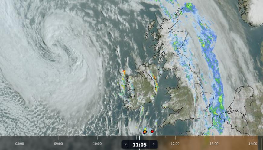
Netweather radar showing the low pressure over the Atlantic (swirl of white cloud), the clearing cold front with rainband and clear skies inbetween with showery trough and (coloured dots) lightning strikes to SW
The remnants of the cold front cloud and rain will continue to edge away eastwards over the North Sea, leaving eastern Britain. There are clear skies and sunshine to follow but also a few distinct troughs, bands of heavy showers bringing the risk of hail, even thunder today. So just be aware that even though the frontal rain has cleared, a heavy downpour could change the sunny picture. Temperatures in England will be in the low 20sC so still warm, but not feeling as close as yesterday. For Northern Ireland and western Britain, it will remain blustery with a fresh south to SW wind.
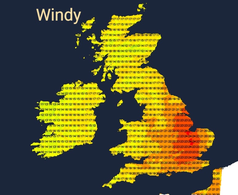
There will be strong to gale-force winds for the Western Isles this evening with rough seas as the low centre heads northwards. Further clusters of heavy showers will work their way up over southwest Britain, into the Midlands, Cumbria and Wales tonight. Much of England will remain mild but Northern Ireland will see temperatures dip into single figures.
For most, Thursday will be a fine, sunny and dry day. Again, there will be a scattering of showers on a SW to westerly breeze making it feel fresher. Temperatures will typically be in the mid to high teens. By Thursday evening, Northern Ireland will see more cloud and outbreaks of rain as the next weather system arrives from the Atlantic
This will spill over northern Britain, particularly the northwest and continue over Northern Ireland on Friday. It will be dry and sunny for much of southeast Britain.
Loading recent activity...