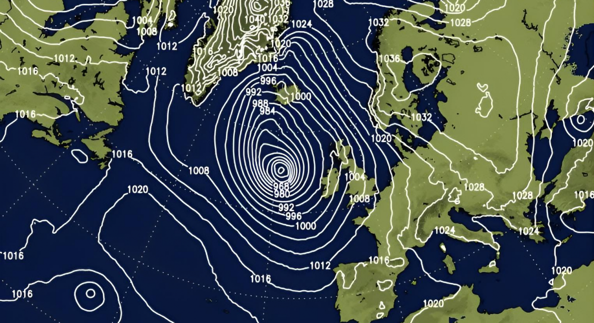
The merging of two low-pressure systems will occur today to the west of Ireland, one of subtropical origin from the Northwest Atlantic, this forming a low-pressure system that will deepen off the coast of Ireland and intensify very rapidly, with explosive cyclogenesis, or a "weather bomb." It could reach a pressure of around 951 hectopascals at its centre on Wednesday morning, but it will remain offshore.
However, the deep low-pressure system moving north to the west of Ireland will bring gale force 8 or strong gale force 9 winds to coastal areas of Ireland and western coastal of mainland UK, with very rough seas developing with potential for waves overtopping and flooding, due to Spring tides. Strongest winds up to 80mph or more staying offshore west of Ireland though.
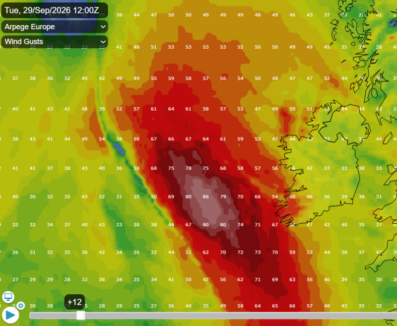
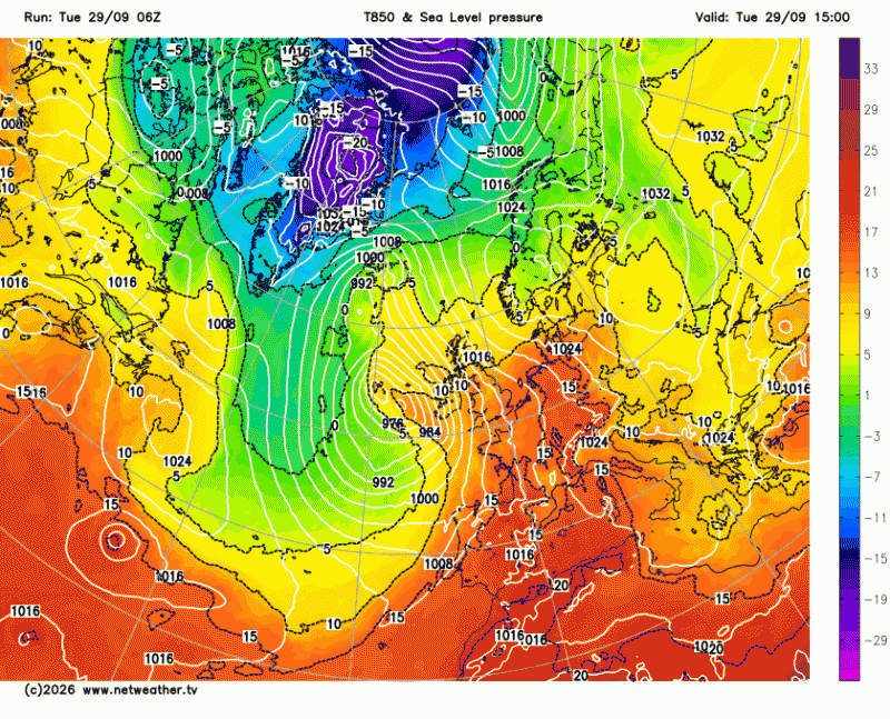
The deepening low will draw a deep south to southeasterly flow over much of western Europe, pulling very warm and humid air north, with maximum temperatures reaching high values for this time of year today, ranging from 22C to 27C across southern England and Northern France, 27-30C across the southern half of France.
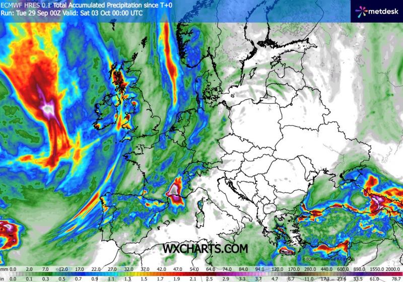
The warm and humid southerly flow, particularly in areas with the flow off the western Mediterranean, will bring areas heavy rain and thunderstorms with a high potential for significant rainfall to the Cevennes and Languedoc regions of France and also NE Spain, including Catalonia / Barcelona between Tuesday evening, September 29th, and Thursday, October 1st. The high temperature of the Mediterranean Sea will exacerbate this humid weather, with very intense rainfall expected.
Further north and west, a very long cold front associated with the deepening low to the west of Ireland will shift east with a band of rain tonight and through Wednesday morning across the UK, northern and western France and northern Iberia, before edge further east then stalling from the North Sea down through Germany and towards southern France on Thursday, where it will weaken with southern extent.
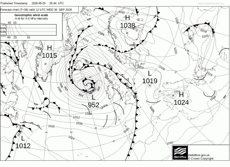
Following the cold front will be cooler and fresher conditions by Thursday across much of western Europe, but with showers, locally heavy and thundery on Wednesday, mostly around southern and western coastal areas of the UK, Atlantic coastal areas of France and northern Spain.
However, Thursday onwards will see a ridge of high pressure build in across France and southern UK, with showers easing a drier, sunnier and more settled conditions developing here. But for Ireland and northern UK, Atlantic fronts will continue to roll in, bringing further showers or longer spells of rain here Thursday and Friday. Low pressure over Iberia will also bring further showers or storms here too.
But over the weekend, high pressure looks to build hold over southern Britain while extending further north, with rain perhaps becoming increasingly confined to northern Scotland.
Loading recent activity...