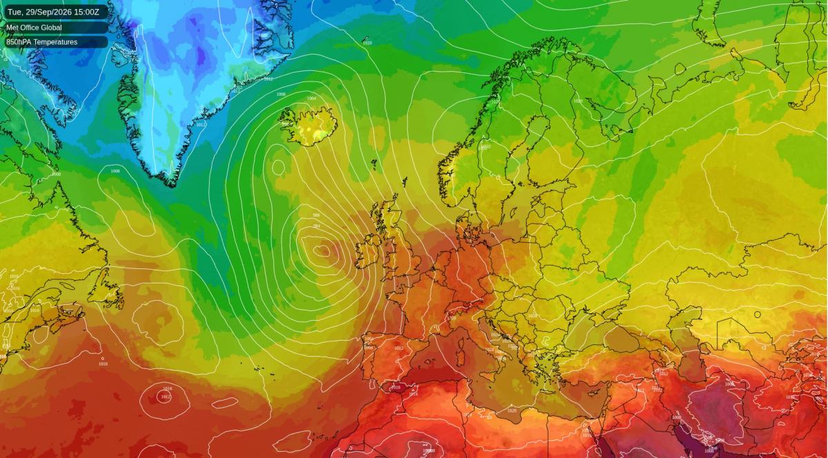
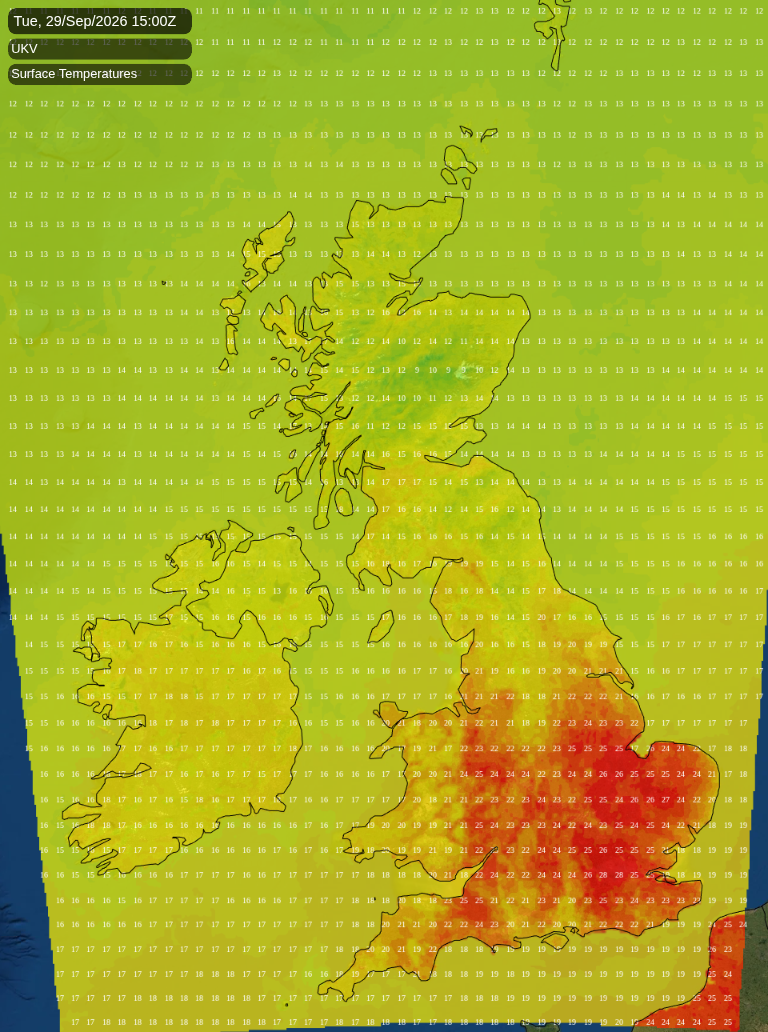
A deep area of low pressure is winding up over the Atlantic west of Ireland today, while high pressure sits over Scandinavia. Between the two, a south-easterly draws warm air up from the continent. This afternoon should reach 24 to 28C across London, the Thames Valley, the Home Counties, Cambridgeshire and the south Midlands, a very warm afternoon for the end of September. Cardiff and Bristol can expect 22 to 24C. It will be much fresher on the North Sea coast, around 15C in Newcastle against 21C in Doncaster, and 13 to 18C in Scotland. The afternoon should stay mostly dry in England, with a chance of a passing shower in the Midlands, Yorkshire and the south-east.
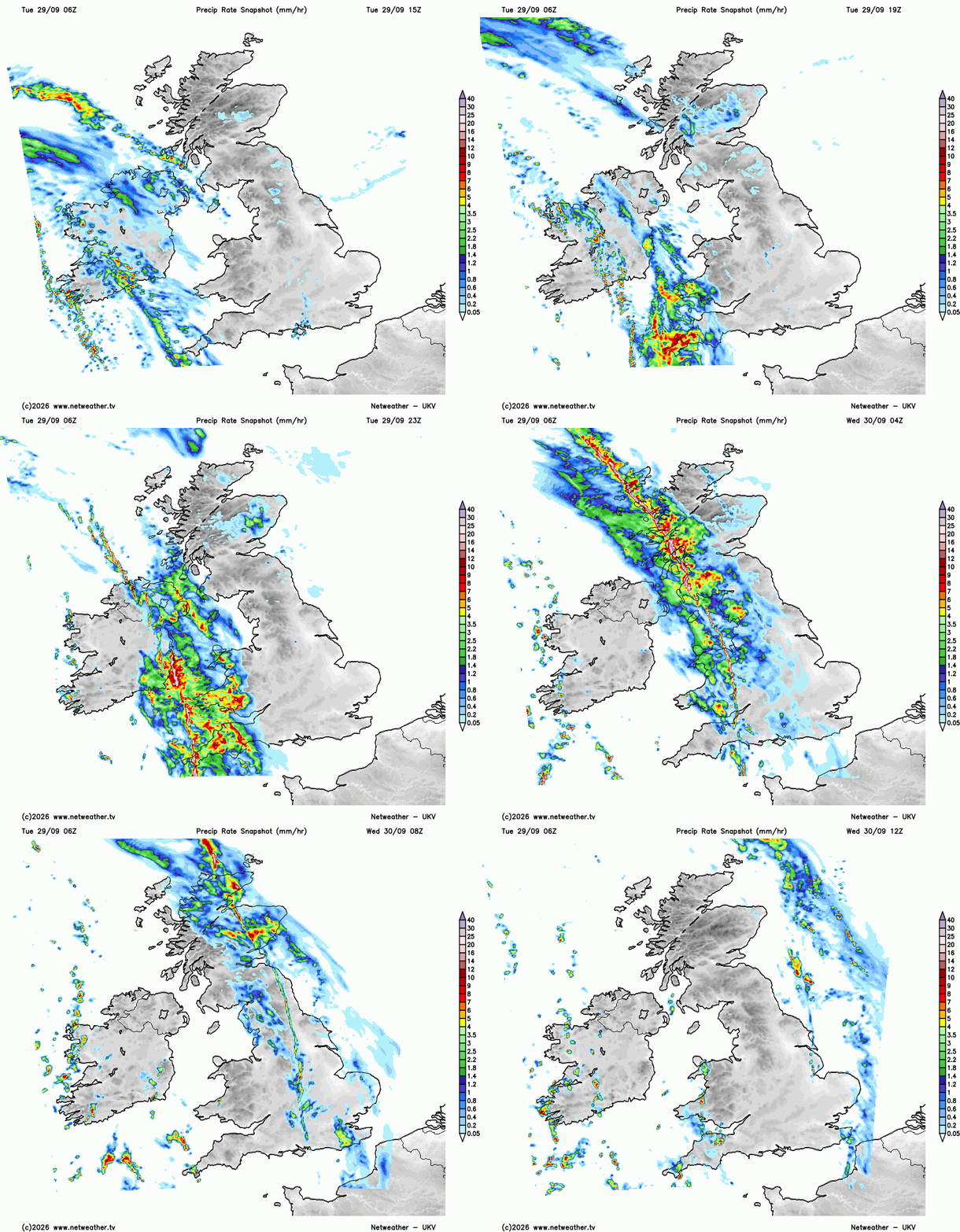
A cold front trailing from the Atlantic low reaches Cornwall later this afternoon. By late evening its rain should cover Cornwall, Devon, Wales, the Isle of Man and eastern Northern Ireland, heaviest over Cornwall and west Devon, where it is likely to be a soaking by midnight. Heavy showers could also break out over inland Aberdeenshire this evening.
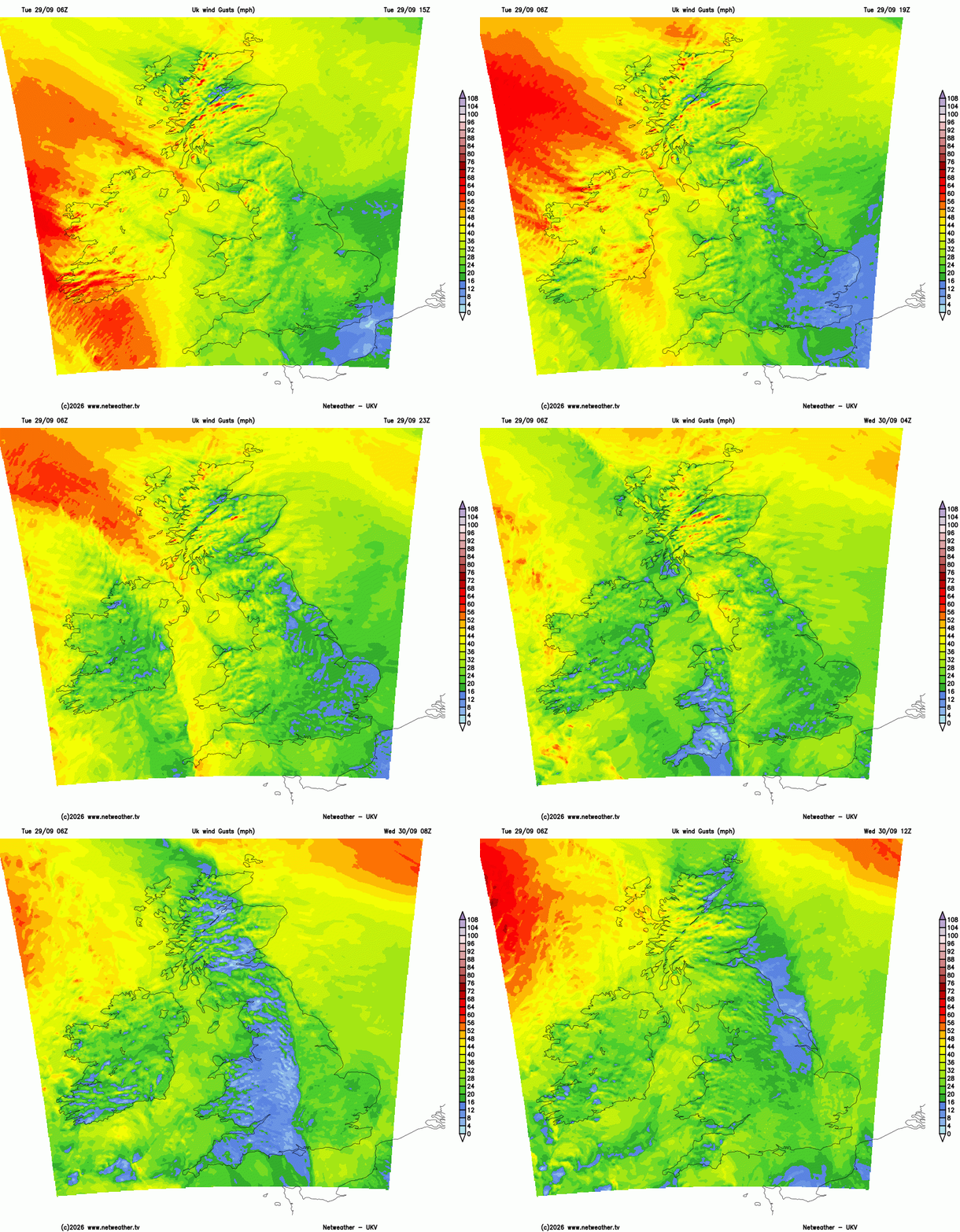
The wind picks up in the west as the front approaches. Gusts of 45 to 50mph are likely in Cornwall, the Western Isles and parts of Northern Ireland, with 55 to 60mph around Lochinver on the far north-west coast of the Highlands.
Overnight the front sweeps west to east across the whole country. After midnight its rain crosses western Scotland, Northern Ireland, north-west England, Wales and the south-west as a narrow line of intense downpours. It will be sharpest over Argyll, the Clyde, Galloway and the Welsh hills in the small hours, and a rumble of thunder is possible along it. By first thing on Wednesday the line runs from the Moray Firth through central Scotland and down the Pennines and the Midlands to Hampshire. Through the morning it moves over eastern England, leaving the Norfolk and Suffolk coast around midday. Nights either side of the front will be very mild in the south-east and East Anglia, generally 15 to 18C.
Behind the front, Wednesday afternoon turns brighter across most of England. London and East Anglia can still expect 22 to 24C. The far south-west, south Wales and Northern Ireland are fresher at 16 to 19C, and showers follow into Wales, Northern Ireland and north-west England later in the day. Shetland could see gusts of 45 to 50mph on Wednesday morning.
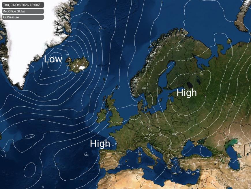
As the low pulls away north-west towards Iceland, a ridge of high pressure builds in from the south-west. Thursday turns fresher. Showers are likely overnight in Scotland, north-west England, Wales and the south-west, but the afternoon is expected to be largely dry, with light winds and East Anglia least likely to see anything. Temperatures ought to reach 18 to 20C in the south-east and East Anglia and 13 to 16C in Scotland, close to average for early October.
By Friday high pressure is expected to be centred over south-east England. London, East Anglia and the south-east look dry, with around 21C in London and Norwich. Further north-west, a weakening front is likely to bring patchy rain into Wales, north-west England and south-west Scotland during the morning, breaking into showers over the Pennines and Yorkshire in the afternoon. Scotland and northern England have a 70 to 80% chance of catching some rain. Wales and the Midlands have about a 60% chance, the Isle of Man an even chance with Belfast a little lower, and the south-west a 30% chance. The Midlands should range from about 15C in Stoke to 20C in Northampton.
Saturday is likely to start chilly in the Scottish Borders and Galloway, around 5C in Dumfries and Hawick, and colder still in the Highland glens at about 3C. Under the high, winds will be light and most places should stay dry, with hazy sunshine in the south and east. Afternoon temperatures look like reaching 19 to 21C from London to Norfolk, and 12 to 15C in Scotland, with a chilly 13C expected in Belfast. Showers are more likely than not in the Hebrides and the western Highlands. The Met Office's detailed model brings the next Atlantic rain into Northern Ireland and southern Scotland by Saturday evening. Our longer-range model keeps it out to the west, and the ensemble puts the chance there below 30%, so it is more likely to hold off.
Loading recent activity...