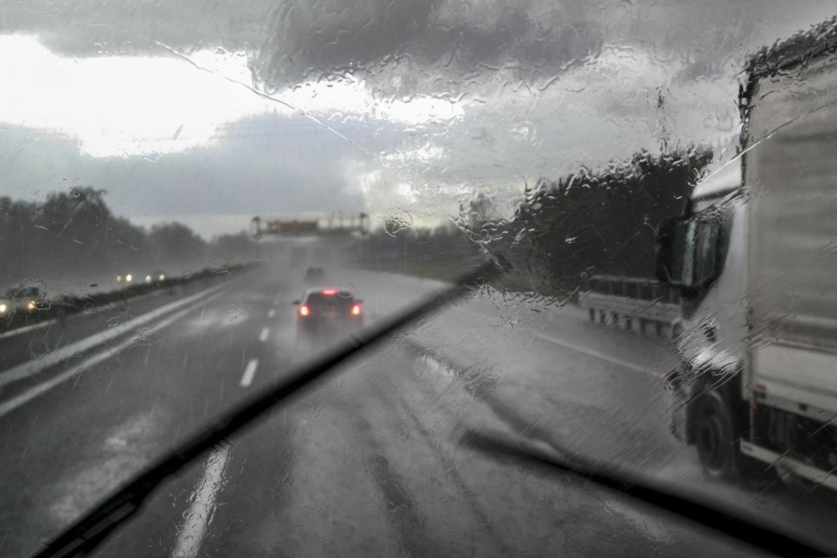
Edinburgh and Lothians saw a deluge on Wednesday morning from a slow moving but active cold front, which dumped heavy rain over eastern Scotland as many people were waking up and getting out of the house. There was thunder and lightning, as flash flooding caused travel disruption and plenty of school children got absolutely soaking wet.
There is a weather saying “Rain before seven, fine before eleven” which only relates to frontal rain. Generally, as low pressure moves near to the UK their weather fronts will sweep west to east and mostly the rain will only last a few hours. So if your day starts with persistent heavy rain, rather than quiet drizzle, then there is a chance that it will all clear out of the way in the morning. Edinburgh is already back into sunshine as the frontal cloud, heavy rain and thunderstorms head away over the North Sea.
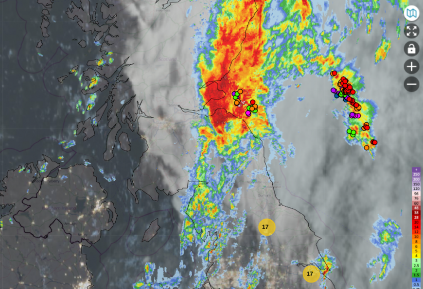
Netweather Radar extra 0745 Wednesday 23rd September, rain radar, satellite, lightning dots and highest temperatures
At this time of year the leaves are beginning to fall and can easily block drains. Often it is the same places that flood and cause delays with huge puddles but there were torrents before dawn and eastern Scotland has been very dry this summer, so the ground is still hard
Behind a cold front, obviously there is relatively colder air, but also often unstable air with showers. Showers come and go, with brighter or sunnier skies in between. This morning it was dark clouds, persistent rain and flashes of lightning with rumbles of thunder.
The Netweather radar showed different colours which represent the amount of rain falling, so heavier rain where there are reds and even whites displayed. The dots are lightning strikes or sferics over time.
Within Netweather Extra you can add more display layers such as temperatures or the top ten: high temps, low temps, wind speeds, wind gusts.
Along a frontal boundary, the winds will veer and we can see that kick from the southwest to a northwesterly wind.
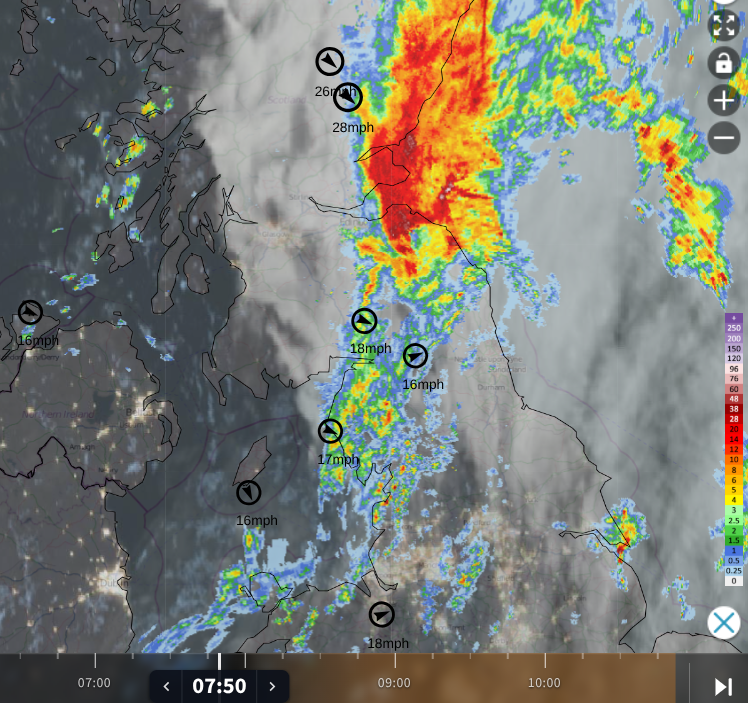
This cold front will bring a noticeable change to our UK temperatures through the middle of this week. Teddington, southwest of London, reached 27.0C on Tuesday. This morning parts of England started the day at 17C, still in the warm and humid air ahead of the front.
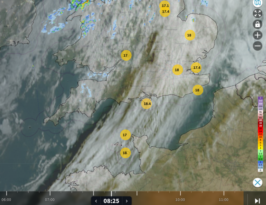
The warmer air ahead of the cold front, over southern Britain, with gaps in the cloud cover
London will still manage 24 or 25C today and ease to 22C by Thursday. The nights will feel fresher but warmer again by day on Friday. Further north, daytime temperatures will be in the mid to high teens but there will be some nippy nights, even a touch of rural frost.
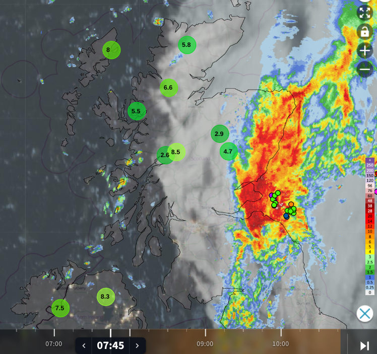
To the west of the cold front, temperatures were in single figures even as sunshine appeared behind the frontal cloud. This temperature contrast helps strengthen the jetstream which enables deeper low pressures in autumn. So far, they have been heading close to Iceland or north of Scotland, but there has been windy weather over the UK and these trailing frontal bands. However, the frontal rain has struggled to reach the drought areas of southern Britain.
Over the Atlantic, you can see open-cell convection where the centres of the cells are cloud-free, but there is cloud (white) around the edges. The cooler Polar Maritime air over relatively warmer seas produces instability and so showers for the west coast of Scotland and then NE Britain on Wednesday afternoon. High pressure is going to interrupt and settle the weather midweek, subduing any shower activity.
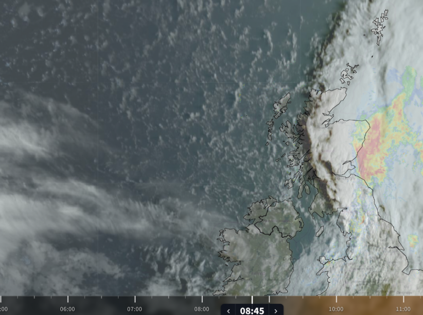
The satellite layer shows the wide band of frontal cloud but also the clearer skies to the northwest and out over the north Atlantic. As it is early morning, a dark shadow is visible to the west. The Sun is rising in the east and a shadow is cast from the cloud sheet (see below).
The cirrus ahead of the next Atlantic low pressure is already visible on the satellite image. Streaming Cirrus should be ignored on an otherwise fine day, the first sign of a low pressure out west. This deepening low will bring wild conditions to Iceland.
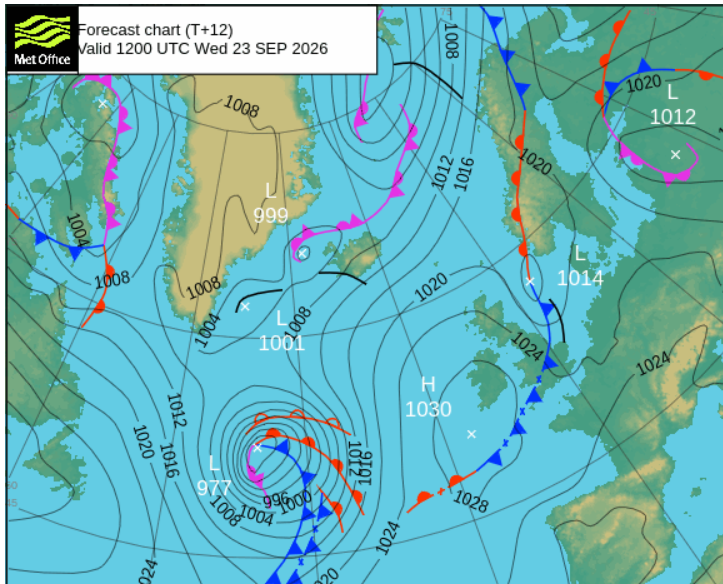
Forecaster’s remarks for Iceland VEDUR.is “Becoming east severe gales, even storm, in the southern parts tomorrow morning. People in the area should secure loose objects outside and travellers should be cautious, mainly if their vehicles are wind-sensitive.”
For the UK, it's another cold front which looks to bring line convection to western Scotland and Northern Ireland on Thursday evening. This could be after the evening rush hour but keep an eye out for sudden squally rain along this front. It could be short-lived but bring poor visibility as this narrow band of heavy rain arrives.
The early rain did clear all but Peterhead on the northeastern tip of Aberdeenshire by 11am, so a good review for that weather proverb.
Loading recent activity...