




Northern Ireland reached 25.5C on Monday 21st, which is the latest point in the year that the Province has experienced such warmth, on record. It was warm across Northern Ireland, but it was Helen’s Bay to the northeast of Belfast, County Down, which produced the top UK temperature, giving those at the seaside an incredible September day.
Tuesday will also be warm but there is cooler air on the way from the northwest thanks to an incoming cold front which will bring heavy rain overnight in the north.
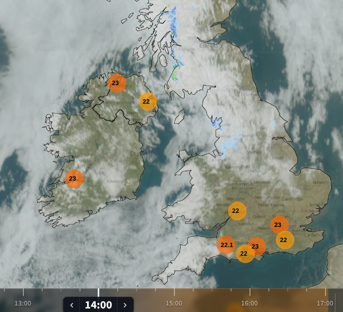
Monday 21st September warmth for Northern Ireland.
It had been nippy overnight, with Aboyne in Grampian down to +2.9C in the early hours of Monday before reaching 23.6C by day in the sunshine; that is quite the diurnal range. Durham reached 23.6C in Northeast England. London Heathrow reached 24.7C and Astwood Bank, Worcestershire reached 24.0C.
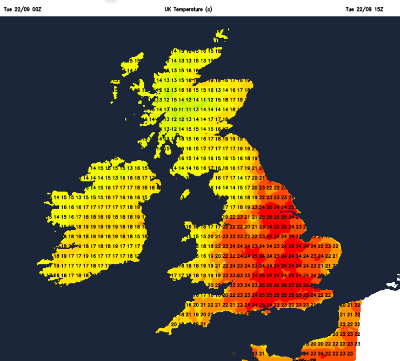
Today, on Tuesday, London could reach 27C as this feed of warm air continues from the south.
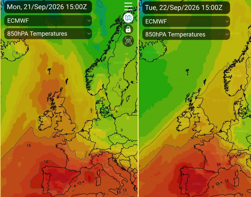
Temperatures in late September can vary greatly. A southerly flow with sunshine under high pressure lifts the temperatures into the 20s Celsius, as we are seeing for the start of this week. A northerly flow can bring a real chill by day, especially if a low pressure is nearby with strong winds. Clear skies at this time of year can allow the temperatures to dip near to freezing, and as cooler air appears from the northwest midweek we will see nighttime temperatures falling away. Where there are light winds and clear skies, there could be a touch of frost on the grass. Any heat from the day soon radiates away as the nights lengthen,
Tonight is the Equinox, the astronomical start of autumn, “when the sun crosses the celestial equator, the imaginary projection of the Earth's equator into the sky.” Guardian.
Meteorological autumn starts on the 1st September as we use three-month blocks for our seasons and to compare seasonal data. The Equilux “equal light” is until Friday 25th September and it is after this that the nights will be longer than the days. Feel free to tell someone that ‘the nights are fair drawing in!’
The UK September temperature record is 35.6°C from the 2nd September 1906 at Bawtry, Hesley Hall in South Yorkshire. This is early in the month and very much more like summer. Looking to the UK October record that was on the 1st October 2011 when Gravesend in Kent reached 29.9°C. So today’s possible 27C is still three degrees away from that.
One update from this summer is the top 2026 temperature. It moved from the 38.1C at Kew Gardens on 13th August to 38.2C in Gloucestershire and was only 0.3C under the current August UK record of 38.5°C from 10th August 2003 at Faversham in Kent.
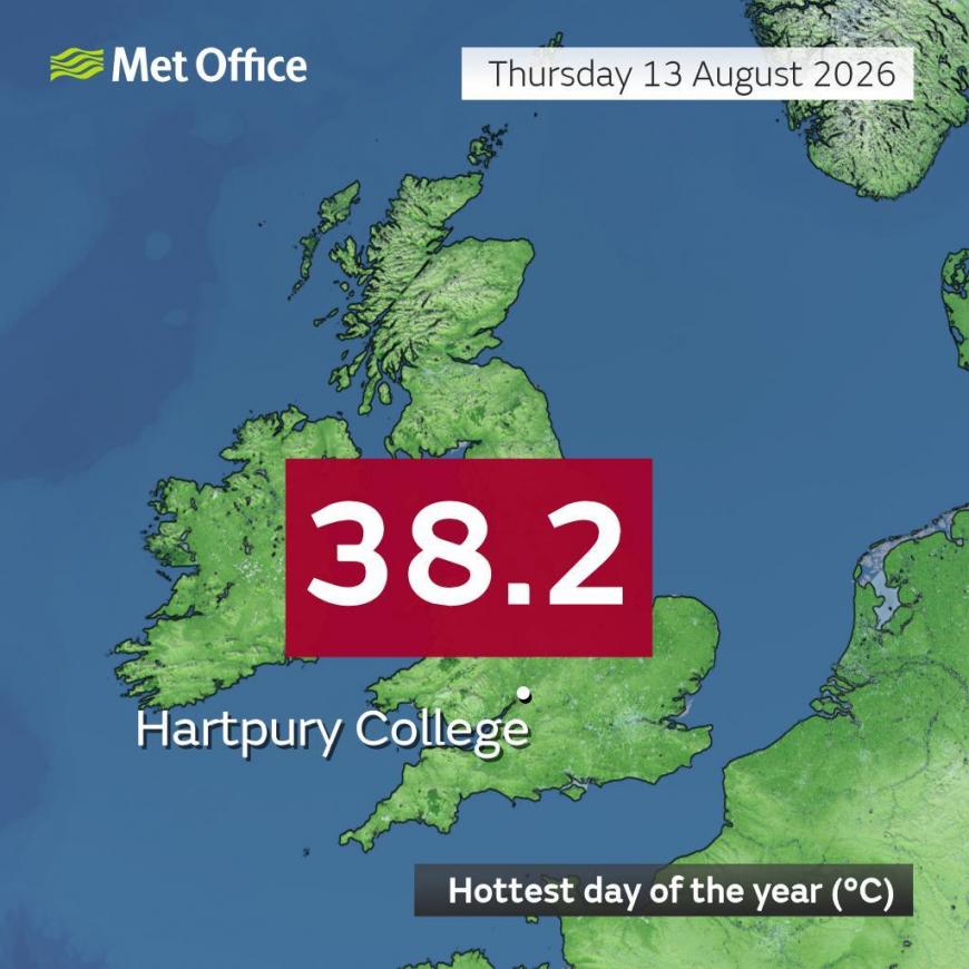
Hartpury College, Gloucs. “Following quality control checks, a manually operated weather station has been confirmed to have recorded 38.2°C on Thursday the 13th of August, making it the hottest day of 2026. This exceeds the previous maximum temperature of 38.1°C recorded at Kew Gardens on the same day." Met Office.
Tuesday
The winds will be very light today with high pressure over the UK. Eastern Scotland could see 20 or 21C today but prepare for a drop tomorrow. Northern Ireland won’t be as warm as yesterday but Belfast could still reach 20C in the sunshine so that will feel fine. Newcastle, Leeds and York will all be in the low 20s C with a fine day. East Anglia up to 23 or 24C with sunshine. Wales, southwest and southern England will be around 18 to 24C and 25C for SE England.
There is a change on the way from the northwest, a cold front. Cooler air will follow a band of rain with a westerly breeze ahead of the rain band on Wednesday morning and a sharp veer to a northwesterly behind. During Tuesday night there will be some heavy rain over mainland Scotland and heavy bursts for northern England towards the Humber on Wednesday morning. It will feel noticeably cooler in the north, although there will be some sunshine as the front clears.
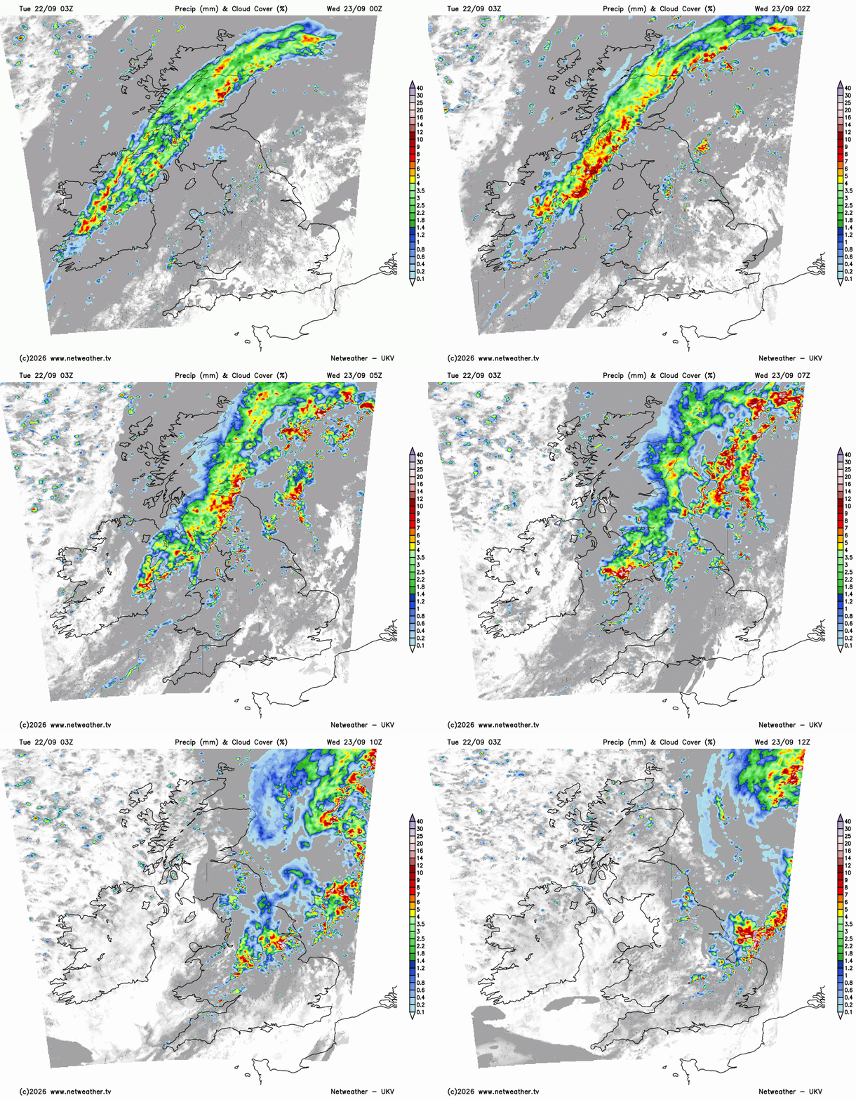
Wednesday
Wednesday will stay warm and humid in SE England with temperatures in the mid 20s C. Elsewhere it won’t be as warm, with temperatures in the north and west in the mid to high teens. Across England, it will still feel fine in the low 20sC where the sunshine, and dry weather, continues.
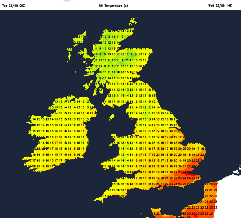
Wednesday night will be colder, with temperatures through Britain down into single figures and the risk of frost in the north for rural spots. A southerly wind will keep Northern Ireland milder.
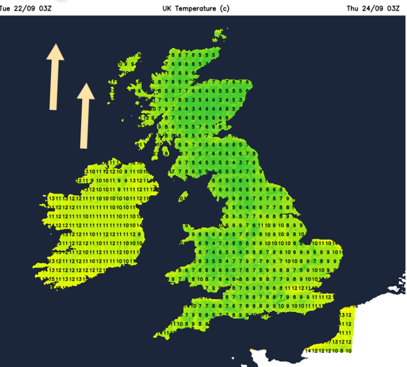
And Thursday’s temperatures will be closer to average across the UK 15 to 21C. So enjoy this September warmth before it eases.
Loading recent activity...








