Considering what weather autumn can throw at us, we have a fair week coming up. No signs of stormy weather or thick fog. There will be some rain and cloud but this doesn’t reach southern England, and often misses the Midlands, southeast Wales and East Anglia. All areas that really need some rain.
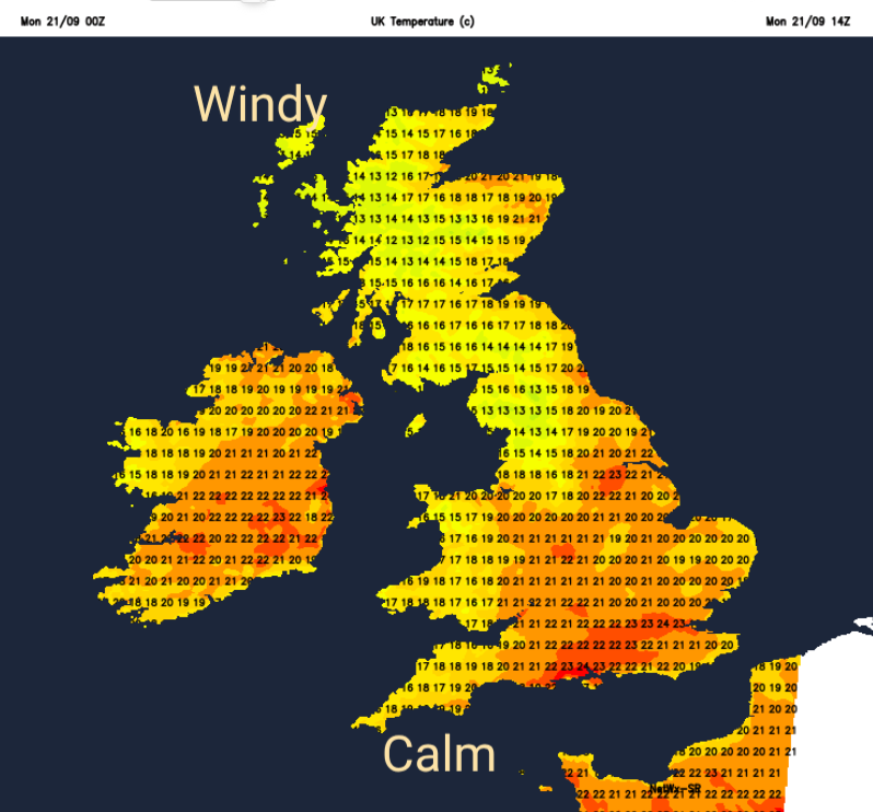
It is still warm, although the night of the autumn equinox this year looks nippy. At the weekend, Swanage on the Dorset coast reached 22.3C on Sunday. London, southern England, and perhaps eastern England could see 23 or 24C on Monday.
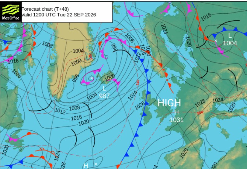
There is a cold front arriving from the northwest on Tuesday, which will bring pulses of heavy rain but not for all of the UK. Behind the front, there will be cooler conditions across the UK by the middle of the week and lower nighttime temperatures.
As the cold front clears Kent in the middle of the week, there is high pressure with more sunshine but a new Atlantic low pressure system will head for Iceland as the jetstream loops northwards.
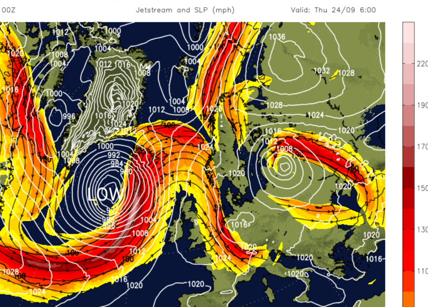
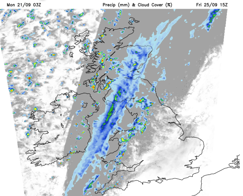
The High pressure protects the UK, although it will turn wet and windy for NW Scotland later on Thursday with rain reaching the west coast and also Northern Ireland in the evening. That front struggles eastwards during Friday, not really bringing any rain to the southeastern third of Britain. There will be clear skies here and a cooler start on Friday for England, but the sunshine will soon warm things up in the south.
Today
High pressure is sitting over the UK centred over Cornwall. There is a weakening warm front bringing cloud over northern Britain and some rain along it. There has been a wet Monday morning around the Moray Firth, up to Caithness and the main area of rain is heading for Orkney. The west coast of Scotland and Cumbria will stay grey and damp with an onshore flow but it will feel quite warm. County Down and Grampian will see sunny spells and temperatures into the low 20s Celsius. Aberdeen could reach 23C in the warm air and sunshine.
Northern areas will have a light to moderate southwesterly wind, but the winds will be very light for southern Britain. It will be a fine, sunny and warm day for most. However, we can’t forget the trailing warm front. This will bring some cloud over northern England, into western Wales and Cornwall and Devon. Western counties might see some damp weather from the thicker cloud this afternoon.
Tonight looks quiet with a lot of dry and fine weather, mostly light winds too. The cold front will approach the Western Isles in the early hours, bringing a band of rain with some sharp downpours embedded in it and a strengthening southwesterly wind as it reaches northwest mainland Scotland.
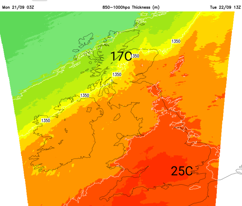
Much of the UK will have a fine, bright or sunny day on Tuesday. Again there will be light winds and warm sunshine. The frontal band will nudge over western and central Scotland and the north of Northern Ireland. The rain will be patchy here but the cloud will increase. Temperatures here will be down a notch on today, but for England and Wales temperatures will be in the low 20s C and London might reach 25C.
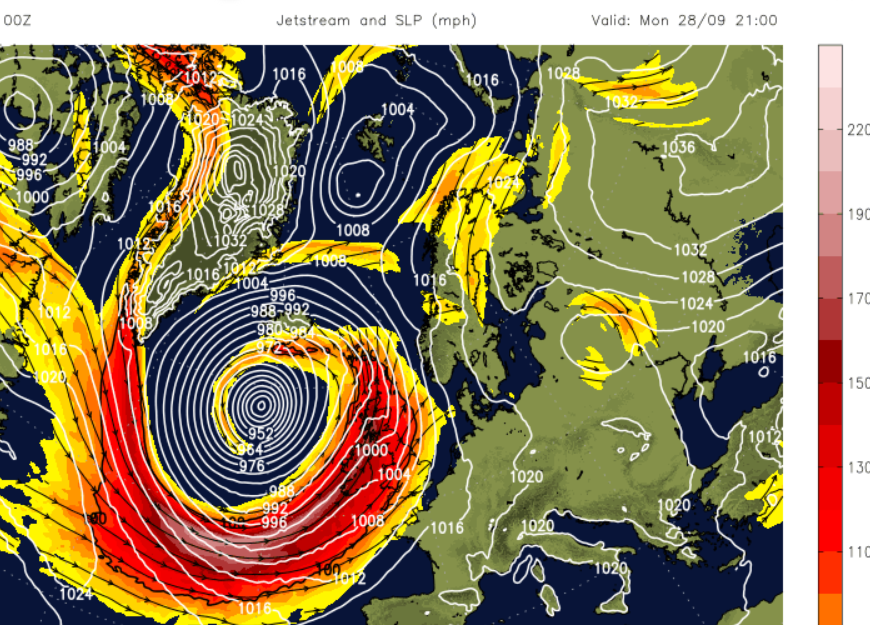
Looking further ahead, a significant low pressure catches the eye early next week. The GFS model (which likes to exaggerate these things) shows a deep low south of Iceland later on Monday 28th.
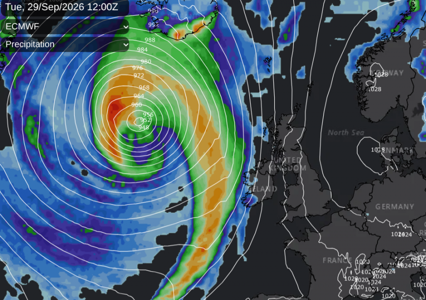
The ECM model shows a deep low on Tuesday 29th throwing frontal rain towards northwestern parts of the UK by midweek, but little else. These low centres seem to be staying away to the north for September at least.
Loading recent activity...