September is a popular time for holiday makers to go to mainland Europe not restricted by the school holidays but still wanting summer warmth. However, it’s not been blue skies and beach weather for those going to parts of southern Europe this week.
The Mediterranean region has been particularly affected by severe thunderstorms over recent days, with coastal areas of eastern Spain, including the cities of Barcelona and Valencia, experiencing flash-flooding earlier this week, as slow-moving thunderstorms fuelled by a marine heatwave affect much of the Mediterranean. Today was the turn of Mallorca to see torrential rain and flash-flooding.
https://x.com/InfoMeteoTuit/status/2100315775441457288?s=20
Spain's national weather agency AEMET issued warnings for heavy rain across eastern regions on Wednesday and Thursday, including a red alert for Barcelona's coastline and Cartagena further south. Some weather stations in the Valencia region recorded up to 70mm of rain in half an hour.
The storms lead to the death of one person whose car was swept away and also disruption to travel across Catalonia and Valencia regions, with flights cancelled and roads submerged.
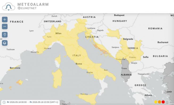
Heavy rain, strong winds and thunderstorms have also affected northern and central regions of Italy over recent days, thanks to a slow-moving area of low pressure over the Gulf of Genoa bringing multiple rounds of intense storms with frequent lightning, flash-flooding and strong winds over these areas. Italian authorities issued weather warnings in 12 regions for Friday, with Sardinia and part of central and northern Italy under weather warnings for a risk of flooding. While thunderstorm warnings are in force for coastal Slovenia, Croatia and Montenegro too.
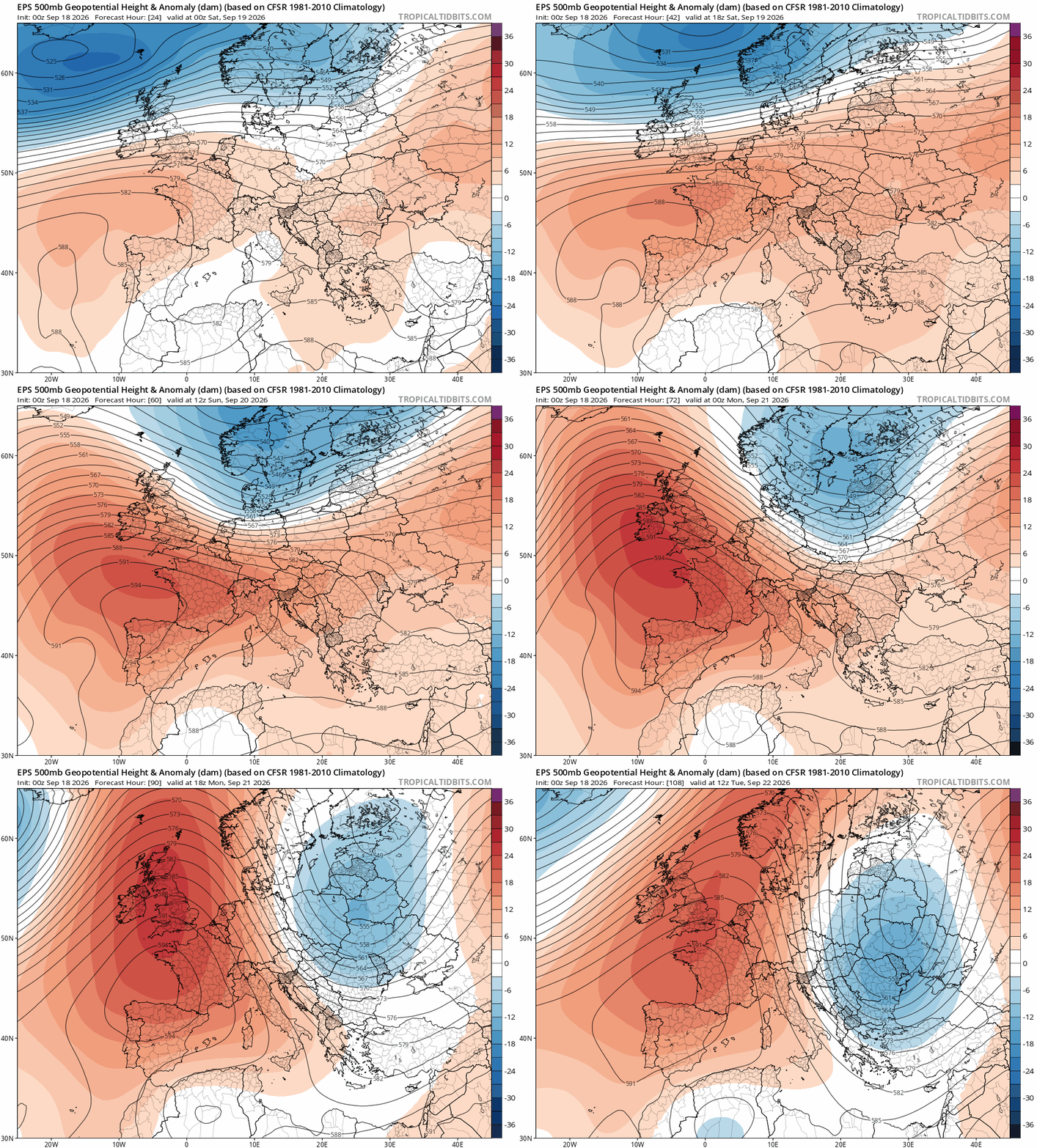
Thankfully, from Sunday onwards, the weather will turn more settled across most of southern Europe and the Mediterranean, as an upper level ridge expands across western Europe while a cooler but stable north to northwest flow affects central and eastern Europe. Just Sicily, Malta and parts of southern Greece that may continue to see a risk of showers or thunderstorms.
Upper level ridge expands across western Europe, including the UK, early next week
The weather will generally turn quieter from Sunday across England and Wales too, though always a risk of further Atlantic frontal systems affecting Scotland and parts of Ireland / N. Ireland through next week.
The week ends and the weekend starts on a wet and windy note across much of the UK Friday afternoon - as a deep area of low pressure passes to the north of Scotland - bringing stronger winds and spells of rain or showers across many areas.
However, from Sunday the weather looks to settle down across England and Wales, as a ridge of high pressure builds north, which will block Atlantic systems from bringing rain through most of next week. However, Scotland. Ireland and N. Ireland will still be prone to fronts off the Atlantic at times, bringing occasional spells of rain. Potential that some of this rain could spread in across northern England and north Wales too during the middle of next week, but uncertainty over this for now.
Current model output suggests that it may stay mostly dry and settled across much of England and Wales until the last few days in the month, when there is a signal for more unsettled conditions to take over off the Atlantic across all parts.
Although rain this month has turned the parched yellow and brown landscape that started the month greener, much of England and Wales (apart from northern England) is still in drought. Research by the Environment Agency (EA) suggests above-average rainfall is needed across England for the next seven months for all areas to recover from drought by spring 2027.
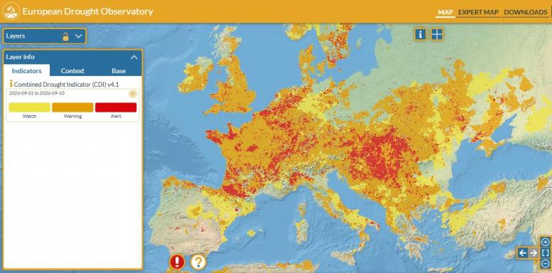
Meanwhile, large parts of continental Europe remain in drought too, particularly critical in France, Belgium, the Netherlands, Luxemburg, western and southern Germany, northern Italy, large parts of the Danube upper and middle river basin, the northern Balkans, and some spots in the northern Iberian Peninsula, the UK and eastern Ukraine. So many farmers and water authorities that supply water will be hoping for a wet rest of autumn and winter.
Loading recent activity...