The midweek fresher northwesterly flow has brought a cooler start to Wednesday with clusters of blustery showers and bright spells.
It feels different from the start of the week. Sutton Bonington in Nottinghamshire only dipped to 18C overnight on Tuesday night; it was so warm and humid. Last night temperatures fell below 12C, so more usual for mid-September. A few spots in Britain dipped to near 7C around dawn on Wednesday. Warmer air will return on Friday night and stay over southern Britain for Saturday, with temperatures peaking in the low to mid 20s Celsius.
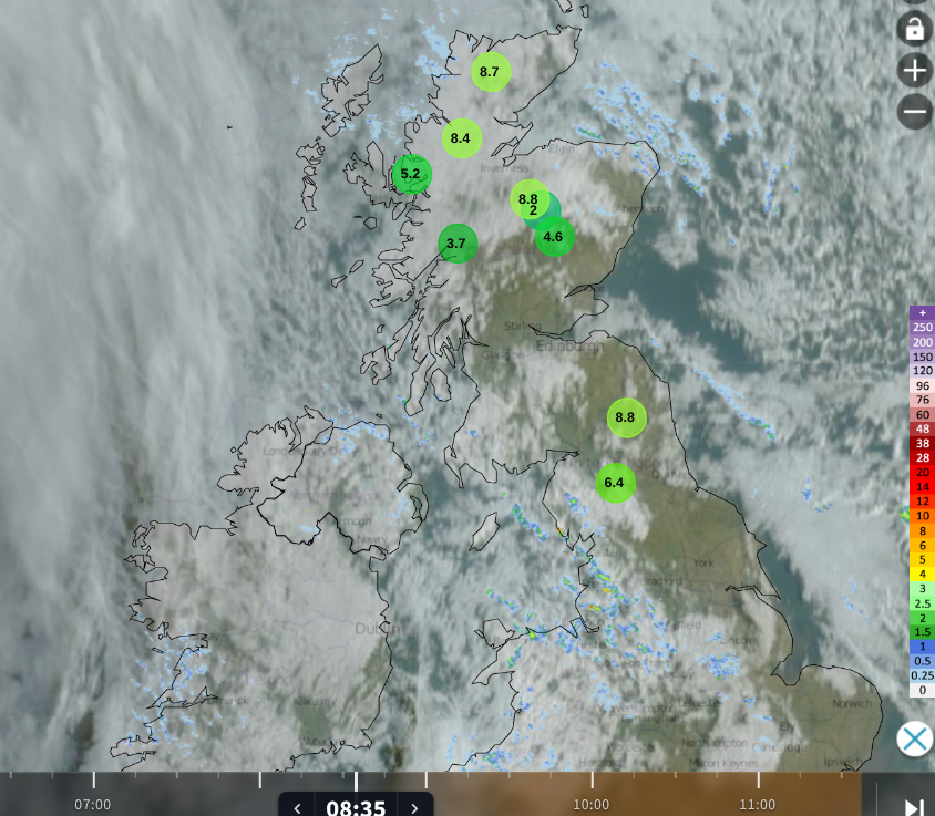
Wednesday morning Netweather Radar showing sunny gaps, thicker cloud with showers from the NW and lowest temperatures.
There was some very wet weather and torrential downpours on Tuesday, mostly for areas exposed to this northwesterly flow. On Wednesday, it is a day with plenty of bright or sunny spells but still with the risk of showers. The light northwesterly breeze will back to a westerly during the day, reaching a southwesterly for Northern Ireland and Scotland. A low pressure close to Iceland will throw its weather fronts towards the northwest of the UK this evening. There will be southwesterly gales for the Western Isles.
There will be a band of cloud and rain working its way southeastwards overnight and on Thursday, but there will be clear spells ahead and behind this. Overnight temperatures will be around 10 to 14C with a blustery start for Thursday.
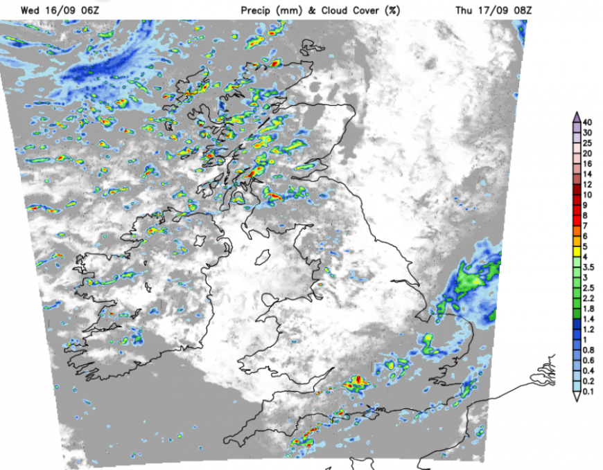
The thinning frontal band will bring showery outbreaks of rain to southern and eastern England, from Devon to Lincolnshire, as many people set off to school and work. The cold front band will head towards Kent and Sussex by late morning, where there could be some lively downpours.
The winds will freshen for northern Britain and Northern Ireland in the afternoon with strong westerly winds for exposed coasts and hills. The low from near Iceland will pass closer to northern Scotland with a rash of heavy and blustery showers running over the Islands and mainland Scotland. Eastern Scotland will see times of fine sunshine but don’t get caught out in a downpour; there will also be showers for Northern Ireland and Cumbria.
Once the cold front clears from Kent early in the afternoon, there will be plenty of fair weather over the southern half of Britain. Temperatures will be around 14 to 19C but with the brisk wind.
It will stay windy for the Northern Isles overnight with further heavy showers, closer to the low centre but elsewhere the winds ease down with plenty of clear weather. Another line of showers will reach northwest Britain as cloud begins to increase from the Atlantic.
Friday
Ahead of the next system there will be a sunny start for eastern Britain before the high cloud starts to stream in from the west. Don’t be fooled, the weather will go downhill. The southwesterly winds will pick up by lunchtime as the rain spills over Britain.
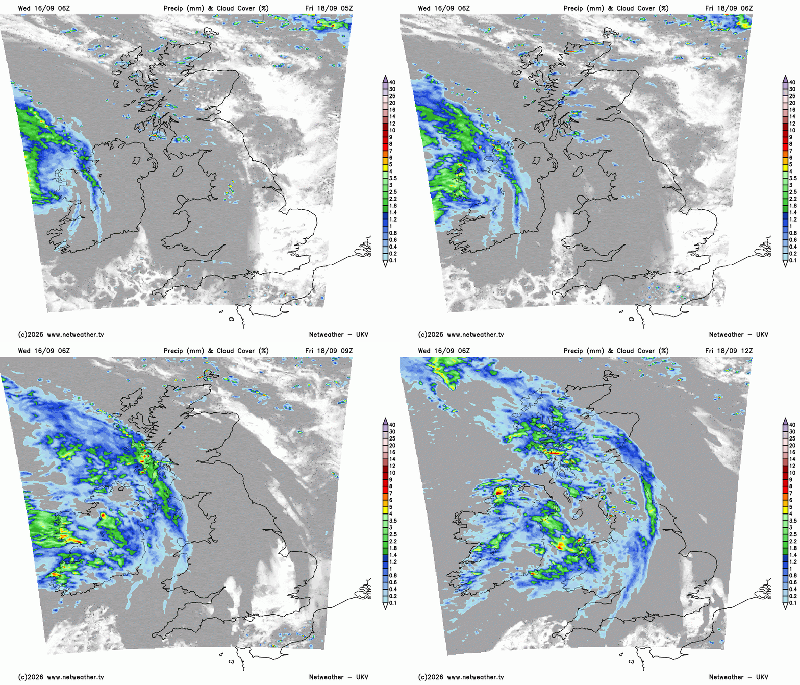
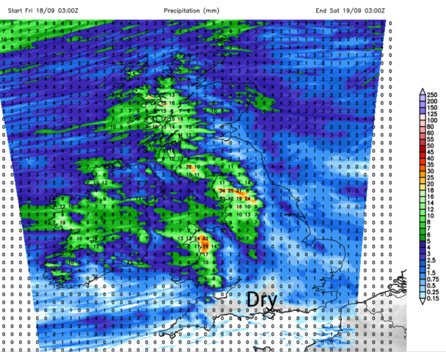
The main rain will miss southern England and there will be rain shadow effects for eastern Britain. It’s quite a traditional autumn rainfall pattern when western-facing upslopes see plenty of rain and elsewhere not so much.
The weekend
Even into the weekend, there will be a lot of fair weather about. Saturday looks windy with more cloud in the south and a scattering of showers. More sunny spells further north but still sharp showers running by, then Sunday looks more settled. High pressure should build over France, then southern Britain, bringing drier and sunnier weather in the south. The GFS is keen on this, but the ECM keeps a more showery picture for the start of Sunday and only lighter winds into southwestern Britain. The models vary with how strongly the high pressure is able to build in for Sunday (leading to more settled and fine weather). Something to watch.
Loading recent activity...