Monday’s fine weather will turn to cloud and rain as a cold front works its way southwards. The warm and humid air, which will lift temperatures into the 20s Celsius, will be swept away and replaced by a cooler and fresher northwesterly flow.
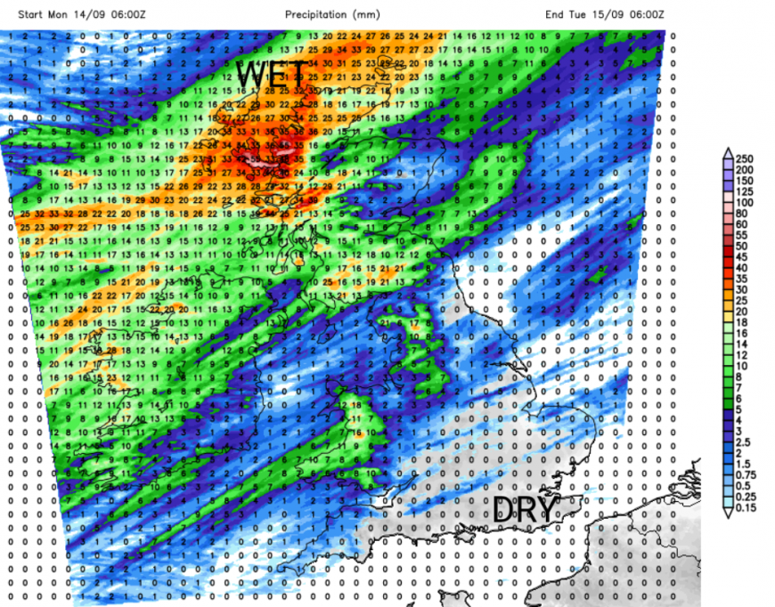
Tuesday morning’s weather will be dominated by blustery showers mixed with bright spells, but it will feel different. England and Wales should see a fine afternoon with more sunshine as the low pressure centre moves between Aberdeen and Bergen.
High pressure will build for the middle of the week, subduing some of the shower activity. For many it will be a fair, bright day, again with autumn sunshine. However, there is a signal for showers over County Antrim, across the Irish Sea into Merseyside and Greater Manchester, north Wales and a scattering working their way across central England into East Anglia through the afternoon. So don’t rely on the midweek high for a completely dry picture. If you are hoping for proper rain, it is northwestern regions that will see the most this week, exposed to the Atlantic flow. Temperatures on Wednesday will be in the mid to high teens, but the sunshine will help.
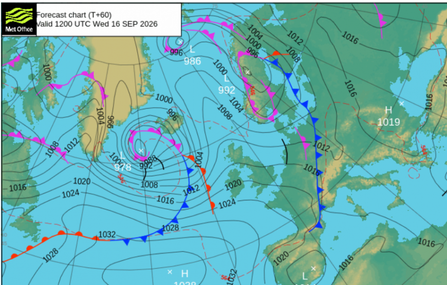
Looking out over the North Atlantic, you can see the next low pressure. The wind and rain from this should reach NW Scotland by Wednesday evening. The frontal rain will reach Northern Ireland, northern Britain and northwest Wales overnight but the band becomes more fragmented by Thursday morning over the rest of England. There could be some sharp downpours over Kent as the frontal band clears away southeastwards. It leaves sunny skies before a new rash of blustery showers rush in from the west. Over Scotland, these will be heavy and continue into the night. Northern Ireland and northern England, particularly the Pennines, will also see showers coming and going on Thursday.
Friday could be another lull day, with pressure rising and more settled, sunny weather. Scotland might have to wait for the showers to clear away to the north but overall it will be a bright and breezy day. The ECM model brings the next weather system in quickly over Ireland, so this may need watching as it could bring a wet end to Friday. That might even be rain over Wales by Friday afternoon.
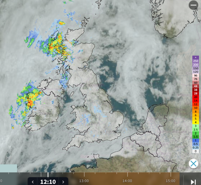
Netweather Radar Monday 14th 12:10
On Monday, much of the UK is still in warm and humid air linked to a hot weekend for Spain, Portugal and western France. As the Arctic loses more daylight and turns colder, the temperature contrast over northwestern Europe grows at this time of year. The jet stream strengthens, and we see more low pressure and sometimes deeper, more impactful storms. Nothing serious is showing up for this week.
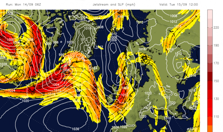
There is a large meander in the jet on Tuesday and we will feel the change to a cooler flow as one low pressure moves over the North Sea. Iceland has seen wet and windy weather as low centres moved by, and also some significant snowfall in the north. Experienced locals are used to these changes but it caught out tourists as they got stuck on some of the higher routes in deep sudden snow in the Highlands on Friday.
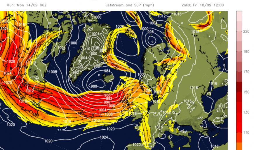
As the cold in the far north deepens in the coming weeks and months the jet stream edges further south and those low centres will come closer to the UK. At the moment we are being swiped by their trailing weather fronts, the showery flows, and then seeing some respite as the Azores High tries to extend our way.
It’s changeable this week.
Loading recent activity...