This week brings a run of fine days and unsettled days, as a ridge of high pressure appears briefly and then an Atlantic low pressure runs in from the west. This pattern repeats itself into the weekend.
Wednesday is a day of high pressure with lighter winds, more sunshine and fine weather. Tuesday’s low brought blustery showers in the north and then east as the cold front rain cleared SE Britain but was joined by a new small low pressure which nipped along the English Channel and brought more wet weather to SE England, especially Kent.
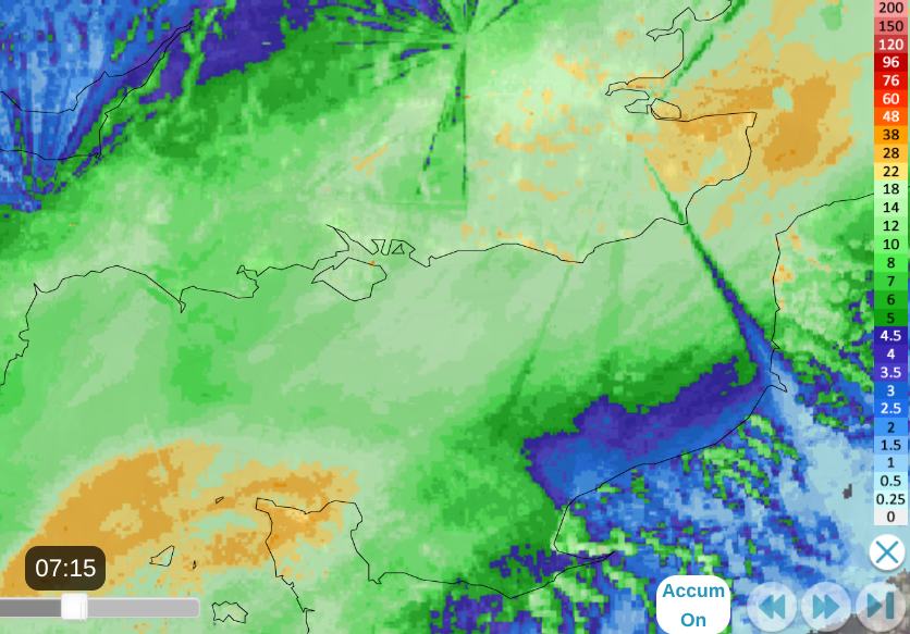
After a chilly night, frontal cloud and then rain will move in from the west on Thursday with a warmer, southerly wind. The low pressure will be centred north of Iceland, but its band of showery rain will work its way over the UK, although it will be rather patchy for southern England. The last of this frontal rain will pull away from Norfolk, Suffolk and Kent during Thursday night and although there will be a few showers, Friday looks fine and sunny.
So this is another of the high pressure, fine days. It will feel cooler and fresher in the far northwest. Southeastern Britain will feel okay, with temperatures around 18 to 23C but warmer thanks to any sunny spells and the very light winds.
It looks fine, mostly dry and bright or sunny on Friday; however it won’t last for the weekend.
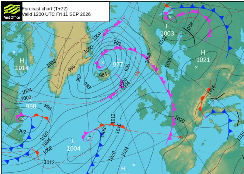
If you are out on Friday evening, it should still be fine in Central London. It will feel warm enough at 21C with hardly any breeze and should be dry. Manchester will still be around 17C and dry. Once the sun disappears for Newcastle and Glasgow, it will feel cooler but it’s not windy or wet. By the small hours, it will be very wet for Northern Ireland (perhaps reaching Strathclyde too) as the southerly winds strengthen.
Saturday sees a new low pressure bringing wet weather in from the Atlantic. If you are looking at a weather app, it will probably show rain symbols for part of the day. Only southern/SE England might escape dry during the day. Consider the overall movement of this system, and note that the timing may change as it edges southeastwards over Britain.
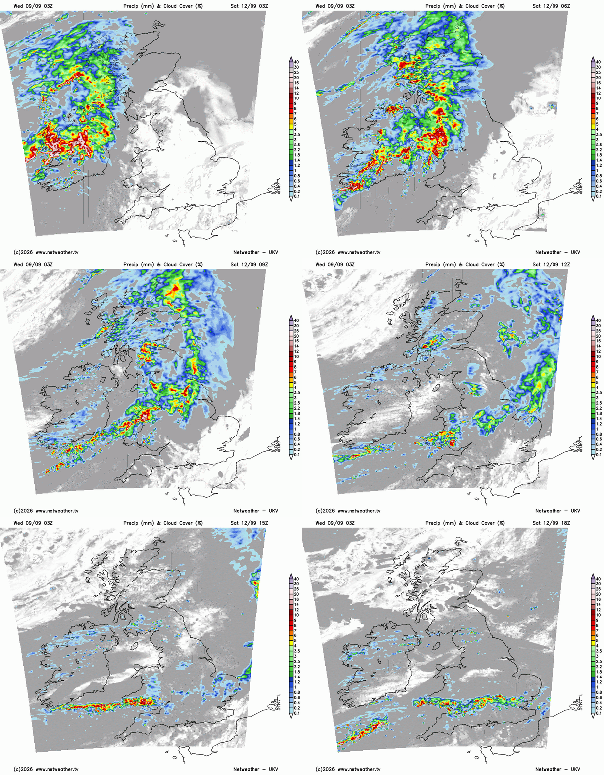
There is a strong signal for the rain arriving over Northern Ireland and into western Scotland, the Irish Sea, by dawn on Saturday but moderate confidence about its progress southwards through England and Wales. The GFS model keeps a coherent band through Saturday morning, but then breaks it up for the afternoon.
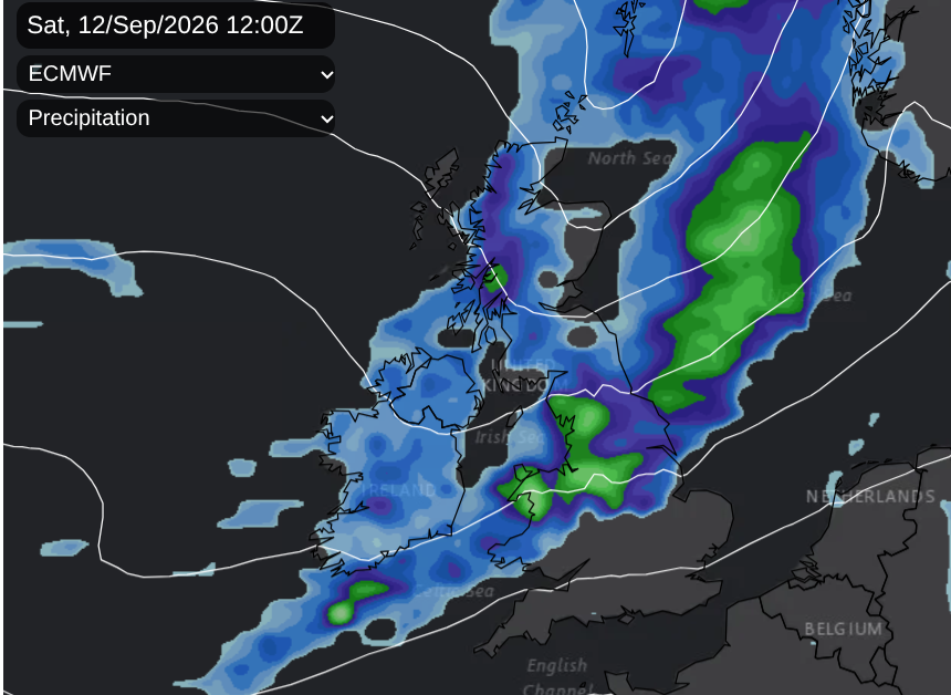
The ECM brings a wet morning to western and southern Scotland, Northern Ireland, the Isle of Man, NW England and north Wales. It also reaches the Pennines and Peak District by midday, then moves into more of northern England and the Midlands by early afternoon. Ahead of this, there will be early sunshine with a fine ParkRun and morning sports, but the rain will be creeping southwards.
The UKV model brings heavy afternoon rain to southern Wales where the band pivots and almost stalls along the M4 and North Circular into Essex. If you are under that band, you would know about it. Again to the south, there will be very little rain. It is a narrow band of heavier downpours, so just be aware and keep an eye on the Netweather radar if you want to avoid getting wet. It will be a blustery day in the southwesterly wind, however it will feel warm if you do see some sunshine. Temperatures will widely be in the high teens. Low to mid 20s Celsius.
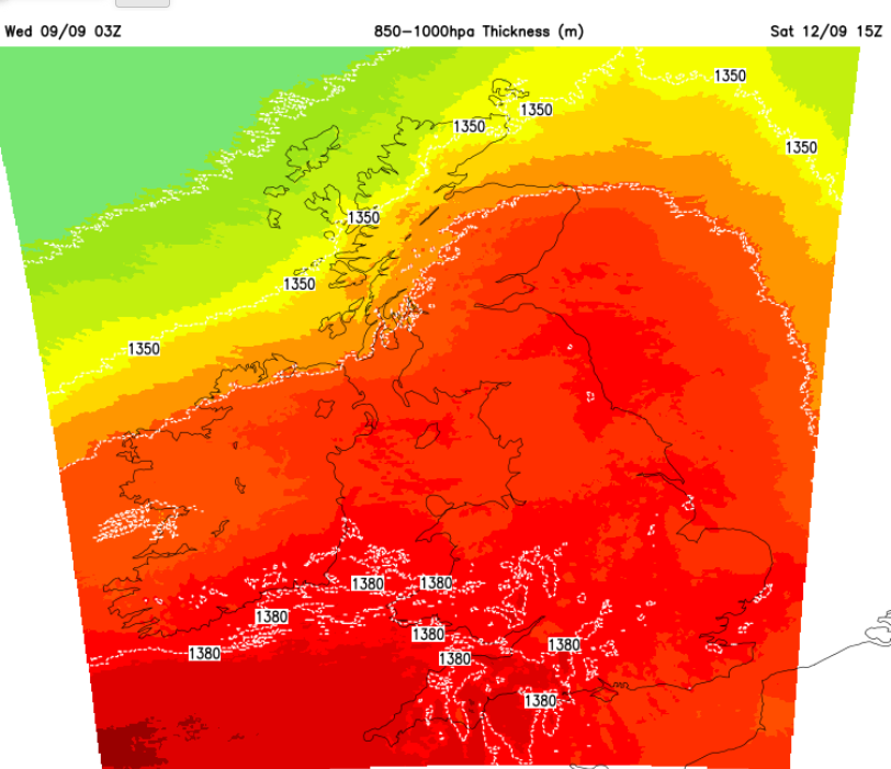
A second band of showery rain will follow over Northern Ireland, W and SW Scotland, during Saturday afternoon, reaching the Lake District in the evening.
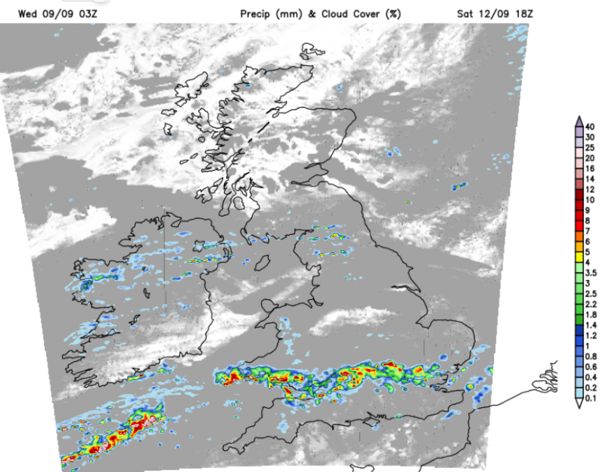
Cooler air will arrive from the north, so a colder night for Scotland and County Londonderry and Co. Antrim. It will stay warm in southern Britain.
Sunday
Around dawn we could be waiting for the two bands of showery rain to finally fade. England and Wales have a higher chance of seeing a shower on Sunday than in Northern Ireland and Scotland. There will be a good deal of fine, bright, even sunny weather as high pressure begins to nudge in once more. The winds will fall light again and southern Britain could see temperatures of 20 to 25C.
So, a sequence of one fine, calm and bright day followed by a blustery day with more cloud and rain.
Loading recent activity...